
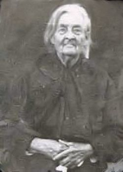
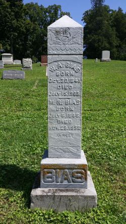
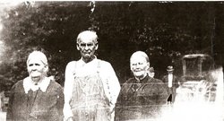
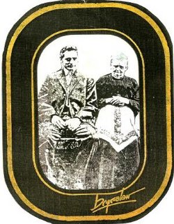
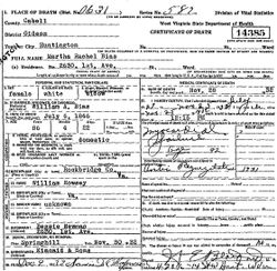
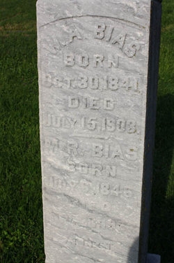
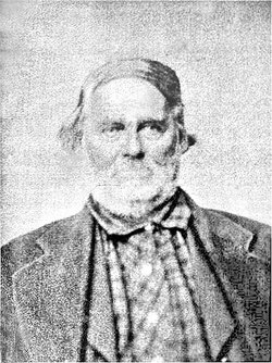
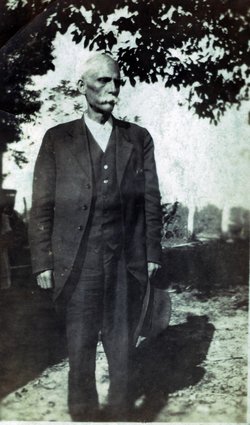
Martha Rachel Rowsey Bias
| Birth | : | 6 Jul 1846 Rockbridge County, Virginia, USA |
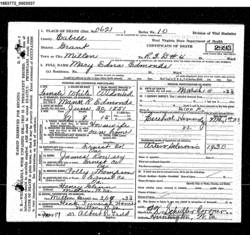
| Death | : | 28 Nov 1932 Huntington, Cabell County, West Virginia, USA |
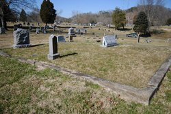
| Burial | : | St Peter and St Paul Churchyard, Drax, Selby District, England |
| Coordinate | : | 53.7293790, -0.9771560 |
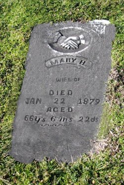
| Description | : | Daughter of James N. Rowsey & Mary H. Thomas. |
frequently asked questions (FAQ):
-
Where is Martha Rachel Rowsey Bias's memorial?
Martha Rachel Rowsey Bias's memorial is located at: St Peter and St Paul Churchyard, Drax, Selby District, England.
-
When did Martha Rachel Rowsey Bias death?
Martha Rachel Rowsey Bias death on 28 Nov 1932 in Huntington, Cabell County, West Virginia, USA
-
Where are the coordinates of the Martha Rachel Rowsey Bias's memorial?
Latitude: 53.7293790
Longitude: -0.9771560
Family Members:
Parent
Spouse
Siblings
Children


Flowers:


Nearby Cemetories:
1. St Peter and St Paul Churchyard
Drax, Selby District, England
Coordinate: 53.7293790, -0.9771560
2. Friends Burial Ground
Drax, Selby District, England
Coordinate: 53.7291640, -0.9771490
3. Drax Cemetery
Drax, Selby District, England
Coordinate: 53.7272540, -0.9875330
4. St. Helen's Churchyard
Barmby on the Marsh, East Riding of Yorkshire Unitary Authority, England
Coordinate: 53.7476490, -0.9549090
5. Barmby on the Marsh Parish Burial Ground
Barmby on the Marsh, East Riding of Yorkshire Unitary Authority, England
Coordinate: 53.7472990, -0.9401910
6. Carlton Cemetery
Carlton, Selby District, England
Coordinate: 53.7129500, -1.0199200
7. St Mary Roman Catholic Church
Carlton, Selby District, England
Coordinate: 53.7111900, -1.0199300
8. St Mary Churchyard
Carlton, Selby District, England
Coordinate: 53.7088060, -1.0209800
9. St Mary the Virgin Churchyard
Hemingbrough, Selby District, England
Coordinate: 53.7672100, -0.9796300
10. Holy Trinity Churchyard
East Cowick, East Riding of Yorkshire Unitary Authority, England
Coordinate: 53.6866220, -1.0000200
11. St David Churchyard
Airmyn, East Riding of Yorkshire Unitary Authority, England
Coordinate: 53.7178030, -0.9016700
12. Howden Cemetery
Howden, East Riding of Yorkshire Unitary Authority, England
Coordinate: 53.7438890, -0.8770090
13. Catholic Church of The Sacred Heart
Howden, East Riding of Yorkshire Unitary Authority, England
Coordinate: 53.7428360, -0.8709800
14. Howden Minster Churchyard
Howden, East Riding of Yorkshire Unitary Authority, England
Coordinate: 53.7449550, -0.8670300
15. St. John the Evangelist Churchyard
Goole, East Riding of Yorkshire Unitary Authority, England
Coordinate: 53.7024600, -0.8719260
16. Hook Cemetery
Hook, East Riding of Yorkshire Unitary Authority, England
Coordinate: 53.7204300, -0.8525380
17. St Mary the Virgin Churchyard
Hook, East Riding of Yorkshire Unitary Authority, England
Coordinate: 53.7207270, -0.8510590
18. Selby Cemetery
Selby, Selby District, England
Coordinate: 53.7766610, -1.0775960
19. Selby Abbey
Selby, Selby District, England
Coordinate: 53.7840990, -1.0670270
20. St. Wilfrid's Parish Churchyard
Brayton, Selby District, England
Coordinate: 53.7718060, -1.0849010
21. Goole Cemetery
Goole, East Riding of Yorkshire Unitary Authority, England
Coordinate: 53.7105940, -0.8513370
22. All Saints Churchyard
Barlby, Selby District, England
Coordinate: 53.7987840, -1.0415840
23. St John The Baptist Churchyard
Chapel Haddlesey, Selby District, England
Coordinate: 53.7279200, -1.1185700
24. St Paul Churchyard
Hensall, Selby District, England
Coordinate: 53.6967500, -1.1185900