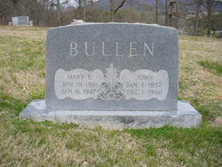
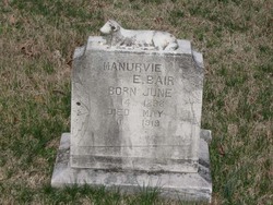
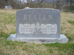
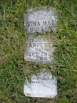
Mary E. Bair Bullen
| Birth | : | 18 Jan 1861 Hawkins County, Tennessee, USA |
| Death | : | 16 Jan 1947 Greene County, Tennessee, USA |
| Burial | : | Adriel Baptist Church Cemetery, Bean Station, Grainger County, USA |
| Coordinate | : | 36.3125000, -83.2897034 |
| Description | : | Morristown Gazette & Mail, Sunday, 19 Jan 1947, pg 6: "Mrs. Mary Bullen Mrs. Mary Bullen, aged 86, died at the home of her son, Henry Bullen, near Mosheim on January 16th. Funeral services were conducted yesterday afternoon at one o'clock, from the Adril church in Grainger county." ~~~~~ Mulberry Gap Baptist Association Minutes, 1947: "OBITUARIES MARY E. BULLEN, daughter of George and Manervia Bare, was born Jan. 21, 1861, departed this life Jan. 10, 1947, age 86 years. She professed faith in Christ at an early age, and joined the Spruce Pine Baptist Church--later moved... Read More |
frequently asked questions (FAQ):
-
Where is Mary E. Bair Bullen's memorial?
Mary E. Bair Bullen's memorial is located at: Adriel Baptist Church Cemetery, Bean Station, Grainger County, USA.
-
When did Mary E. Bair Bullen death?
Mary E. Bair Bullen death on 16 Jan 1947 in Greene County, Tennessee, USA
-
Where are the coordinates of the Mary E. Bair Bullen's memorial?
Latitude: 36.3125000
Longitude: -83.2897034
Family Members:
Parent
Spouse
Siblings
Children
Flowers:
Nearby Cemetories:
1. Adriel Baptist Church Cemetery
Bean Station, Grainger County, USA
Coordinate: 36.3125000, -83.2897034
2. Samsel Cemetery
Bean Station, Grainger County, USA
Coordinate: 36.3114014, -83.2925034
3. First Independent Freewill Baptist Church Cemetery
Bean Station, Grainger County, USA
Coordinate: 36.3158860, -83.2855850
4. Meek Cemetery
Bean Station, Grainger County, USA
Coordinate: 36.3207180, -83.2797150
5. County Line Cemetery
Bean Station, Grainger County, USA
Coordinate: 36.3207700, -83.2789850
6. Dodson Cemetery
Bean Station, Grainger County, USA
Coordinate: 36.2989006, -83.2869034
7. Rocky Summit Cemetery
Bean Station, Grainger County, USA
Coordinate: 36.2984750, -83.2799030
8. Grantham Cemetery
Grainger County, USA
Coordinate: 36.2946860, -83.2794570
9. DeBord Cemetery
Bean Station, Grainger County, USA
Coordinate: 36.3315000, -83.2834000
10. Taylor Family Cemetery
Bean Station, Grainger County, USA
Coordinate: 36.2876670, -83.2907330
11. Ford Cemetery
Grainger County, USA
Coordinate: 36.2902985, -83.3071976
12. Central United Methodist Church Cemetery
Bean Station, Grainger County, USA
Coordinate: 36.3422740, -83.2798470
13. Garrett Cemetery
Grainger County, USA
Coordinate: 36.3414001, -83.3082962
14. Harris Cemetery
Grainger County, USA
Coordinate: 36.3055992, -83.3308029
15. Livingston Cemetery
Bean Station, Grainger County, USA
Coordinate: 36.2785988, -83.2791977
16. Moores Chapel Cemetery
Bean Station, Grainger County, USA
Coordinate: 36.3488998, -83.2897034
17. Samsel Cemetery
Bean Station, Grainger County, USA
Coordinate: 36.3424020, -83.3167060
18. Noeton Baptist Church Cemetery Original
Bean Station, Grainger County, USA
Coordinate: 36.3012600, -83.3342200
19. Samsel Lakeview Cemetery
Bean Station, Grainger County, USA
Coordinate: 36.3475800, -83.3189468
20. N L Henard Cemetery
Morristown, Hamblen County, USA
Coordinate: 36.2708221, -83.2726048
21. Dalton Cemetery
Bean Station, Grainger County, USA
Coordinate: 36.3428001, -83.3296967
22. Meadow Branch Cemetery
Bean Station, Grainger County, USA
Coordinate: 36.3572006, -83.2822037
23. Harrell Cemetery
Bean Station, Grainger County, USA
Coordinate: 36.3074989, -83.3463974
24. Holt Cemetery #2
Bean Station, Grainger County, USA
Coordinate: 36.3630560, -83.2844440

