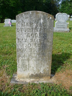
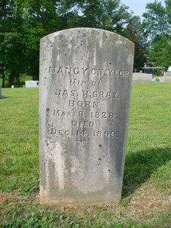
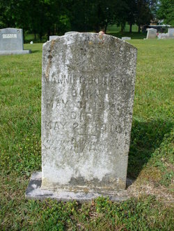
Mary E. Gray Stubblefield
| Birth | : | 21 May 1845 Tennessee, USA |
| Death | : | 30 Nov 1915 Grainger County, Tennessee, USA |
| Burial | : | Adriel Baptist Church Cemetery, Bean Station, Grainger County, USA |
| Coordinate | : | 36.3125000, -83.2897034 |
| Description | : | Despite the bio below and what has been published elsewhere, Mary E. Gray Dodson Carr's third marriage was to William (not Joseph) Stubblefield in 1885. According to Mary's 1912 Tennessee Confederate widow's pension application (W5203), her third husband William Stubblefield had "been gone 20 years" at the time she applied, having gone out West, and was presumed dead by her and his family members in Tennessee. Also, according to an affidavit in that application, it is stated that William had children by a previous marriage, having "been out West for years and coming back to Tenn., was married to... Read More |
frequently asked questions (FAQ):
-
Where is Mary E. Gray Stubblefield's memorial?
Mary E. Gray Stubblefield's memorial is located at: Adriel Baptist Church Cemetery, Bean Station, Grainger County, USA.
-
When did Mary E. Gray Stubblefield death?
Mary E. Gray Stubblefield death on 30 Nov 1915 in Grainger County, Tennessee, USA
-
Where are the coordinates of the Mary E. Gray Stubblefield's memorial?
Latitude: 36.3125000
Longitude: -83.2897034
Family Members:
Parent
Spouse
Siblings
Children
Flowers:
Nearby Cemetories:
1. Adriel Baptist Church Cemetery
Bean Station, Grainger County, USA
Coordinate: 36.3125000, -83.2897034
2. Samsel Cemetery
Bean Station, Grainger County, USA
Coordinate: 36.3114014, -83.2925034
3. First Independent Freewill Baptist Church Cemetery
Bean Station, Grainger County, USA
Coordinate: 36.3158860, -83.2855850
4. Meek Cemetery
Bean Station, Grainger County, USA
Coordinate: 36.3207180, -83.2797150
5. County Line Cemetery
Bean Station, Grainger County, USA
Coordinate: 36.3207700, -83.2789850
6. Dodson Cemetery
Bean Station, Grainger County, USA
Coordinate: 36.2989006, -83.2869034
7. Rocky Summit Cemetery
Bean Station, Grainger County, USA
Coordinate: 36.2984750, -83.2799030
8. Grantham Cemetery
Grainger County, USA
Coordinate: 36.2946860, -83.2794570
9. DeBord Cemetery
Bean Station, Grainger County, USA
Coordinate: 36.3315000, -83.2834000
10. Taylor Family Cemetery
Bean Station, Grainger County, USA
Coordinate: 36.2876670, -83.2907330
11. Ford Cemetery
Grainger County, USA
Coordinate: 36.2902985, -83.3071976
12. Central United Methodist Church Cemetery
Bean Station, Grainger County, USA
Coordinate: 36.3422740, -83.2798470
13. Garrett Cemetery
Grainger County, USA
Coordinate: 36.3414001, -83.3082962
14. Harris Cemetery
Grainger County, USA
Coordinate: 36.3055992, -83.3308029
15. Livingston Cemetery
Bean Station, Grainger County, USA
Coordinate: 36.2785988, -83.2791977
16. Moores Chapel Cemetery
Bean Station, Grainger County, USA
Coordinate: 36.3488998, -83.2897034
17. Samsel Cemetery
Bean Station, Grainger County, USA
Coordinate: 36.3424020, -83.3167060
18. Noeton Baptist Church Cemetery Original
Bean Station, Grainger County, USA
Coordinate: 36.3012600, -83.3342200
19. Samsel Lakeview Cemetery
Bean Station, Grainger County, USA
Coordinate: 36.3475800, -83.3189468
20. N L Henard Cemetery
Morristown, Hamblen County, USA
Coordinate: 36.2708221, -83.2726048
21. Dalton Cemetery
Bean Station, Grainger County, USA
Coordinate: 36.3428001, -83.3296967
22. Meadow Branch Cemetery
Bean Station, Grainger County, USA
Coordinate: 36.3572006, -83.2822037
23. Harrell Cemetery
Bean Station, Grainger County, USA
Coordinate: 36.3074989, -83.3463974
24. Holt Cemetery #2
Bean Station, Grainger County, USA
Coordinate: 36.3630560, -83.2844440


