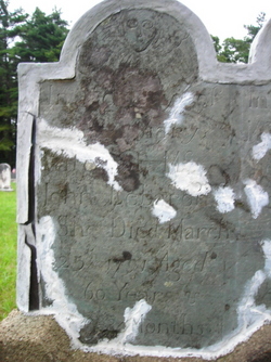
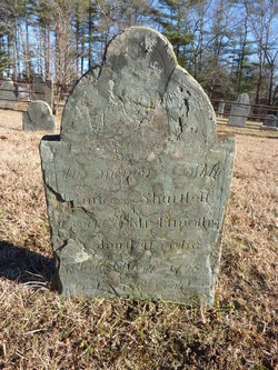
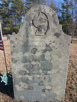
Mary Raymond LeBarron
| Birth | : | Jul 1730 Middleborough, Plymouth County, Massachusetts, USA |
| Death | : | 25 Mar 1791 Middleborough, Plymouth County, Massachusetts, USA |
| Burial | : | St Nicholas Churchyard, Harpenden, St Albans District, England |
| Coordinate | : | 51.8169470, -0.3583300 |
| Description | : | She was the wife of John Lebarron∼Mary was the fourth of five daughters and thirteenth of fifteen children of Thomas Raymond and Mary Coombs. Granddaughter of John Rayment 1631-1725 and Martha Woodin 1655-1722, Anthony Coombs 1643-1728 and Dorcas Woodin 1671-1722, sister of Martha. Mary was the wife of John LeBaron, the son of James LeBaron and Martha Benson Parker LeBaron. They were married 26 Nov 1748 in Middleborough and had the following children: * Abiezer LeBaron 1749-1772 * John Lebaron Jr. 1750-1836 * Zebulon LeBaron 1752-1793 * Eunice LeBaron, Mrs Timothy Shurtleff 1761-1795 * Joshua Lebaron 1763-1793 * Levi LeBaron 1765-1820 * Chloe Lebaron 1773-1813 * Mary... Read More |
frequently asked questions (FAQ):
-
Where is Mary Raymond LeBarron's memorial?
Mary Raymond LeBarron's memorial is located at: St Nicholas Churchyard, Harpenden, St Albans District, England.
-
When did Mary Raymond LeBarron death?
Mary Raymond LeBarron death on 25 Mar 1791 in Middleborough, Plymouth County, Massachusetts, USA
-
Where are the coordinates of the Mary Raymond LeBarron's memorial?
Latitude: 51.8169470
Longitude: -0.3583300
Family Members:
Spouse
Children
Flowers:
Nearby Cemetories:
1. Westfield Road Cemetery
Harpenden, St Albans District, England
Coordinate: 51.8270720, -0.3540300
2. National Children's Home Cemetery
Harpenden, St Albans District, England
Coordinate: 51.8305000, -0.3563000
3. Holy Trinity Churchyard
East Hyde, Central Bedfordshire Unitary Authority, England
Coordinate: 51.8433710, -0.3640760
4. St Mary Churchyard
Childwickbury, St Albans District, England
Coordinate: 51.7836980, -0.3473020
5. Childwickbury Manor
Childwickbury, St Albans District, England
Coordinate: 51.7809460, -0.3499100
6. Wheathampstead United Churchyard
Wheathampstead, St Albans District, England
Coordinate: 51.8108170, -0.2972210
7. St. Mary's Churchyard
Redbourn, St Albans District, England
Coordinate: 51.7916200, -0.4066100
8. St. Helen's Churchyard
Wheathampstead, St Albans District, England
Coordinate: 51.8124510, -0.2946400
9. St. Leonard's Churchyard
Flamstead, Dacorum Borough, England
Coordinate: 51.8199400, -0.4326800
10. St. Giles in the Woods Priory
Flamstead, Dacorum Borough, England
Coordinate: 51.8187400, -0.4374400
11. St Leonard Churchyard & Extension
Sandridge, St Albans District, England
Coordinate: 51.7813690, -0.3036580
12. Ss Peter and Paul Churchyard
Kimpton, North Hertfordshire District, England
Coordinate: 51.8527990, -0.2918240
13. St Lawrence Churchyard
Ayot St Lawrence, Welwyn Hatfield District, England
Coordinate: 51.8379490, -0.2717340
14. Ayot St Lawrence Old Churchyard
Ayot St Lawrence, Welwyn Hatfield District, England
Coordinate: 51.8377038, -0.2678795
15. St Andrew Woodside Churchyard
Slip End, Central Bedfordshire Unitary Authority, England
Coordinate: 51.8577160, -0.4306600
16. Luton Vauxhall Motors War Memorial
Luton, Luton Borough, England
Coordinate: 51.8745100, -0.3967500
17. St Peter's Churchyard
St Albans, St Albans District, England
Coordinate: 51.7555400, -0.3350270
18. St Michael’s Churchyard
St Albans, St Albans District, England
Coordinate: 51.7529540, -0.3560640
19. Dagnall Lane Baptist Chapel
St Albans, St Albans District, England
Coordinate: 51.7526990, -0.3405156
20. Spicer Street Chapel Burial Ground
St Albans, St Albans District, England
Coordinate: 51.7523288, -0.3423231
21. Romeland Hill Garden of Rest
St Albans, St Albans District, England
Coordinate: 51.7514540, -0.3438830
22. Aley Green Cemetery
Slip End, Central Bedfordshire Unitary Authority, England
Coordinate: 51.8522500, -0.4496420
23. Saint Alban's Cathedral
St Albans, St Albans District, England
Coordinate: 51.7504425, -0.3423680
24. Friend's Burial Ground
Luton, Luton Borough, England
Coordinate: 51.8738060, -0.4170870


