
| Birth | : | 7 May 1881 Pacolet, Spartanburg County, South Carolina, USA |
| Death | : | 30 Mar 1968 |
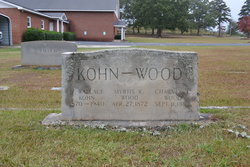
| Burial | : | St Mary Churchyard, Stelling Minnis, Shepway District, England |
| Coordinate | : | 51.1963830, 1.0644830 |
| Description | : | She was married twice: first to Giles Sinclair and then to Charles Wood - she was a daughter of John and Dora Smith Scales - a member of Philippi Baptist Church |
frequently asked questions (FAQ):
-
Where is Nola Scales Wood's memorial?
Nola Scales Wood's memorial is located at: St Mary Churchyard, Stelling Minnis, Shepway District, England.
-
When did Nola Scales Wood death?
Nola Scales Wood death on 30 Mar 1968 in
-
Where are the coordinates of the Nola Scales Wood's memorial?
Latitude: 51.1963830
Longitude: 1.0644830
Family Members:
Parent

Spouse
Siblings
Flowers:


Nearby Cemetories:
1. St Mary Churchyard
Stelling Minnis, Shepway District, England
Coordinate: 51.1963830, 1.0644830
2. St Peter and St Paul Churchyard
Upper Hardres, City of Canterbury, England
Coordinate: 51.2152380, 1.0811020
3. All Saints Churchyard
Petham, City of Canterbury, England
Coordinate: 51.2206030, 1.0496330
4. St Bartholomew Churchyard
Waltham, City of Canterbury, England
Coordinate: 51.1961680, 1.0223940
5. St Mary's Churchyard
Lower Hardres, City of Canterbury, England
Coordinate: 51.2371410, 1.0821320
6. St Mary the Blessed Virgin Churchyard
Crundale, Ashford Borough, England
Coordinate: 51.1985000, 0.9842100
7. Elham Methodist Church
Elham, Shepway District, England
Coordinate: 51.1542930, 1.1113970
8. St. Mary the Virgin Churchyard
Hastingleigh, Ashford Borough, England
Coordinate: 51.1610820, 1.0047880
9. St. Mary the Virgin Churchyard
Elham, Shepway District, England
Coordinate: 51.1521870, 1.1118610
10. St Mary Churchyard
Bishopsbourne, City of Canterbury, England
Coordinate: 51.2307620, 1.1323170
11. St Augustine Hospital Burial Ground
Chartham, City of Canterbury, England
Coordinate: 51.2480170, 1.0342770
12. Elham Burial Ground
Elham, Shepway District, England
Coordinate: 51.1497940, 1.1115020
13. St. Mary's Churchyard
Nackington, City of Canterbury, England
Coordinate: 51.2498670, 1.0892370
14. St. Giles Churchyard
Kingston, City of Canterbury, England
Coordinate: 51.2181750, 1.1463980
15. St Peter Churchyard
Bridge, City of Canterbury, England
Coordinate: 51.2443730, 1.1271000
16. St John the Baptist Churchyard
Barham, City of Canterbury, England
Coordinate: 51.2065410, 1.1620830
17. St John the Baptist Church Cemetery
Barham, City of Canterbury, England
Coordinate: 51.2056600, 1.1629900
18. St. Mary the Virgin Churchyard
Chartham, City of Canterbury, England
Coordinate: 51.2558720, 1.0180810
19. St Mary Magdalene Churchyard
Denton, Dover District, England
Coordinate: 51.1767118, 1.1694535
20. St Mary the Blessed Virgin Churchyard
Brabourne, Ashford Borough, England
Coordinate: 51.1358410, 1.0054050
21. St Mary and St Ethelburga Churchyard
Lyminge, Shepway District, England
Coordinate: 51.1262670, 1.0869770
22. Barham Crematorium
Barham, City of Canterbury, England
Coordinate: 51.1972610, 1.1800310
23. St Mary Churchyard
Patrixbourne, City of Canterbury, England
Coordinate: 51.2534430, 1.1364840
24. Aylesham Cemetery
Aylesham, Dover District, England
Coordinate: 51.2126910, 1.1781980