
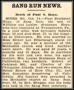
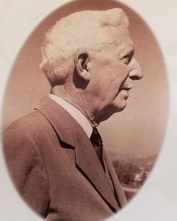
Paul Stutzman Hoye
| Birth | : | 15 May 1886 Garrett County, Maryland, USA |
| Death | : | 27 Sep 1922 Uniontown, Fayette County, Pennsylvania, USA |
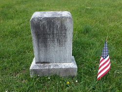
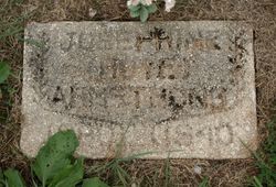
| Burial | : | Upper Sang Run Cemetery, McHenry, Garrett County, USA |
| Coordinate | : | 39.5717810, -79.4242430 |
| Description | : | m. Elinor L. Hinebaugh, March 26, 1911, at McHenry, Maryland. Paul Hoye farmed his parent's farm at Sang Run. He died from injuries received in a coal mine accident in Pennsylvania. (Source: The Hoyes of Maryland, Charles E Hoye, Sang Run, 1942; Sincell Printing Company, Oakland, Maryland; Page 151) |
frequently asked questions (FAQ):
-
Where is Paul Stutzman Hoye's memorial?
Paul Stutzman Hoye's memorial is located at: Upper Sang Run Cemetery, McHenry, Garrett County, USA.
-
When did Paul Stutzman Hoye death?
Paul Stutzman Hoye death on 27 Sep 1922 in Uniontown, Fayette County, Pennsylvania, USA
-
Where are the coordinates of the Paul Stutzman Hoye's memorial?
Latitude: 39.5717810
Longitude: -79.4242430
Family Members:
Parent
Spouse

Siblings
Children
Flowers:


Nearby Cemetories:
1. Upper Sang Run Cemetery
McHenry, Garrett County, USA
Coordinate: 39.5717810, -79.4242430
2. Hoye Family Cemetery - Crab Tree Bottom
McHenry, Garrett County, USA
Coordinate: 39.5642220, -79.3855000
3. Oak Grove Church of the Brethren Cemetery
McHenry, Garrett County, USA
Coordinate: 39.5694400, -79.3834300
4. Hoyes Run Cemetery
Garrett County, USA
Coordinate: 39.5313100, -79.4110900
5. Saint Dominic Catholic Cemetery
Hoyes, Garrett County, USA
Coordinate: 39.5868300, -79.3698600
6. Hoyes Cemetery
Garrett County, USA
Coordinate: 39.5905991, -79.3683014
7. Cranesville Cemetery
Cranesville, Preston County, USA
Coordinate: 39.5543920, -79.4929870
8. Flatwood Cemetery
Accident, Garrett County, USA
Coordinate: 39.5923500, -79.3515400
9. Lake Ford Cemetery
Garrett County, USA
Coordinate: 39.5278015, -79.4792023
10. Sisler Cemetery
Mountain Dale, Preston County, USA
Coordinate: 39.6081009, -79.4938965
11. Skiles Cemetery
Accident, Garrett County, USA
Coordinate: 39.5971570, -79.3439160
12. Keeler Glade Cemetery
Garrett County, USA
Coordinate: 39.6308000, -79.4768000
13. Bumblebee Ridge Cemetery
McHenry, Garrett County, USA
Coordinate: 39.5774400, -79.3296800
14. Bray Cemetery
Oakland, Garrett County, USA
Coordinate: 39.5006900, -79.3858100
15. Miller Cemetery
Preston County, USA
Coordinate: 39.5250015, -79.5081024
16. Taylor-Sines Cemetery
Oakland, Garrett County, USA
Coordinate: 39.4894470, -79.4165480
17. Savage Cemetery
Hazelton, Preston County, USA
Coordinate: 39.6323470, -79.5003360
18. Blooming Rose Church Cemetery
Friendsville, Garrett County, USA
Coordinate: 39.6558900, -79.4399500
19. Kelly Cemetery
Afton, Preston County, USA
Coordinate: 39.5492200, -79.5333720
20. Friend Cemetery
Oakland, Garrett County, USA
Coordinate: 39.4913500, -79.3778000
21. Friend Family Graveyard
Friendsville, Garrett County, USA
Coordinate: 39.6622000, -79.4124200
22. Andrew Friend Cemetery
Friendsville, Garrett County, USA
Coordinate: 39.6631700, -79.4197000
23. Cuppett-Falkner Cemetery
Hazelton, Preston County, USA
Coordinate: 39.6493900, -79.4879280
24. Steele Cemetery
Friendsville, Garrett County, USA
Coordinate: 39.6650009, -79.4005966