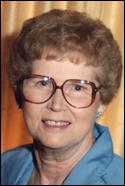
Pauline Janet Padavich Allen
| Birth | : | 26 Jan 1924 Centerville, Appanoose County, Iowa, USA |
| Death | : | 16 Jan 2009 Ottumwa, Wapello County, Iowa, USA |
| Burial | : | Vine Street Hill Cemetery, Cincinnati, Hamilton County, USA |
| Coordinate | : | 39.1516991, -84.5091019 |
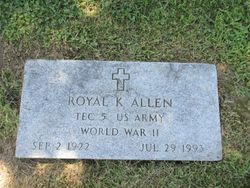
| Description | : | Pauline Janet Allen, 84, formerly of 430 Silverwood Lane, died at 2:30 p.m. Jan. 16, 2009, at The Good Samaritan Society-Ottumwa. She was born Jan. 26, 1924, in Centerville, Iowa, to Jack and Lucille Radosovich Padavich. She married Royal Kenneth Allen July 12, 1941. He preceded her in death July 27, 1993. A resident of Ottumwa most of her life, she had worked at Sunnyslope Care Center and as a Home Health Aid. She was a member of St. Patrick Catholic Church, Altar and Rosary Society, O.B. Nelson Unit No. 3 American Legion Auxiliary and Walter B. Schafer Post No. 775 Veterans... Read More |
frequently asked questions (FAQ):
-
Where is Pauline Janet Padavich Allen's memorial?
Pauline Janet Padavich Allen's memorial is located at: Vine Street Hill Cemetery, Cincinnati, Hamilton County, USA.
-
When did Pauline Janet Padavich Allen death?
Pauline Janet Padavich Allen death on 16 Jan 2009 in Ottumwa, Wapello County, Iowa, USA
-
Where are the coordinates of the Pauline Janet Padavich Allen's memorial?
Latitude: 39.1516991
Longitude: -84.5091019
Family Members:
Parent
Spouse
Siblings
Children
Flowers:
Nearby Cemetories:
1. Vine Street Hill Cemetery
Cincinnati, Hamilton County, USA
Coordinate: 39.1516991, -84.5091019
2. Saint John Cemetery
Saint Bernard, Hamilton County, USA
Coordinate: 39.1643982, -84.5053024
3. Clifton United Jewish Cemetery
Cincinnati, Hamilton County, USA
Coordinate: 39.1470871, -84.5292816
4. Spring Grove Cemetery
Cincinnati, Hamilton County, USA
Coordinate: 39.1647900, -84.5231500
5. Hillside Chapel Crematory and Columbarium
Cincinnati, Hamilton County, USA
Coordinate: 39.1393509, -84.5247192
6. First German Protestant Cemetery
Avondale, Hamilton County, USA
Coordinate: 39.1492004, -84.4863968
7. Methodist Protestant Cemetery (Defunct)
Cincinnati, Hamilton County, USA
Coordinate: 39.1324770, -84.4983160
8. Saint Mary Cemetery
Saint Bernard, Hamilton County, USA
Coordinate: 39.1664009, -84.4880981
9. Walnut Hills Cemetery
Cincinnati, Hamilton County, USA
Coordinate: 39.1355950, -84.4809040
10. Walnut Hills Jewish Cemetery
Evanston, Hamilton County, USA
Coordinate: 39.1403700, -84.4731300
11. Wesleyan Cemetery
Cincinnati, Hamilton County, USA
Coordinate: 39.1599998, -84.5468979
12. Calvary Cemetery
Cincinnati, Hamilton County, USA
Coordinate: 39.1403008, -84.4697037
13. Third Quaker Cemetery (Defunct)
Cincinnati, Hamilton County, USA
Coordinate: 39.1542400, -84.5523720
14. Christ Church Cemetery
Over-The-Rhine, Hamilton County, USA
Coordinate: 39.1126480, -84.5157623
15. Second Quaker Cemetery (Defunct)
Cincinnati, Hamilton County, USA
Coordinate: 39.1153090, -84.5305240
16. Christ Episcopal Churchyard (Defunct)
Cincinnati, Hamilton County, USA
Coordinate: 39.1100520, -84.5177220
17. Potters Field
Cincinnati, Hamilton County, USA
Coordinate: 39.1094440, -84.5188890
18. Thomas Williams Cemetery (Defunct)
Cincinnati, Hamilton County, USA
Coordinate: 39.1085060, -84.5146050
19. Presbyterian Burying Ground
Cincinnati, Hamilton County, USA
Coordinate: 39.1082510, -84.5175720
20. Old Finneytown Cemetery
Finneytown, Hamilton County, USA
Coordinate: 39.1962220, -84.5206120
21. Chestnut Street Cemetery
Over-The-Rhine, Hamilton County, USA
Coordinate: 39.1071610, -84.5212210
22. Lincoln Park Potters Field (Defunct)
Cincinnati, Hamilton County, USA
Coordinate: 39.1097710, -84.5346450
23. Enon Baptist Church Burying Ground (Defunct)
Cincinnati, Hamilton County, USA
Coordinate: 39.1065420, -84.5238110
24. Catherine Street Burying Ground
Cincinnati, Hamilton County, USA
Coordinate: 39.1067490, -84.5252700


