
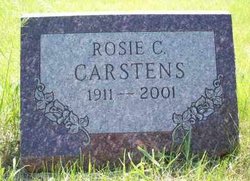
Rosie Caroline Carstens
| Birth | : | 17 Aug 1911 Pierce County, Nebraska, USA |
| Death | : | 9 Mar 2001 Norfolk, Madison County, Nebraska, USA |
| Burial | : | Elizabeth Methodist Church Cemetery, Elizabeth, Crockett County, USA |
| Coordinate | : | 35.9605010, -89.1770140 |
frequently asked questions (FAQ):
-
Where is Rosie Caroline Carstens's memorial?
Rosie Caroline Carstens's memorial is located at: Elizabeth Methodist Church Cemetery, Elizabeth, Crockett County, USA.
-
When did Rosie Caroline Carstens death?
Rosie Caroline Carstens death on 9 Mar 2001 in Norfolk, Madison County, Nebraska, USA
-
Where are the coordinates of the Rosie Caroline Carstens's memorial?
Latitude: 35.9605010
Longitude: -89.1770140
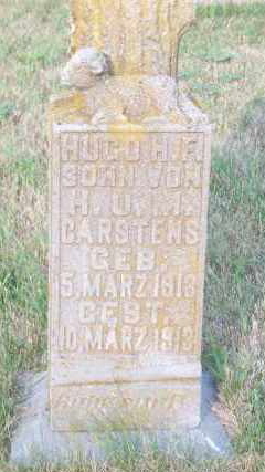
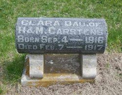
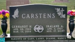
Family Members:
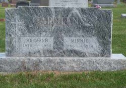
Parent

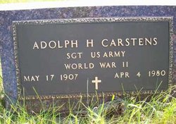
Siblings

Flowers:


Nearby Cemetories:
1. Elizabeth Methodist Church Cemetery
Elizabeth, Crockett County, USA
Coordinate: 35.9605010, -89.1770140
2. Young & Williams Cemetery
Elizabeth, Crockett County, USA
Coordinate: 35.9707990, -89.1937240
3. Bethesda Cemetery
Wilcox, Crockett County, USA
Coordinate: 35.9361230, -89.1557970
4. Old Mayfield Cemetery
Eaton, Gibson County, USA
Coordinate: 35.9894960, -89.1666780
5. Mays Chapel Cemetery
Friendship, Crockett County, USA
Coordinate: 35.9363540, -89.2006050
6. Mayfield Cemetery
Eaton, Gibson County, USA
Coordinate: 35.9910230, -89.1678300
7. Hendrix Cemetery
Tigrett, Dyer County, USA
Coordinate: 35.9511500, -89.2206950
8. Williams Chapel Baptist Church Cemetery
Friendship, Crockett County, USA
Coordinate: 35.9258940, -89.1916320
9. Allen Chapel Cemetery
Tigrett, Dyer County, USA
Coordinate: 35.9511400, -89.2207500
10. Deaton Cemetery
Friendship, Crockett County, USA
Coordinate: 35.9350080, -89.2122640
11. Edwards Cemetery
Friendship, Crockett County, USA
Coordinate: 35.9314120, -89.2146810
12. Spring Hill Baptist Church Cemetery
Eaton, Gibson County, USA
Coordinate: 35.9859520, -89.1221080
13. Mount Zion Cemetery
Friendship, Crockett County, USA
Coordinate: 35.9131950, -89.2032590
14. Sanders Cemetery
Crockett Mills, Crockett County, USA
Coordinate: 35.9096750, -89.1609030
15. Springhill MB Church Cemetery
Eaton, Gibson County, USA
Coordinate: 35.9871860, -89.1210420
16. Bowen Chapel Cemetery
Friendship, Dyer County, USA
Coordinate: 35.9311810, -89.2353720
17. Warren Cemetery
Crockett Mills, Crockett County, USA
Coordinate: 35.9074790, -89.1521770
18. McGary Family Cemetery
Tigrett, Dyer County, USA
Coordinate: 35.9649530, -89.2501520
19. Saint Peter Cemetery
Tigrett, Dyer County, USA
Coordinate: 35.9616440, -89.2520140
20. Wilson Cemetery
Gibson County, USA
Coordinate: 35.9706001, -89.0980988
21. Friendship Cemetery
Friendship, Crockett County, USA
Coordinate: 35.9146430, -89.2381450
22. Bellevernon Cemetery
Friendship, Crockett County, USA
Coordinate: 35.9135830, -89.2495910
23. Providence Baptist Church Cemetery
Crockett Mills, Crockett County, USA
Coordinate: 35.8839830, -89.1595080
24. Asprey Cemetery
Crockett Mills, Crockett County, USA
Coordinate: 35.8844990, -89.1532570