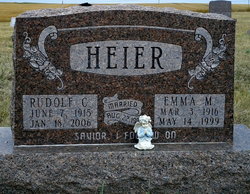
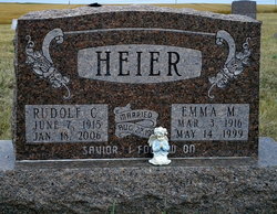
Rudolf Christian Heier
| Birth | : | 7 Jun 1915 |
| Death | : | 18 Jan 2006 Bowdle, Edmunds County, South Dakota, USA |
| Burial | : | Crescent Cemetery, Crescent, Pottawattamie County, USA |
| Coordinate | : | 41.3664894, -95.8566208 |
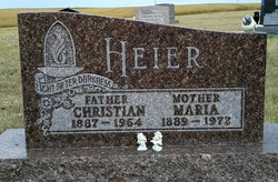
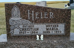
| Description | : | Akaska - Rudolf C. Heier, 90, Akaska, used his ticket to Paradise Wednesday, Jan. 18, 2006, at the Bowdle Nursing Home. Funeral services will be Monday, Jan. 23, 2006, at the Zion Evangelical Lutheran Church, Akaska, with Pastor Michael Gorte officiating. Burial follows at the Akaska Cemetery. Rudolf Christian Heier, son of Maria (Kosel) and Christian Heier, was born June 7, 1915. He lived on the family farm until he was eight years old, and then moved to Akaska. He graduated from the only graduating class in Akaska's history-The Class of 1934. He attended Aberdeen... Read More |
frequently asked questions (FAQ):
-
Where is Rudolf Christian Heier's memorial?
Rudolf Christian Heier's memorial is located at: Crescent Cemetery, Crescent, Pottawattamie County, USA.
-
When did Rudolf Christian Heier death?
Rudolf Christian Heier death on 18 Jan 2006 in Bowdle, Edmunds County, South Dakota, USA
-
Where are the coordinates of the Rudolf Christian Heier's memorial?
Latitude: 41.3664894
Longitude: -95.8566208
Family Members:
Parent
Spouse
Flowers:
Nearby Cemetories:
1. Crescent Cemetery
Crescent, Pottawattamie County, USA
Coordinate: 41.3664894, -95.8566208
2. William C McIntosh Cemetery
Crescent, Pottawattamie County, USA
Coordinate: 41.4088745, -95.8477097
3. Evans Cemetery
Crescent, Pottawattamie County, USA
Coordinate: 41.3255997, -95.8368988
4. Hazel Dell Cemetery
Council Bluffs, Pottawattamie County, USA
Coordinate: 41.3489723, -95.7939911
5. Gregg Cemetery
Weston, Pottawattamie County, USA
Coordinate: 41.3330000, -95.7931000
6. Reels Cemetery
Crescent, Pottawattamie County, USA
Coordinate: 41.4234100, -95.8321700
7. Allen Cemetery
Pottawattamie County, USA
Coordinate: 41.4427986, -95.8550034
8. Garner Cemetery
Council Bluffs, Pottawattamie County, USA
Coordinate: 41.2956161, -95.8001709
9. Grange Cemetery
Honey Creek, Pottawattamie County, USA
Coordinate: 41.4446678, -95.8034668
10. Saint Columbanus Cemetery
Weston, Pottawattamie County, USA
Coordinate: 41.3429440, -95.7435260
11. Mormon Pioneer Cemetery
Omaha, Douglas County, USA
Coordinate: 41.3348450, -95.9663720
12. Crook Cemetery
Honey Creek, Pottawattamie County, USA
Coordinate: 41.4581330, -95.8737000
13. Green Valley Cemetery
Council Bluffs, Pottawattamie County, USA
Coordinate: 41.2743988, -95.8225021
14. Fairview Cemetery
Council Bluffs, Pottawattamie County, USA
Coordinate: 41.2703018, -95.8480988
15. Walnut Hill Cemetery
Council Bluffs, Pottawattamie County, USA
Coordinate: 41.2719002, -95.8255997
16. Saint Joseph Cemetery
Council Bluffs, Pottawattamie County, USA
Coordinate: 41.2722015, -95.8208008
17. Shipley Cemetery
Washington County, USA
Coordinate: 41.3932991, -95.9828033
18. Saint Pauls Lutheran Cemetery
Neola, Pottawattamie County, USA
Coordinate: 41.4337000, -95.7607000
19. Bikhor Cholim Cemetery
Council Bluffs, Pottawattamie County, USA
Coordinate: 41.2703670, -95.8229350
20. Ridgewood Cemetery
Council Bluffs, Pottawattamie County, USA
Coordinate: 41.2694016, -95.8272018
21. Oak Hill Cemetery
Council Bluffs, Pottawattamie County, USA
Coordinate: 41.2700900, -95.8226400
22. Cedar Lawn Cemetery
Council Bluffs, Pottawattamie County, USA
Coordinate: 41.2694016, -95.8182983
23. Saint Bridgets Cemetery
Honey Creek, Pottawattamie County, USA
Coordinate: 41.4664001, -95.8289032
24. Pleasant Hill Jewish Cemetery
Omaha, Douglas County, USA
Coordinate: 41.3185997, -95.9766998


