
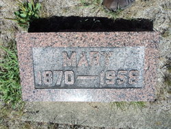
| Birth | : | 16 Jul 1874 Gilbertville, Black Hawk County, Iowa, USA |
| Death | : | 12 Mar 1965 Waterloo, Black Hawk County, Iowa, USA |
| Burial | : | Old St. Nicholas Churchyard, Heythrop, West Oxfordshire District, England |
| Coordinate | : | 51.9468000, -1.4889600 |
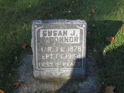
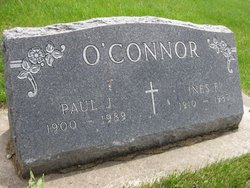
| Inscription | : | O'Connor Father Richard F 1863 - 1944 Mother Sophia J 1874 - 1965 |
| Description | : | Sophia's maiden name and parental links were provided courtesy of Find A Grave member M. Aumen. Thank you |
frequently asked questions (FAQ):
-
Where is Sophia Josephine Youngblut O'Connor's memorial?
Sophia Josephine Youngblut O'Connor's memorial is located at: Old St. Nicholas Churchyard, Heythrop, West Oxfordshire District, England.
-
When did Sophia Josephine Youngblut O'Connor death?
Sophia Josephine Youngblut O'Connor death on 12 Mar 1965 in Waterloo, Black Hawk County, Iowa, USA
-
Where are the coordinates of the Sophia Josephine Youngblut O'Connor's memorial?
Latitude: 51.9468000
Longitude: -1.4889600
Family Members:
Parent

Spouse
Siblings
Children
Flowers:


Nearby Cemetories:
1. Old St. Nicholas Churchyard
Heythrop, West Oxfordshire District, England
Coordinate: 51.9468000, -1.4889600
2. St Johns Churchyard
Little Tew, West Oxfordshire District, England
Coordinate: 51.9540390, -1.4419230
3. Holy Trinity Catholic Churchyard
Chipping Norton, West Oxfordshire District, England
Coordinate: 51.9439300, -1.5388200
4. St Kenelm's Churchyard Extension
Enstone, West Oxfordshire District, England
Coordinate: 51.9240960, -1.4484250
5. St. Kenelms Churchyard
Enstone, West Oxfordshire District, England
Coordinate: 51.9232490, -1.4494010
6. St Mary Churchyard
Swerford, West Oxfordshire District, England
Coordinate: 51.9773470, -1.4593150
7. St. Mary the Virgin Churchyard
Chipping Norton, West Oxfordshire District, England
Coordinate: 51.9434900, -1.5476200
8. Friends Burial Ground
Chipping Norton, West Oxfordshire District, England
Coordinate: 51.9415950, -1.5498310
9. Great Rollright St Andrews Churchyard
Rollright, West Oxfordshire District, England
Coordinate: 51.9809290, -1.5255550
10. Chipping Norton Cemetery
Chipping Norton, West Oxfordshire District, England
Coordinate: 51.9414200, -1.5555900
11. St Michael and All Angels Churchyard
Great Tew, West Oxfordshire District, England
Coordinate: 51.9569280, -1.4205150
12. Hook Norton Baptist Burial Ground
Hook Norton, Cherwell District, England
Coordinate: 51.9953000, -1.4860900
13. St Peters Churchyard
Hook Norton, Cherwell District, England
Coordinate: 51.9954200, -1.4842490
14. Hook Norton Cemetery
Hook Norton, Cherwell District, England
Coordinate: 51.9969440, -1.4787690
15. St. Nicholas Church
Chadlington, West Oxfordshire District, England
Coordinate: 51.8959090, -1.5160180
16. All Saints Churchyard
Spelsbury, West Oxfordshire District, England
Coordinate: 51.8909988, -1.4941750
17. St. Philip Church
Little Rollright, West Oxfordshire District, England
Coordinate: 51.9688330, -1.5742230
18. St. Mary's Churchyard
Salford, West Oxfordshire District, England
Coordinate: 51.9505810, -1.5844700
19. Saint Giles
Wigginton, Cherwell District, England
Coordinate: 51.9966400, -1.4324000
20. St Martins Churchyard
Sandford St Martin, West Oxfordshire District, England
Coordinate: 51.9371500, -1.3901400
21. St Nicholas Churchyard
Kiddington, West Oxfordshire District, England
Coordinate: 51.9032900, -1.4031790
22. St James Churchyard
Nether Worton, West Oxfordshire District, England
Coordinate: 51.9678100, -1.3807900
23. All Saints Churchyard
Churchill, West Oxfordshire District, England
Coordinate: 51.9146590, -1.5898010
24. St James' Church
Sarsden, West Oxfordshire District, England
Coordinate: 51.9048470, -1.5806760