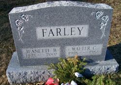
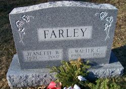
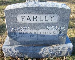
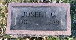
Walter C. Farley
| Birth | : | 10 Jan 1918 Hunterdon County, New Jersey, USA |
| Death | : | 14 Aug 1984 Naples, Collier County, Florida, USA |
| Burial | : | St Mary's Abbey, Reculver, City of Canterbury, England |
| Coordinate | : | 51.3795360, 1.1993770 |
| Description | : | He and his wife ran the Farley's General Store in Oldwick. Retired as the Postmaster in 1972. Member of the North Hunterdon Regional High School Board of Education. Member of the Huterdon County Selective Service Board. Past master of Hobart Lodge, F&AM, High Bridge, an exempt member of the Oldwick Fire Company and member of the Oldwick United Methodist Church. Bio by Donna Lamerson. |
frequently asked questions (FAQ):
-
Where is Walter C. Farley's memorial?
Walter C. Farley's memorial is located at: St Mary's Abbey, Reculver, City of Canterbury, England.
-
When did Walter C. Farley death?
Walter C. Farley death on 14 Aug 1984 in Naples, Collier County, Florida, USA
-
Where are the coordinates of the Walter C. Farley's memorial?
Latitude: 51.3795360
Longitude: 1.1993770
Family Members:
Parent
Spouse
Siblings
Children
Flowers:
Nearby Cemetories:
1. St Mary's Abbey
Reculver, City of Canterbury, England
Coordinate: 51.3795360, 1.1993770
2. St Mary the Virgin Churchyard
Reculver, City of Canterbury, England
Coordinate: 51.3684750, 1.1766050
3. St Nicholas-at-Wade Cemetery
St Nicholas at Wade, Thanet District, England
Coordinate: 51.3578344, 1.2534168
4. St. Nicholas' Churchyard
St Nicholas at Wade, Thanet District, England
Coordinate: 51.3542160, 1.2517980
5. St Mary The Virgin Churchyard
Chislet, City of Canterbury, England
Coordinate: 51.3343610, 1.1921020
6. Herne Bay Cemetery
Herne Bay, City of Canterbury, England
Coordinate: 51.3571810, 1.1304820
7. St Martins
Herne, City of Canterbury, England
Coordinate: 51.3500600, 1.1333200
8. St Martin's Churchyard
Herne, City of Canterbury, England
Coordinate: 51.3497060, 1.1334370
9. All Saints Churchyard
Stourmouth, Dover District, England
Coordinate: 51.3202600, 1.2365520
10. All Saints Churchyard
Birchington, Thanet District, England
Coordinate: 51.3736580, 1.3059360
11. Stodmarsh St Marys Churchyard
Wickhambreaux, City of Canterbury, England
Coordinate: 51.3009500, 1.1836900
12. All Saints Churchyard
Westbere, City of Canterbury, England
Coordinate: 51.3065380, 1.1437670
13. St Mildred Churchyard
Preston, Dover District, England
Coordinate: 51.2985000, 1.2173980
14. Minster Cemetery
Minster-in-Thanet, Thanet District, England
Coordinate: 51.3423100, 1.3160550
15. St John the Baptist Churchyard
Swalecliffe, City of Canterbury, England
Coordinate: 51.3645500, 1.0667200
16. Sturry Cemetery
Sturry, City of Canterbury, England
Coordinate: 51.3058100, 1.1277700
17. Elmstone Churchyard
Preston, Dover District, England
Coordinate: 51.2967160, 1.2424980
18. St Mary the Virgin Church
Minster-in-Thanet, Thanet District, England
Coordinate: 51.3305810, 1.3156720
19. St Nicholas Churchyard
Sturry, City of Canterbury, England
Coordinate: 51.2984830, 1.1201330
20. St Mary the Virgin Churchyard
Fordwich, City of Canterbury, England
Coordinate: 51.2958300, 1.1270530
21. St Andrew Churchyard
Wickhambreaux, City of Canterbury, England
Coordinate: 51.2844400, 1.1822300
22. All Saints Churchyard
Whitstable, City of Canterbury, England
Coordinate: 51.3558090, 1.0396670
23. Whitstable Cemetery
Whitstable, City of Canterbury, England
Coordinate: 51.3529870, 1.0338530
24. St Mary the Virgin Churchyard
Wingham, Dover District, England
Coordinate: 51.2721220, 1.2128950

