
| Birth | : | Feb 1872 Honington, South Kesteven District, Lincolnshire, England |
| Death | : | 20 Mar 1932 Honington, South Kesteven District, Lincolnshire, England |
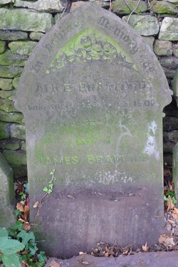
| Burial | : | St. Wilfrid Churchyard, Honington, South Kesteven District, England |
| Coordinate | : | 52.9795600, -0.5965700 |
frequently asked questions (FAQ):
-
Where is William Campain Bradford's memorial?
William Campain Bradford's memorial is located at: St. Wilfrid Churchyard, Honington, South Kesteven District, England.
-
When did William Campain Bradford death?
William Campain Bradford death on 20 Mar 1932 in Honington, South Kesteven District, Lincolnshire, England
-
Where are the coordinates of the William Campain Bradford's memorial?
Latitude: 52.9795600
Longitude: -0.5965700
Family Members:
Parent

Spouse

Siblings
Flowers:


Nearby Cemetories:
1. St. Wilfrid Churchyard
Honington, South Kesteven District, England
Coordinate: 52.9795600, -0.5965700
2. St. Nicholas Churchyard
Carlton Scroop, South Kesteven District, England
Coordinate: 52.9940290, -0.5895960
3. St Nicholas Churchyard
Barkston, South Kesteven District, England
Coordinate: 52.9629960, -0.6129380
4. St Marys Churchyard
Syston, South Kesteven District, England
Coordinate: 52.9578420, -0.6172940
5. St Nicholas Churchyard
Normanton, South Kesteven District, England
Coordinate: 53.0051390, -0.5874570
6. All Saints Churchyard
Hough-on-the-Hill, South Kesteven District, England
Coordinate: 53.0069700, -0.6255100
7. Ancaster Cemetery
Ancaster, South Kesteven District, England
Coordinate: 52.9814450, -0.5387892
8. St. Martin Churchyard
Ancaster, South Kesteven District, England
Coordinate: 52.9804810, -0.5377820
9. St. Peter and St. Paul's Churchyard
Belton, South Kesteven District, England
Coordinate: 52.9451000, -0.6177000
10. St. Vincent Churchyard
Caythorpe, South Kesteven District, England
Coordinate: 53.0261420, -0.6015930
11. St John the Baptist Churchyard
Londonthorpe, South Kesteven District, England
Coordinate: 52.9312060, -0.5837350
12. All Saints Churchyard
Hougham, South Kesteven District, England
Coordinate: 52.9878240, -0.6806910
13. St John the Evangelist Churchyard
Manthorpe, South Kesteven District, England
Coordinate: 52.9306320, -0.6323160
14. St Andrew Churchyard
Kelby, North Kesteven District, England
Coordinate: 52.9608000, -0.5074000
15. St. Andrew's Churchyard
South Kesteven District, England
Coordinate: 52.9608000, -0.5074000
16. St. Mary's Churchyard
Wilsford, North Kesteven District, England
Coordinate: 52.9751600, -0.5023700
17. St Sebastian Churchyard
Great Gonerby, South Kesteven District, England
Coordinate: 52.9329260, -0.6657700
18. St. Nicholas Churchyard
Fulbeck, South Kesteven District, England
Coordinate: 53.0426840, -0.5871030
19. Manthorpe Road Old Cemetery
Grantham, South Kesteven District, England
Coordinate: 52.9173900, -0.6409900
20. St. Michael's and All Angels Churchyard
Heydour, South Kesteven District, England
Coordinate: 52.9444900, -0.4987800
21. Saint Michael Churchyard
Heydour, South Kesteven District, England
Coordinate: 52.9443700, -0.4987000
22. St. Wulfram Churchyard
Grantham, South Kesteven District, England
Coordinate: 52.9148180, -0.6408520
23. Grantham Cemetery and Crematorium
Grantham, South Kesteven District, England
Coordinate: 52.9095320, -0.6326120
24. St Peter's Churchyard
North Rauceby, North Kesteven District, England
Coordinate: 53.0056400, -0.4796500