
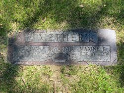
William F Mether
| Birth | : | 14 Oct 1916 Logan, Harrison County, Iowa, USA |
| Death | : | 28 Nov 2006 Council Bluffs, Pottawattamie County, Iowa, USA |
| Burial | : | Ellesmere Public Cemetery, Leeston, Selwyn District, New Zealand |
| Coordinate | : | -43.7775690, 172.2599220 |
| Description | : | William F "Bill" Mether, 90 Years, Council Bluffs, Passed away Nov 28, 2006. Born on Oct 14, 1916, in rural Logan, Iowa, to the late Herman J and Amanda [Lennert] Mether, he was a 1934 graduate of Magnolia High school. He served in the 22nd Tank Bn. of the 11th Armored Division Thunderbolts in Europe during World War II. A member of Broadway Christian Church, he was a life member of VFW Post 737. He was retired from teh Iowa Highway Commission. He loved to travel and fish. He and his wife, Maxine E [Shockey] would have observed their 58th wedding... Read More |
frequently asked questions (FAQ):
-
Where is William F Mether's memorial?
William F Mether's memorial is located at: Ellesmere Public Cemetery, Leeston, Selwyn District, New Zealand.
-
When did William F Mether death?
William F Mether death on 28 Nov 2006 in Council Bluffs, Pottawattamie County, Iowa, USA
-
Where are the coordinates of the William F Mether's memorial?
Latitude: -43.7775690
Longitude: 172.2599220
Family Members:
Parent

Siblings
Flowers:


Nearby Cemetories:
1. Ellesmere Public Cemetery
Leeston, Selwyn District, New Zealand
Coordinate: -43.7775690, 172.2599220
2. Ellesmere Catholic Cemetery
Leeston, Selwyn District, New Zealand
Coordinate: -43.7845860, 172.2690990
3. Bishops Corner Cemetery
Southbridge, Selwyn District, New Zealand
Coordinate: -43.7824100, 172.2422900
4. St James Churchyard
Southbridge, Selwyn District, New Zealand
Coordinate: -43.8092360, 172.2502680
5. Killinchy Cemetery
Leeston, Selwyn District, New Zealand
Coordinate: -43.7325610, 172.2411540
6. Sedgemere Cemetery
Sedgemere, Selwyn District, New Zealand
Coordinate: -43.8366600, 172.3149500
7. St Luke's Anglican Churchyard
Brookside, Selwyn District, New Zealand
Coordinate: -43.6903100, 172.3029000
8. Brookside Cemetery
Brookside, Selwyn District, New Zealand
Coordinate: -43.6751800, 172.2683700
9. Hone Wetere Churchyard
Taumutu, Selwyn District, New Zealand
Coordinate: -43.8567680, 172.3586330
10. Dunsandel Cemetery
Dunsandel, Selwyn District, New Zealand
Coordinate: -43.6710940, 172.1382620
11. Dorie Cemetery
Dorie, Ashburton District, New Zealand
Coordinate: -43.8772900, 172.0862500
12. St Mary's Churchyard
Springston, Selwyn District, New Zealand
Coordinate: -43.6446560, 172.4263590
13. Kyle Cemetery
Dorie, Ashburton District, New Zealand
Coordinate: -43.9193236, 172.0979192
14. Rakaia Cemetery
Rakaia, Ashburton District, New Zealand
Coordinate: -43.7548910, 171.9939270
15. Springston Cemetery
Lincoln, Selwyn District, New Zealand
Coordinate: -43.6404360, 172.4509420
16. Lincoln Cemetery
Lincoln, Selwyn District, New Zealand
Coordinate: -43.6311790, 172.4862570
17. Weedons Cemetery
Weedons, Selwyn District, New Zealand
Coordinate: -43.5670010, 172.4015870
18. Chertsey Cemetery
Chertsey, Ashburton District, New Zealand
Coordinate: -43.8030500, 171.9319400
19. Shands Road Cemetery
Prebbleton, Selwyn District, New Zealand
Coordinate: -43.5792540, 172.4888630
20. Prebbleton Cemetery
Prebbleton, Selwyn District, New Zealand
Coordinate: -43.5887200, 172.5053500
21. St Paul's Anglican Church Cemetery
West Melton, Selwyn District, New Zealand
Coordinate: -43.5261700, 172.3701800
22. Greendale Cemetery
Greendale, Selwyn District, New Zealand
Coordinate: -43.5447560, 172.0772460
23. Church of the Epiphany Churchyard
Teddington, Christchurch City, New Zealand
Coordinate: -43.7016200, 172.6182200
24. All Saint's Churchyard
Prebbleton, Selwyn District, New Zealand
Coordinate: -43.5781040, 172.5131430