
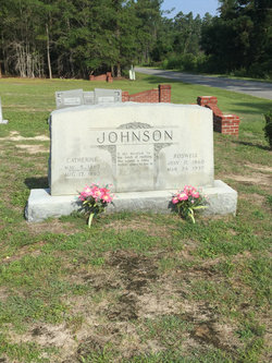

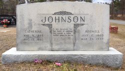

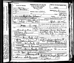
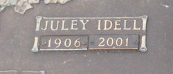
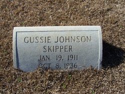
William Roswell Johnson
| Birth | : | 17 Jul 1860 South Carolina, USA |
| Death | : | 24 Mar 1937 Horry County, South Carolina, USA |
| Burial | : | Wells Cathedral, Wells, Mendip District, England |
| Coordinate | : | 51.2103610, -2.6433940 |
| Description | : | This was my great granddaddy..he had a heart attack while checking his tobacco beds and was found dead by one of his children |
frequently asked questions (FAQ):
-
Where is William Roswell Johnson's memorial?
William Roswell Johnson's memorial is located at: Wells Cathedral, Wells, Mendip District, England.
-
When did William Roswell Johnson death?
William Roswell Johnson death on 24 Mar 1937 in Horry County, South Carolina, USA
-
Where are the coordinates of the William Roswell Johnson's memorial?
Latitude: 51.2103610
Longitude: -2.6433940
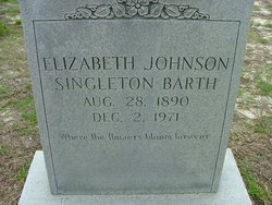
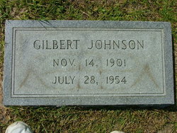
Family Members:
Parent

Spouse
Siblings

Children
Flowers:


Nearby Cemetories:
1. Wells Cathedral
Wells, Mendip District, England
Coordinate: 51.2103610, -2.6433940
2. St. Cuthbert Churchyard
Wells, Mendip District, England
Coordinate: 51.2080930, -2.6502690
3. St Thomas Churchyard
Wells, Mendip District, England
Coordinate: 51.2132380, -2.6370870
4. Mendip Hospital Cemetery
Wells, Mendip District, England
Coordinate: 51.2106490, -2.6262980
5. Wells Cemetery
Wells, Mendip District, England
Coordinate: 51.2088240, -2.6640120
6. Saint Michael & All Angels Churchyard
Dinder, Mendip District, England
Coordinate: 51.1994600, -2.6094800
7. Coxley Methodist Churchyard
Coxley, Mendip District, England
Coordinate: 51.1918900, -2.6723700
8. Saint John the Evangelist
East Horrington, Mendip District, England
Coordinate: 51.2180000, -2.6006900
9. St. Matthew Churchyard
Wookey, Mendip District, England
Coordinate: 51.2093000, -2.6893000
10. Christ Church
Coxley, Mendip District, England
Coordinate: 51.1869530, -2.6797580
11. Saint Mary Churchyard
Croscombe, Mendip District, England
Coordinate: 51.1974000, -2.5872000
12. St Peter Churchyard
North Wootton, Mendip District, England
Coordinate: 51.1738520, -2.6252470
13. Mendip crematorium
Mendip District, England
Coordinate: 51.1911487, -2.5797562
14. Christ Church Churchyard
Henton, Mendip District, England
Coordinate: 51.2056460, -2.7256380
15. St Lawrence Churchyard
Westbury, Mendip District, England
Coordinate: 51.2354140, -2.7182630
16. St. Lawrence's Churchyard
Priddy, Mendip District, England
Coordinate: 51.2596770, -2.6777600
17. St. John The Baptist Churchyard
Pilton, Mendip District, England
Coordinate: 51.1650000, -2.5898000
18. Shepton Mallet Cemetery
Shepton Mallet, Mendip District, England
Coordinate: 51.1948900, -2.5483390
19. St Peter and St Paul Church
Shepton Mallet, Mendip District, England
Coordinate: 51.1908700, -2.5454300
20. Holy Trinity Churchyard
Binegar, Mendip District, England
Coordinate: 51.2425530, -2.5524812
21. Holy Trinity Church
Godney, Mendip District, England
Coordinate: 51.1793400, -2.7377400
22. St Nicholas Churchyard
West Pennard, Mendip District, England
Coordinate: 51.1415596, -2.6413050
23. Glastonbury Cemetery
Glastonbury, Mendip District, England
Coordinate: 51.1565160, -2.7132380
24. St. Leonard's Churchyard
Rodney Stoke, Mendip District, England
Coordinate: 51.2455140, -2.7431800