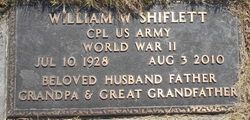
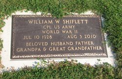
William Warren “Bill” Shiflett
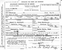
| Birth | : | 10 Jul 1928 Fortine, Lincoln County, Montana, USA |
| Death | : | 3 Aug 2010 Santa Monica, Los Angeles County, California, USA |
| Burial | : | St. Andrew's Churchyard, Cheddar, Sedgemoor District, England |
| Coordinate | : | 51.2736740, -2.7761330 |
| Description | : | William "Bill" Warren Shiflett passed away Aug. 3, 2010 of cancer while visiting family in Santa Monica, Calif. Bill was born in Fortine and was a longtime resident of Libby. He served in the U.S. Army from 1945-52. Bill married Irma Jean Wilson on March 30, 1952. Irma preceded him in death on Dec. 30, 1989. Bill married Joanne Fillbrown Jaquith on March 17, 1991. Bill was followed in death by his daughter, Billie Louise Hemphill of Eagle River, Alaska on Sept. 5, 2010 of complications from a stroke. He is survived by his wife, Joanne; daughters, Janie McNair of Libby; and Lorrie... Read More |
frequently asked questions (FAQ):
-
Where is William Warren “Bill” Shiflett's memorial?
William Warren “Bill” Shiflett's memorial is located at: St. Andrew's Churchyard, Cheddar, Sedgemoor District, England.
-
When did William Warren “Bill” Shiflett death?
William Warren “Bill” Shiflett death on 3 Aug 2010 in Santa Monica, Los Angeles County, California, USA
-
Where are the coordinates of the William Warren “Bill” Shiflett's memorial?
Latitude: 51.2736740
Longitude: -2.7761330
Family Members:
Parent
Spouse
Siblings
Children
Nearby Cemetories:
1. St. Andrew's Churchyard
Cheddar, Sedgemoor District, England
Coordinate: 51.2736740, -2.7761330
2. Cheddar Baptist Burial Ground
Cheddar, Sedgemoor District, England
Coordinate: 51.2767330, -2.7792010
3. St. Peter's Churchyard
Draycott, Mendip District, England
Coordinate: 51.2580900, -2.7523800
4. St. Michael Sanatorium Cemetery
Axbridge, Sedgemoor District, England
Coordinate: 51.2904100, -2.8056900
5. St. John the Baptist Churchyard
Axbridge, Sedgemoor District, England
Coordinate: 51.2876300, -2.8162900
6. St. Leonard's Churchyard
Rodney Stoke, Mendip District, England
Coordinate: 51.2455140, -2.7431800
7. St Gregory Churchyard
Weare, Sedgemoor District, England
Coordinate: 51.2699900, -2.8408600
8. St Leonard's Churchyard
Shipham, Sedgemoor District, England
Coordinate: 51.3130980, -2.8001830
9. St. Mary Magdalene Churchyard Extension
Wedmore, Sedgemoor District, England
Coordinate: 51.2327583, -2.8065246
10. Shipham Cemetery
Shipham, Sedgemoor District, England
Coordinate: 51.3201930, -2.7992390
11. St. Mary Churchyard
Wedmore, Sedgemoor District, England
Coordinate: 51.2276790, -2.8110360
12. St Michael and All Angels
Rowberrow, North Somerset Unitary Authority, England
Coordinate: 51.3240000, -2.7915000
13. Allerton Churchyard
Chapel Allerton, Sedgemoor District, England
Coordinate: 51.2479860, -2.8482400
14. Baptist Churchyard
Wedmore, Sedgemoor District, England
Coordinate: 51.2260400, -2.8099800
15. St Lawrence Churchyard
Westbury, Mendip District, England
Coordinate: 51.2354140, -2.7182630
16. St. James the Great Churchyard
Winscombe, North Somerset Unitary Authority, England
Coordinate: 51.3059750, -2.8456900
17. St Congar Churchyard
Badgworth, Sedgemoor District, England
Coordinate: 51.2699300, -2.8674000
18. Holy Trinity Churchyard
Burrington, North Somerset Unitary Authority, England
Coordinate: 51.3307830, -2.7496010
19. Saint Andrew Churchyard
Compton Bishop, Sedgemoor District, England
Coordinate: 51.2943290, -2.8678900
20. Winscombe and Sandford Cemetery
Winscombe, North Somerset Unitary Authority, England
Coordinate: 51.3223861, -2.8386889
21. Methodist Church Burial Ground
Churchill, North Somerset Unitary Authority, England
Coordinate: 51.3344140, -2.8000610
22. Christ Church Theale
Wedmore, Sedgemoor District, England
Coordinate: 51.2113720, -2.7631570
23. St. Lawrence's Churchyard
Priddy, Mendip District, England
Coordinate: 51.2596770, -2.6777600
24. Holy Trinity Churchyard
Blackford, Sedgemoor District, England
Coordinate: 51.2257800, -2.8483000


