
| Memorials | : | 0 |
| Location | : | Boquillas Crossing, Brewster County, USA |
| Coordinate | : | 29.1931830, -102.9438930 |
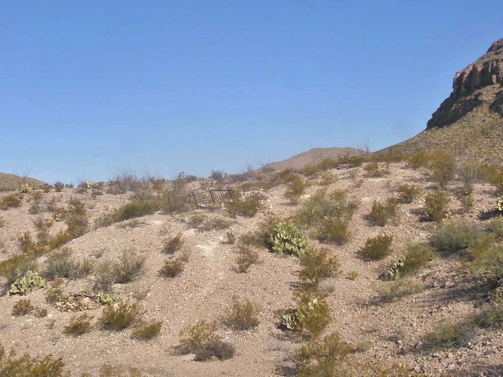
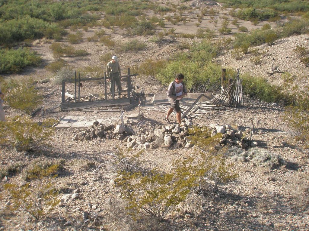
| Description | : | 5 graves at the site of the old Chata's store, inside Big Bend National Park, in the Boquillas Canyon area. Directions: Take the main Big Bend National Park road east to Boquillas Canyon. Go past the Boquillas Crossing port of entry road one-quarter mile (two and a half tenths) to Research Station Rd. Park out of the way there, and walk 150 feet west. The cemetery is on the north side of the road. |
frequently asked questions (FAQ):
-
Where is Chatta's Store Cemetery?
Chatta's Store Cemetery is located at Boquillas Crossing, Brewster County ,Texas ,USA.
-
Chatta's Store Cemetery cemetery's updated grave count on graveviews.com?
0 memorials
-
Where are the coordinates of the Chatta's Store Cemetery?
Latitude: 29.1931830
Longitude: -102.9438930
Nearby Cemetories:
1. Boqullias Crossing
Boquillas Crossing, Brewster County, USA
Coordinate: 29.1884000, -102.9490200
2. Jesse M. Parker Gravesite
Brewster County, USA
Coordinate: 29.1933050, -102.9316380
3. Boqullias
Las Boquillas, Hidalgo del Parral Municipality, Mexico
Coordinate: 29.1653500, -102.9508200
4. San Vicente Cemetery
Brewster County, USA
Coordinate: 29.1557100, -103.0189420
5. Juan De Leon Gravesite
Brewster County, USA
Coordinate: 29.2465610, -103.0191900
6. La Noria Cemetery
Brewster County, USA
Coordinate: 29.2484050, -103.0263025
7. San Vicente Crossing Cemetery
San Vicente Crossing, Brewster County, USA
Coordinate: 29.1326220, -103.0225550
8. Rice Cemetery
Brewster County, USA
Coordinate: 29.2455997, -103.1318970
9. Glenn Springs Cemetery
Brewster County, USA
Coordinate: 29.1741910, -103.1581210
10. Solis Burial Site
Solis Landing, Brewster County, USA
Coordinate: 29.0593720, -103.1107950
11. Green Wax Camp Cemetery
Brewster County, USA
Coordinate: 29.4057800, -103.1052950
12. Nina Marie Seawell Hannold Gravesite
Brewster County, USA
Coordinate: 29.3694020, -103.1674940
13. Woodson's Cemetery
Brewster County, USA
Coordinate: 29.0076110, -103.2934410
14. Sierra Chino Burial Site
Sierra Chino, Brewster County, USA
Coordinate: 29.0415820, -103.4155680
15. Terlingua Ranch Cemetery
Terlingua, Brewster County, USA
Coordinate: 29.4616000, -103.3826000
16. El Ojito Cemetery
Castolon, Brewster County, USA
Coordinate: 29.1244320, -103.5036250
17. Castolon Cemetery
Castolon, Brewster County, USA
Coordinate: 29.1339870, -103.5108100
18. La Coyota Burial Site
Castolon, Brewster County, USA
Coordinate: 29.1459250, -103.5370170
19. Study Butte Cemetery
Terlingua, Brewster County, USA
Coordinate: 29.3132880, -103.5249610
20. Coyote Cemetery
Brewster County, USA
Coordinate: 29.1495750, -103.5430960
21. Valenzuela Ranch Cemetery
Terlingua, Brewster County, USA
Coordinate: 29.2236800, -103.5816010
22. Terlingua de Abajo Cemetery
Terlingua Abaja, Brewster County, USA
Coordinate: 29.2170550, -103.5989530
23. Dryden Ranch Cemetery
Brewster County, USA
Coordinate: 29.2169360, -103.5991290
24. Terlingua Abajo Campground
Terlingua, Brewster County, USA
Coordinate: 29.1981970, -103.6034530