
| Memorials | : | 0 |
| Location | : | Castolon, Brewster County, USA |
| Coordinate | : | 29.1339870, -103.5108100 |
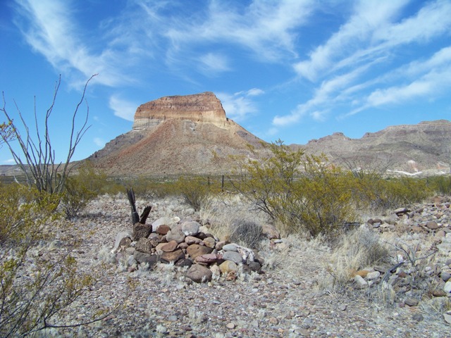
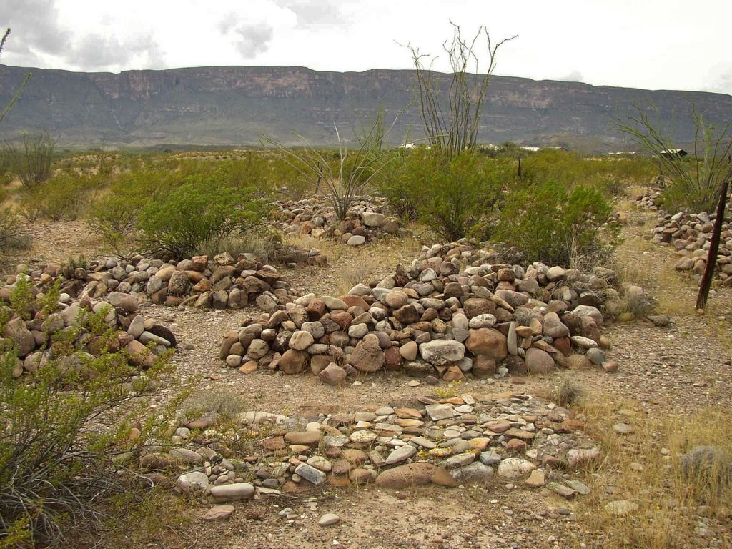
| Description | : | n the early 1900s, people began to live and farm along the banks of the Rio Grande River here. The fields were fertile and the community grew. The farmers raised corn, beans, wheat, squash, tomatoes, and melons. In 1901, Cipriano Hernandez started the first store in the area and sold goods to his neighbors and to the mining community in Terlingua. From about 1912 to 1920, revolution raged in Mexico, and many Mexican families moved north of the river to avoid the bloodshed and bandit raids. The raids brought the U.S. military to defend the border, with a camp at Castolon (Camp Santa Helena),... Read More |
frequently asked questions (FAQ):
-
Where is Castolon Cemetery?
Castolon Cemetery is located at Castolon, Brewster County ,Texas ,USA.
-
Castolon Cemetery cemetery's updated grave count on graveviews.com?
0 memorials
-
Where are the coordinates of the Castolon Cemetery?
Latitude: 29.1339870
Longitude: -103.5108100

Nearby Cemetories:
1. El Ojito Cemetery
Castolon, Brewster County, USA
Coordinate: 29.1244320, -103.5036250
2. La Coyota Burial Site
Castolon, Brewster County, USA
Coordinate: 29.1459250, -103.5370170
3. Coyote Cemetery
Brewster County, USA
Coordinate: 29.1495750, -103.5430960
4. Terlingua Abaja II Cemetery
Terlingua Abaja, Brewster County, USA
Coordinate: 29.1878450, -103.6107320
5. Terlingua Abajo Campground
Terlingua, Brewster County, USA
Coordinate: 29.1981970, -103.6034530
6. Valenzuela Ranch Cemetery
Terlingua, Brewster County, USA
Coordinate: 29.2236800, -103.5816010
7. Terlingua de Abajo Cemetery
Terlingua Abaja, Brewster County, USA
Coordinate: 29.2170550, -103.5989530
8. Dryden Ranch Cemetery
Brewster County, USA
Coordinate: 29.2169360, -103.5991290
9. Sierra Chino Burial Site
Sierra Chino, Brewster County, USA
Coordinate: 29.0415820, -103.4155680
10. Study Butte Cemetery
Terlingua, Brewster County, USA
Coordinate: 29.3132880, -103.5249610
11. Terlingua Cemetery
Terlingua, Brewster County, USA
Coordinate: 29.3197994, -103.6123962
12. Woodson's Cemetery
Brewster County, USA
Coordinate: 29.0076110, -103.2934410
13. Lajitas Cemetery
Brewster County, USA
Coordinate: 29.2623005, -103.7745972
14. Glenn Springs Cemetery
Brewster County, USA
Coordinate: 29.1741910, -103.1581210
15. Terlingua Ranch Cemetery
Terlingua, Brewster County, USA
Coordinate: 29.4616000, -103.3826000
16. Panteón Municipal de Manuel Benavides
Manuel Benavides, Manuel Benavides Municipality, Mexico
Coordinate: 29.1040780, -103.9081030
17. Rice Cemetery
Brewster County, USA
Coordinate: 29.2455997, -103.1318970
18. Solis Burial Site
Solis Landing, Brewster County, USA
Coordinate: 29.0593720, -103.1107950
19. Nina Marie Seawell Hannold Gravesite
Brewster County, USA
Coordinate: 29.3694020, -103.1674940
20. San Vicente Crossing Cemetery
San Vicente Crossing, Brewster County, USA
Coordinate: 29.1326220, -103.0225550
21. San Vicente Cemetery
Brewster County, USA
Coordinate: 29.1557100, -103.0189420
22. La Noria Cemetery
Brewster County, USA
Coordinate: 29.2484050, -103.0263025
23. Juan De Leon Gravesite
Brewster County, USA
Coordinate: 29.2465610, -103.0191900
24. Green Wax Camp Cemetery
Brewster County, USA
Coordinate: 29.4057800, -103.1052950