
| Memorials | : | 0 |
| Location | : | Brewster County, USA |
| Coordinate | : | 29.1557100, -103.0189420 |
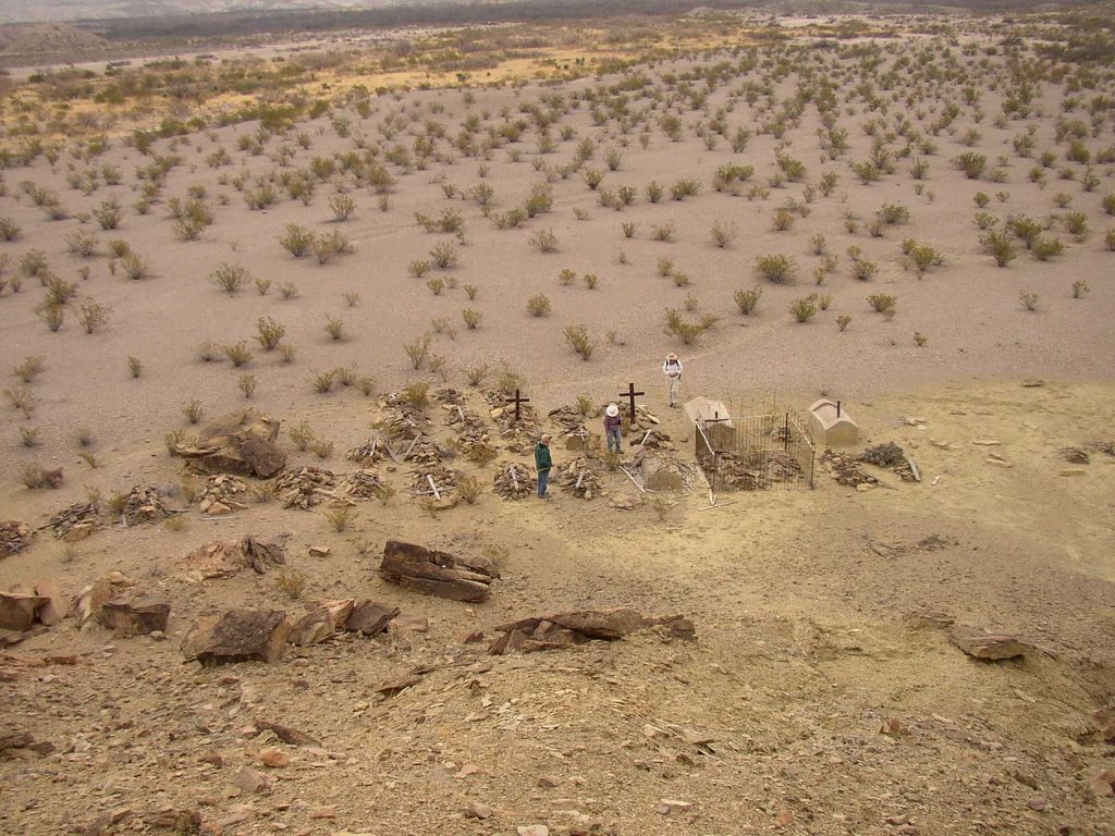
| Description | : | The San Vicente cemetery is located at the former site of the village of San Vicente, within Big Bend National Park, which still contains traces of its former occupation. The cemetery lies at the base of a ridgeline and contains 37 graves. It should not be confused with San Vicente Crossing farther southwest, which has another cemetery. Directions: From Main Park Road 118, turn south onto dirt River Road East. Drive 2.7 miles south to where the La Clocha road branches off to the southeast. Go another 1500 feet to the next dry creek bed. Park out of the way,... Read More |
frequently asked questions (FAQ):
-
Where is San Vicente Cemetery?
San Vicente Cemetery is located at Brewster County ,Texas ,USA.
-
San Vicente Cemetery cemetery's updated grave count on graveviews.com?
0 memorials
-
Where are the coordinates of the San Vicente Cemetery?
Latitude: 29.1557100
Longitude: -103.0189420
Nearby Cemetories:
1. San Vicente Crossing Cemetery
San Vicente Crossing, Brewster County, USA
Coordinate: 29.1326220, -103.0225550
2. Boqullias
Las Boquillas, Hidalgo del Parral Municipality, Mexico
Coordinate: 29.1653500, -102.9508200
3. Boqullias Crossing
Boquillas Crossing, Brewster County, USA
Coordinate: 29.1884000, -102.9490200
4. Chatta's Store Cemetery
Boquillas Crossing, Brewster County, USA
Coordinate: 29.1931830, -102.9438930
5. Jesse M. Parker Gravesite
Brewster County, USA
Coordinate: 29.1933050, -102.9316380
6. Juan De Leon Gravesite
Brewster County, USA
Coordinate: 29.2465610, -103.0191900
7. La Noria Cemetery
Brewster County, USA
Coordinate: 29.2484050, -103.0263025
8. Glenn Springs Cemetery
Brewster County, USA
Coordinate: 29.1741910, -103.1581210
9. Solis Burial Site
Solis Landing, Brewster County, USA
Coordinate: 29.0593720, -103.1107950
10. Rice Cemetery
Brewster County, USA
Coordinate: 29.2455997, -103.1318970
11. Nina Marie Seawell Hannold Gravesite
Brewster County, USA
Coordinate: 29.3694020, -103.1674940
12. Green Wax Camp Cemetery
Brewster County, USA
Coordinate: 29.4057800, -103.1052950
13. Woodson's Cemetery
Brewster County, USA
Coordinate: 29.0076110, -103.2934410
14. Sierra Chino Burial Site
Sierra Chino, Brewster County, USA
Coordinate: 29.0415820, -103.4155680
15. El Ojito Cemetery
Castolon, Brewster County, USA
Coordinate: 29.1244320, -103.5036250
16. Castolon Cemetery
Castolon, Brewster County, USA
Coordinate: 29.1339870, -103.5108100
17. Terlingua Ranch Cemetery
Terlingua, Brewster County, USA
Coordinate: 29.4616000, -103.3826000
18. La Coyota Burial Site
Castolon, Brewster County, USA
Coordinate: 29.1459250, -103.5370170
19. Coyote Cemetery
Brewster County, USA
Coordinate: 29.1495750, -103.5430960
20. Study Butte Cemetery
Terlingua, Brewster County, USA
Coordinate: 29.3132880, -103.5249610
21. Valenzuela Ranch Cemetery
Terlingua, Brewster County, USA
Coordinate: 29.2236800, -103.5816010
22. Terlingua de Abajo Cemetery
Terlingua Abaja, Brewster County, USA
Coordinate: 29.2170550, -103.5989530
23. Dryden Ranch Cemetery
Brewster County, USA
Coordinate: 29.2169360, -103.5991290
24. Terlingua Abajo Campground
Terlingua, Brewster County, USA
Coordinate: 29.1981970, -103.6034530