
| Memorials | : | 0 |
| Location | : | San Vicente Crossing, Brewster County, USA |
| Coordinate | : | 29.1326220, -103.0225550 |
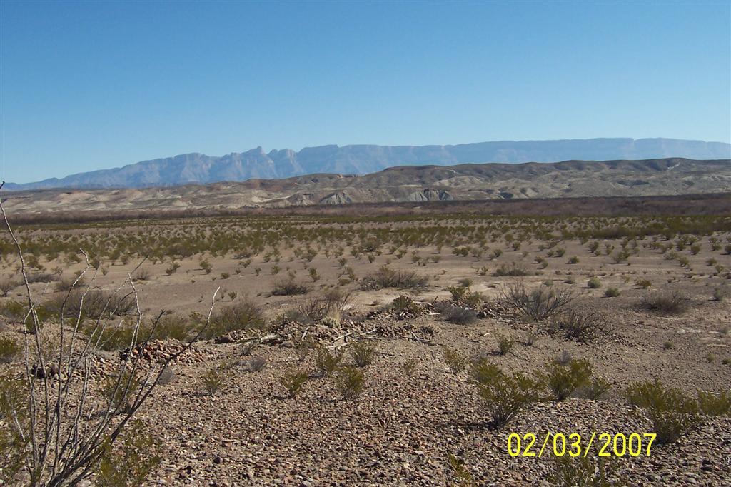
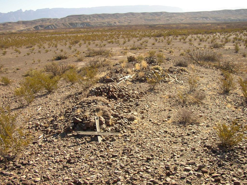
| Description | : | The San Vicente Crossing cemetery is located 1000 feet north of where the access road crosses the dry creek bed and enters the Rio Grande River flood plain. This is also the location of the former village of San Vicente Crossing, which still contains traces of its former occupation. It should not be confused with San Vicente further north-east, which has yet another cemetery. The cemetery is located atop two low intersecting linear mounds of earth which form the shape of a natural cross. The graves, about 29 of them, consist of piles of stones, and are located... Read More |
frequently asked questions (FAQ):
-
Where is San Vicente Crossing Cemetery?
San Vicente Crossing Cemetery is located at San Vicente Crossing, Brewster County ,Texas ,USA.
-
San Vicente Crossing Cemetery cemetery's updated grave count on graveviews.com?
0 memorials
-
Where are the coordinates of the San Vicente Crossing Cemetery?
Latitude: 29.1326220
Longitude: -103.0225550
Nearby Cemetories:
1. San Vicente Cemetery
Brewster County, USA
Coordinate: 29.1557100, -103.0189420
2. Boqullias
Las Boquillas, Hidalgo del Parral Municipality, Mexico
Coordinate: 29.1653500, -102.9508200
3. Boqullias Crossing
Boquillas Crossing, Brewster County, USA
Coordinate: 29.1884000, -102.9490200
4. Chatta's Store Cemetery
Boquillas Crossing, Brewster County, USA
Coordinate: 29.1931830, -102.9438930
5. Jesse M. Parker Gravesite
Brewster County, USA
Coordinate: 29.1933050, -102.9316380
6. Solis Burial Site
Solis Landing, Brewster County, USA
Coordinate: 29.0593720, -103.1107950
7. Juan De Leon Gravesite
Brewster County, USA
Coordinate: 29.2465610, -103.0191900
8. La Noria Cemetery
Brewster County, USA
Coordinate: 29.2484050, -103.0263025
9. Glenn Springs Cemetery
Brewster County, USA
Coordinate: 29.1741910, -103.1581210
10. Rice Cemetery
Brewster County, USA
Coordinate: 29.2455997, -103.1318970
11. Woodson's Cemetery
Brewster County, USA
Coordinate: 29.0076110, -103.2934410
12. Nina Marie Seawell Hannold Gravesite
Brewster County, USA
Coordinate: 29.3694020, -103.1674940
13. Green Wax Camp Cemetery
Brewster County, USA
Coordinate: 29.4057800, -103.1052950
14. Sierra Chino Burial Site
Sierra Chino, Brewster County, USA
Coordinate: 29.0415820, -103.4155680
15. El Ojito Cemetery
Castolon, Brewster County, USA
Coordinate: 29.1244320, -103.5036250
16. Castolon Cemetery
Castolon, Brewster County, USA
Coordinate: 29.1339870, -103.5108100
17. La Coyota Burial Site
Castolon, Brewster County, USA
Coordinate: 29.1459250, -103.5370170
18. Terlingua Ranch Cemetery
Terlingua, Brewster County, USA
Coordinate: 29.4616000, -103.3826000
19. Coyote Cemetery
Brewster County, USA
Coordinate: 29.1495750, -103.5430960
20. Study Butte Cemetery
Terlingua, Brewster County, USA
Coordinate: 29.3132880, -103.5249610
21. Valenzuela Ranch Cemetery
Terlingua, Brewster County, USA
Coordinate: 29.2236800, -103.5816010
22. Terlingua de Abajo Cemetery
Terlingua Abaja, Brewster County, USA
Coordinate: 29.2170550, -103.5989530
23. Dryden Ranch Cemetery
Brewster County, USA
Coordinate: 29.2169360, -103.5991290
24. Terlingua Abajo Campground
Terlingua, Brewster County, USA
Coordinate: 29.1981970, -103.6034530