
| Memorials | : | 0 |
| Location | : | Brewster County, USA |
| Coordinate | : | 29.1495750, -103.5430960 |
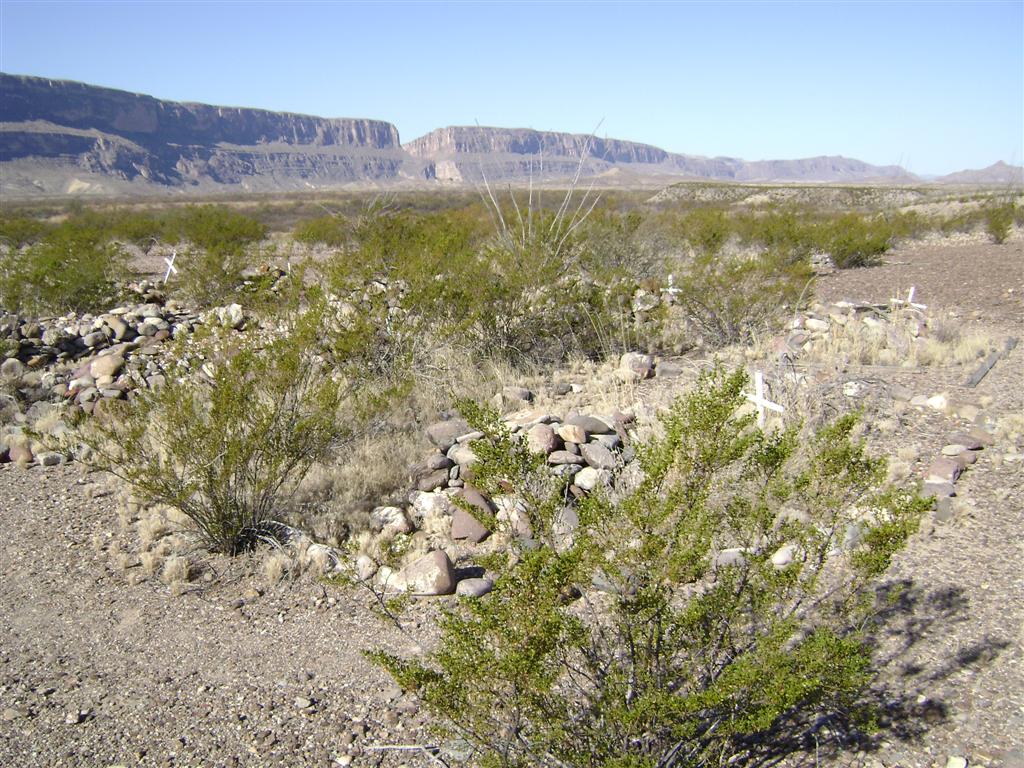
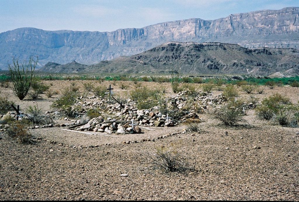
| Description | : | Coyote Cemetery is in Big Bend National Park, Brewster County, Texas. The cemetery contains 21 graves, consisting of piles of rocks, many with remnants of wooden crosses, and updated with white metal crosses. Directions: Drive 2.1 miles from Castolon towards Santa Elena Canyon on Ross Maxwell Scenic Drive. Park off the road, and hike 250 feet south to find the cemetery, which is clearly visible on a flat hilltop with sparse vegetation. |
frequently asked questions (FAQ):
-
Where is Coyote Cemetery?
Coyote Cemetery is located at Brewster County ,Texas ,USA.
-
Coyote Cemetery cemetery's updated grave count on graveviews.com?
0 memorials
-
Where are the coordinates of the Coyote Cemetery?
Latitude: 29.1495750
Longitude: -103.5430960

Nearby Cemetories:
1. La Coyota Burial Site
Castolon, Brewster County, USA
Coordinate: 29.1459250, -103.5370170
2. Castolon Cemetery
Castolon, Brewster County, USA
Coordinate: 29.1339870, -103.5108100
3. El Ojito Cemetery
Castolon, Brewster County, USA
Coordinate: 29.1244320, -103.5036250
4. Terlingua Abaja II Cemetery
Terlingua Abaja, Brewster County, USA
Coordinate: 29.1878450, -103.6107320
5. Terlingua Abajo Campground
Terlingua, Brewster County, USA
Coordinate: 29.1981970, -103.6034530
6. Valenzuela Ranch Cemetery
Terlingua, Brewster County, USA
Coordinate: 29.2236800, -103.5816010
7. Dryden Ranch Cemetery
Brewster County, USA
Coordinate: 29.2169360, -103.5991290
8. Terlingua de Abajo Cemetery
Terlingua Abaja, Brewster County, USA
Coordinate: 29.2170550, -103.5989530
9. Sierra Chino Burial Site
Sierra Chino, Brewster County, USA
Coordinate: 29.0415820, -103.4155680
10. Study Butte Cemetery
Terlingua, Brewster County, USA
Coordinate: 29.3132880, -103.5249610
11. Terlingua Cemetery
Terlingua, Brewster County, USA
Coordinate: 29.3197994, -103.6123962
12. Lajitas Cemetery
Brewster County, USA
Coordinate: 29.2623005, -103.7745972
13. Woodson's Cemetery
Brewster County, USA
Coordinate: 29.0076110, -103.2934410
14. Panteón Municipal de Manuel Benavides
Manuel Benavides, Manuel Benavides Municipality, Mexico
Coordinate: 29.1040780, -103.9081030
15. Glenn Springs Cemetery
Brewster County, USA
Coordinate: 29.1741910, -103.1581210
16. Terlingua Ranch Cemetery
Terlingua, Brewster County, USA
Coordinate: 29.4616000, -103.3826000
17. Rice Cemetery
Brewster County, USA
Coordinate: 29.2455997, -103.1318970
18. Solis Burial Site
Solis Landing, Brewster County, USA
Coordinate: 29.0593720, -103.1107950
19. Nina Marie Seawell Hannold Gravesite
Brewster County, USA
Coordinate: 29.3694020, -103.1674940
20. San Vicente Crossing Cemetery
San Vicente Crossing, Brewster County, USA
Coordinate: 29.1326220, -103.0225550
21. San Vicente Cemetery
Brewster County, USA
Coordinate: 29.1557100, -103.0189420
22. Green Wax Camp Cemetery
Brewster County, USA
Coordinate: 29.4057800, -103.1052950
23. La Noria Cemetery
Brewster County, USA
Coordinate: 29.2484050, -103.0263025
24. Juan De Leon Gravesite
Brewster County, USA
Coordinate: 29.2465610, -103.0191900