
| Memorials | : | 0 |
| Location | : | Terlingua Abaja, Brewster County, USA |
| Coordinate | : | 29.2170550, -103.5989530 |
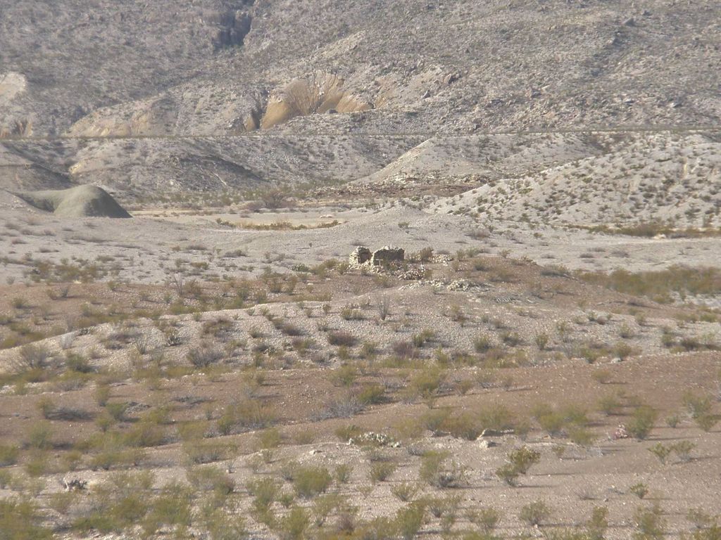
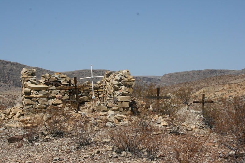
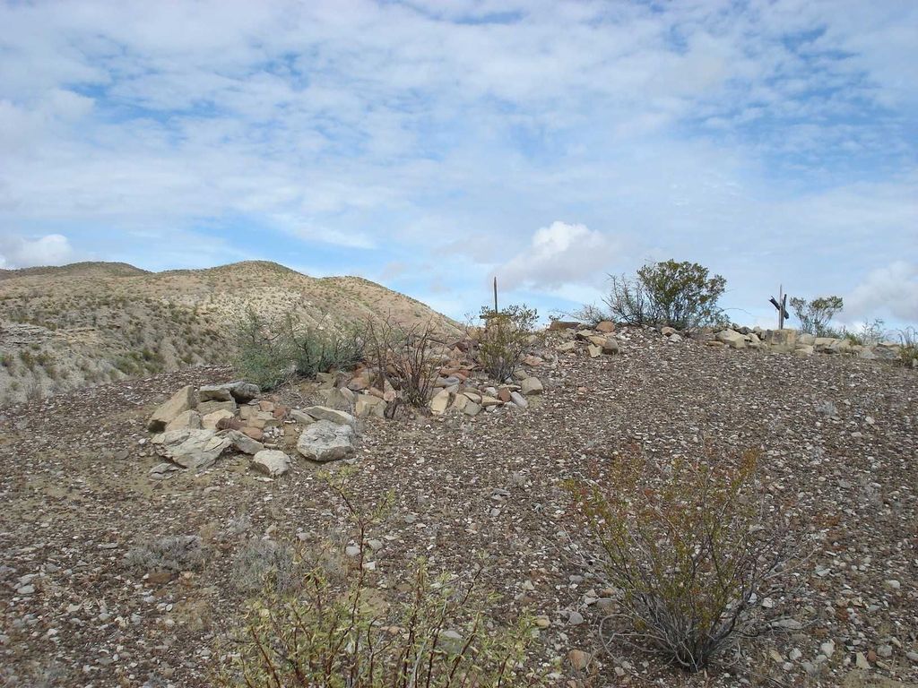
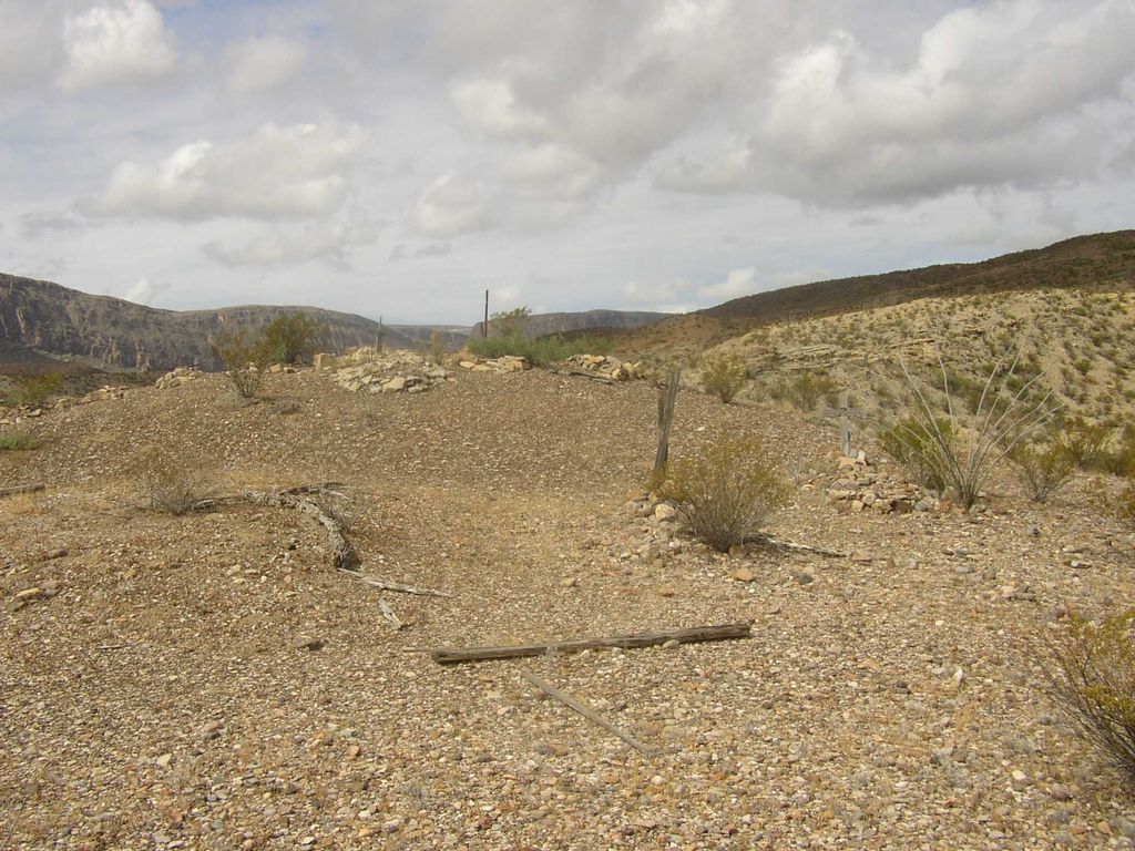
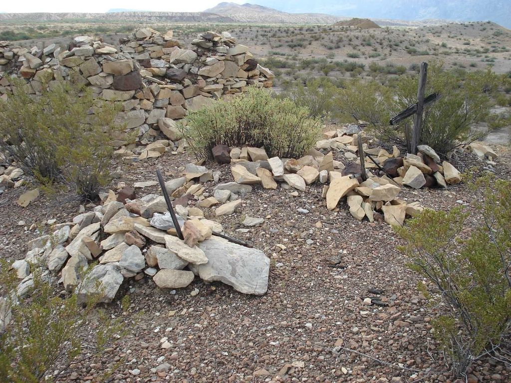
| Description | : | This cemetery is located in Big Bend National Park along Terlingua Creek, north of the mouth of Santa Elena Canyon, in the Terlingua Abaja area. This was the site of a former farming and ranching village, which supplied food to the miners in the area. There are 23 graves, but only four that have legible names. There is a cluster of 13 graves in and around the stone walls, and behind that on a small hill is another cluster of 10 more. The burials consist of piles of stones, many with weathered wooden crosses. Directions: Start at the Terlingua Abaja... Read More |
frequently asked questions (FAQ):
-
Where is Terlingua de Abajo Cemetery?
Terlingua de Abajo Cemetery is located at Terlingua Abaja, Brewster County ,Texas ,USA.
-
Terlingua de Abajo Cemetery cemetery's updated grave count on graveviews.com?
0 memorials
-
Where are the coordinates of the Terlingua de Abajo Cemetery?
Latitude: 29.2170550
Longitude: -103.5989530
Nearby Cemetories:
1. Dryden Ranch Cemetery
Brewster County, USA
Coordinate: 29.2169360, -103.5991290
2. Valenzuela Ranch Cemetery
Terlingua, Brewster County, USA
Coordinate: 29.2236800, -103.5816010
3. Terlingua Abajo Campground
Terlingua, Brewster County, USA
Coordinate: 29.1981970, -103.6034530
4. Terlingua Abaja II Cemetery
Terlingua Abaja, Brewster County, USA
Coordinate: 29.1878450, -103.6107320
5. Coyote Cemetery
Brewster County, USA
Coordinate: 29.1495750, -103.5430960
6. La Coyota Burial Site
Castolon, Brewster County, USA
Coordinate: 29.1459250, -103.5370170
7. Terlingua Cemetery
Terlingua, Brewster County, USA
Coordinate: 29.3197994, -103.6123962
8. Castolon Cemetery
Castolon, Brewster County, USA
Coordinate: 29.1339870, -103.5108100
9. Study Butte Cemetery
Terlingua, Brewster County, USA
Coordinate: 29.3132880, -103.5249610
10. El Ojito Cemetery
Castolon, Brewster County, USA
Coordinate: 29.1244320, -103.5036250
11. Lajitas Cemetery
Brewster County, USA
Coordinate: 29.2623005, -103.7745972
12. Sierra Chino Burial Site
Sierra Chino, Brewster County, USA
Coordinate: 29.0415820, -103.4155680
13. Panteón Municipal de Manuel Benavides
Manuel Benavides, Manuel Benavides Municipality, Mexico
Coordinate: 29.1040780, -103.9081030
14. Terlingua Ranch Cemetery
Terlingua, Brewster County, USA
Coordinate: 29.4616000, -103.3826000
15. Woodson's Cemetery
Brewster County, USA
Coordinate: 29.0076110, -103.2934410
16. Glenn Springs Cemetery
Brewster County, USA
Coordinate: 29.1741910, -103.1581210
17. Nina Marie Seawell Hannold Gravesite
Brewster County, USA
Coordinate: 29.3694020, -103.1674940
18. Rice Cemetery
Brewster County, USA
Coordinate: 29.2455997, -103.1318970
19. Solis Burial Site
Solis Landing, Brewster County, USA
Coordinate: 29.0593720, -103.1107950
20. Green Wax Camp Cemetery
Brewster County, USA
Coordinate: 29.4057800, -103.1052950
21. La Noria Cemetery
Brewster County, USA
Coordinate: 29.2484050, -103.0263025
22. Juan De Leon Gravesite
Brewster County, USA
Coordinate: 29.2465610, -103.0191900
23. San Vicente Cemetery
Brewster County, USA
Coordinate: 29.1557100, -103.0189420
24. San Vicente Crossing Cemetery
San Vicente Crossing, Brewster County, USA
Coordinate: 29.1326220, -103.0225550