
| Memorials | : | 0 |
| Location | : | Brewster County, USA |
| Coordinate | : | 29.2484050, -103.0263025 |
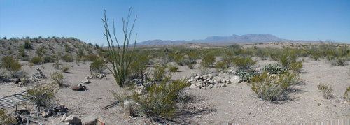
| Description | : | On this land overlooking a branch of Tornillo Creek, along the Ore Road from Boquillas to Marathon, Max Ernst opened a store in 1898 to cater to all the miners and prospectors in the area. He built a one-room school near his store, and in 1903 succeeded in getting the post office moved from Boquillas to his store. By then the farming community he had founded was known as La Noria, or "the well". From about 1912 to 1920, revolution raged in Mexico and many Mexican families moved north of the Rio Grande River to avoid the bloodshed. Mexican... Read More |
frequently asked questions (FAQ):
-
Where is La Noria Cemetery?
La Noria Cemetery is located at Brewster County ,Texas ,USA.
-
La Noria Cemetery cemetery's updated grave count on graveviews.com?
0 memorials
-
Where are the coordinates of the La Noria Cemetery?
Latitude: 29.2484050
Longitude: -103.0263025
Nearby Cemetories:
1. Juan De Leon Gravesite
Brewster County, USA
Coordinate: 29.2465610, -103.0191900
2. Boqullias Crossing
Boquillas Crossing, Brewster County, USA
Coordinate: 29.1884000, -102.9490200
3. Chatta's Store Cemetery
Boquillas Crossing, Brewster County, USA
Coordinate: 29.1931830, -102.9438930
4. Rice Cemetery
Brewster County, USA
Coordinate: 29.2455997, -103.1318970
5. San Vicente Cemetery
Brewster County, USA
Coordinate: 29.1557100, -103.0189420
6. Jesse M. Parker Gravesite
Brewster County, USA
Coordinate: 29.1933050, -102.9316380
7. Boqullias
Las Boquillas, Hidalgo del Parral Municipality, Mexico
Coordinate: 29.1653500, -102.9508200
8. San Vicente Crossing Cemetery
San Vicente Crossing, Brewster County, USA
Coordinate: 29.1326220, -103.0225550
9. Glenn Springs Cemetery
Brewster County, USA
Coordinate: 29.1741910, -103.1581210
10. Green Wax Camp Cemetery
Brewster County, USA
Coordinate: 29.4057800, -103.1052950
11. Nina Marie Seawell Hannold Gravesite
Brewster County, USA
Coordinate: 29.3694020, -103.1674940
12. Solis Burial Site
Solis Landing, Brewster County, USA
Coordinate: 29.0593720, -103.1107950
13. Woodson's Cemetery
Brewster County, USA
Coordinate: 29.0076110, -103.2934410
14. Terlingua Ranch Cemetery
Terlingua, Brewster County, USA
Coordinate: 29.4616000, -103.3826000
15. Sierra Chino Burial Site
Sierra Chino, Brewster County, USA
Coordinate: 29.0415820, -103.4155680
16. El Ojito Cemetery
Castolon, Brewster County, USA
Coordinate: 29.1244320, -103.5036250
17. Castolon Cemetery
Castolon, Brewster County, USA
Coordinate: 29.1339870, -103.5108100
18. Study Butte Cemetery
Terlingua, Brewster County, USA
Coordinate: 29.3132880, -103.5249610
19. La Coyota Burial Site
Castolon, Brewster County, USA
Coordinate: 29.1459250, -103.5370170
20. Coyote Cemetery
Brewster County, USA
Coordinate: 29.1495750, -103.5430960
21. Valenzuela Ranch Cemetery
Terlingua, Brewster County, USA
Coordinate: 29.2236800, -103.5816010
22. Terlingua de Abajo Cemetery
Terlingua Abaja, Brewster County, USA
Coordinate: 29.2170550, -103.5989530
23. Dryden Ranch Cemetery
Brewster County, USA
Coordinate: 29.2169360, -103.5991290
24. Terlingua Abajo Campground
Terlingua, Brewster County, USA
Coordinate: 29.1981970, -103.6034530