
| Memorials | : | 0 |
| Location | : | Cincinnati, Hamilton County, USA |
| Coordinate | : | 39.0964090, -84.5082230 |
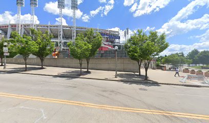
| Description | : | The gravesite was located beside a blockhouse on the north side of the Ohio River at Cincinnati opposite the mouth of Licking River. Breastworks were thrown over the grave, which were still visible in 1832. |
frequently asked questions (FAQ):
-
Where is McCrackin Gravesite?
McCrackin Gravesite is located at Joe Nuxhall Way Cincinnati, Hamilton County ,Ohio , 45202USA.
-
McCrackin Gravesite cemetery's updated grave count on graveviews.com?
0 memorials
-
Where are the coordinates of the McCrackin Gravesite?
Latitude: 39.0964090
Longitude: -84.5082230
Nearby Cemetories:
1. First Presbyterian Church Cemetery
Cincinnati, Hamilton County, USA
Coordinate: 39.1005310, -84.5102830
2. Christ Church Cathedral Columbarium
Cincinnati, Hamilton County, USA
Coordinate: 39.1009690, -84.5073790
3. Wesleyan Chapel Methodist Church Cemetery
Cincinnati, Hamilton County, USA
Coordinate: 39.1022390, -84.5073540
4. Trinity Episcopal Church Memorial Garden
Covington, Kenton County, USA
Coordinate: 39.0873540, -84.5106140
5. First Quaker Cemetery (Defunct)
Cincinnati, Hamilton County, USA
Coordinate: 39.1004360, -84.5201220
6. Madison Street Burying Ground
Newport, Campbell County, USA
Coordinate: 39.0922790, -84.4948560
7. Mother of God Church
Covington, Kenton County, USA
Coordinate: 39.0839600, -84.5125700
8. Thomas Williams Cemetery (Defunct)
Cincinnati, Hamilton County, USA
Coordinate: 39.1085060, -84.5146050
9. Craig Street Burying Ground
Covington, Kenton County, USA
Coordinate: 39.0840890, -84.5151330
10. Presbyterian Burying Ground
Cincinnati, Hamilton County, USA
Coordinate: 39.1082510, -84.5175720
11. Old Newport Cemetery
Newport, Campbell County, USA
Coordinate: 39.0877100, -84.4940800
12. Chestnut Street Cemetery
Over-The-Rhine, Hamilton County, USA
Coordinate: 39.1071610, -84.5212210
13. Potters Field
Cincinnati, Hamilton County, USA
Coordinate: 39.1094440, -84.5188890
14. Christ Episcopal Churchyard (Defunct)
Cincinnati, Hamilton County, USA
Coordinate: 39.1100520, -84.5177220
15. Enon Baptist Church Burying Ground (Defunct)
Cincinnati, Hamilton County, USA
Coordinate: 39.1065420, -84.5238110
16. Catherine Street Methodist Cemetery (Defunct)
Cincinnati, Hamilton County, USA
Coordinate: 39.1064840, -84.5243150
17. Catherine Street Burying Ground
Cincinnati, Hamilton County, USA
Coordinate: 39.1067490, -84.5252700
18. Christ Church Cemetery
Over-The-Rhine, Hamilton County, USA
Coordinate: 39.1126480, -84.5157623
19. Cathedral Basilica of the Assumption
Covington, Kenton County, USA
Coordinate: 39.0781120, -84.5081700
20. Mount Saint Martins Cemetery (Defunct)
Newport, Campbell County, USA
Coordinate: 39.0860570, -84.4845320
21. Linden Grove Cemetery
Covington, Kenton County, USA
Coordinate: 39.0738983, -84.5152969
22. Lincoln Park Potters Field (Defunct)
Cincinnati, Hamilton County, USA
Coordinate: 39.1097710, -84.5346450
23. Second Quaker Cemetery (Defunct)
Cincinnati, Hamilton County, USA
Coordinate: 39.1153090, -84.5305240
24. Cote Brilliante World War II Memorial
Newport, Campbell County, USA
Coordinate: 39.0885220, -84.4754710