
| Memorials | : | 1 |
| Location | : | Newport, Campbell County, USA |
| Coordinate | : | 39.0877100, -84.4940800 |
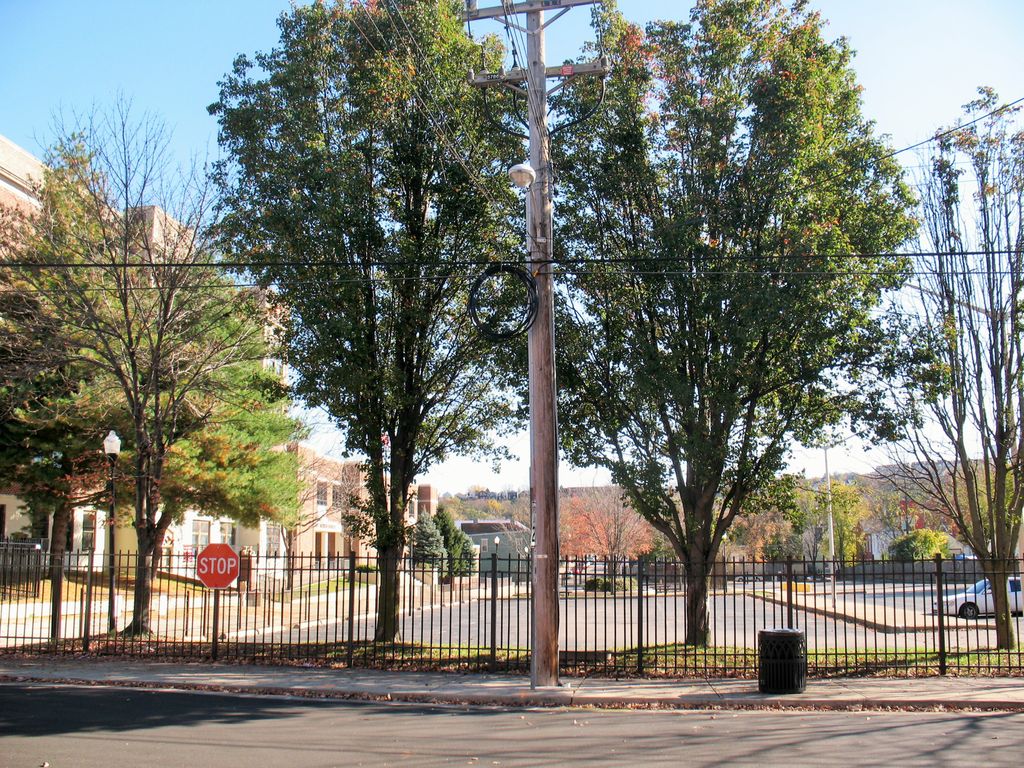
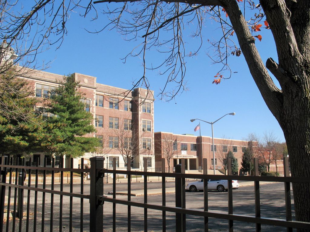
| Description | : | The second cemetery serving the community of Newport, it operated from 1820 until 1848. Originally located on Ringgold Street, this defunct place of burial is now located on the grounds of the Newport Junior High School at 8th and Columbia Streets. Many of the early burials here were relocated to what is now Evergreen Cemetery in Southgate, just to the south of Newport, but when the Newport High School was built on this site in 1872, many human remains were found. In the 1990s when an addition was being added to the present Junior High School, bones... Read More |
frequently asked questions (FAQ):
-
Where is Old Newport Cemetery?
Old Newport Cemetery is located at 8th & Columbia Streets Newport, Campbell County ,Kentucky , 41071USA.
-
Old Newport Cemetery cemetery's updated grave count on graveviews.com?
1 memorials
-
Where are the coordinates of the Old Newport Cemetery?
Latitude: 39.0877100
Longitude: -84.4940800
Nearby Cemetories:
1. Madison Street Burying Ground
Newport, Campbell County, USA
Coordinate: 39.0922790, -84.4948560
2. Mount Saint Martins Cemetery (Defunct)
Newport, Campbell County, USA
Coordinate: 39.0860570, -84.4845320
3. Trinity Episcopal Church Memorial Garden
Covington, Kenton County, USA
Coordinate: 39.0873540, -84.5106140
4. McCrackin Gravesite
Cincinnati, Hamilton County, USA
Coordinate: 39.0964090, -84.5082230
5. Cote Brilliante World War II Memorial
Newport, Campbell County, USA
Coordinate: 39.0885220, -84.4754710
6. Cathedral Basilica of the Assumption
Covington, Kenton County, USA
Coordinate: 39.0781120, -84.5081700
7. Mother of God Church
Covington, Kenton County, USA
Coordinate: 39.0839600, -84.5125700
8. Craig Street Burying Ground
Covington, Kenton County, USA
Coordinate: 39.0840890, -84.5151330
9. Christ Church Cathedral Columbarium
Cincinnati, Hamilton County, USA
Coordinate: 39.1009690, -84.5073790
10. Wesleyan Chapel Methodist Church Cemetery
Cincinnati, Hamilton County, USA
Coordinate: 39.1022390, -84.5073540
11. First Presbyterian Church Cemetery
Cincinnati, Hamilton County, USA
Coordinate: 39.1005310, -84.5102830
12. Linden Grove Cemetery
Covington, Kenton County, USA
Coordinate: 39.0738983, -84.5152969
13. First Quaker Cemetery (Defunct)
Cincinnati, Hamilton County, USA
Coordinate: 39.1004360, -84.5201220
14. Thomas Williams Cemetery (Defunct)
Cincinnati, Hamilton County, USA
Coordinate: 39.1085060, -84.5146050
15. Evergreen Cemetery
Southgate, Campbell County, USA
Coordinate: 39.0667000, -84.4721985
16. Presbyterian Burying Ground
Cincinnati, Hamilton County, USA
Coordinate: 39.1082510, -84.5175720
17. Chestnut Street Cemetery
Over-The-Rhine, Hamilton County, USA
Coordinate: 39.1071610, -84.5212210
18. Christ Episcopal Churchyard (Defunct)
Cincinnati, Hamilton County, USA
Coordinate: 39.1100520, -84.5177220
19. Potters Field
Cincinnati, Hamilton County, USA
Coordinate: 39.1094440, -84.5188890
20. Buena Vista Cemetery
Covington, Kenton County, USA
Coordinate: 39.0595200, -84.5040000
21. Enon Baptist Church Burying Ground (Defunct)
Cincinnati, Hamilton County, USA
Coordinate: 39.1065420, -84.5238110
22. Catherine Street Methodist Cemetery (Defunct)
Cincinnati, Hamilton County, USA
Coordinate: 39.1064840, -84.5243150
23. Christ Church Cemetery
Over-The-Rhine, Hamilton County, USA
Coordinate: 39.1126480, -84.5157623
24. Catherine Street Burying Ground
Cincinnati, Hamilton County, USA
Coordinate: 39.1067490, -84.5252700