
| Memorials | : | 6 |
| Location | : | Cincinnati, Hamilton County, USA |
| Coordinate | : | 39.1022390, -84.5073540 |
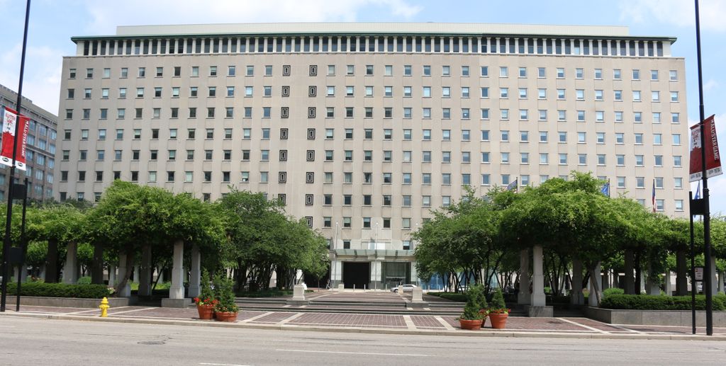
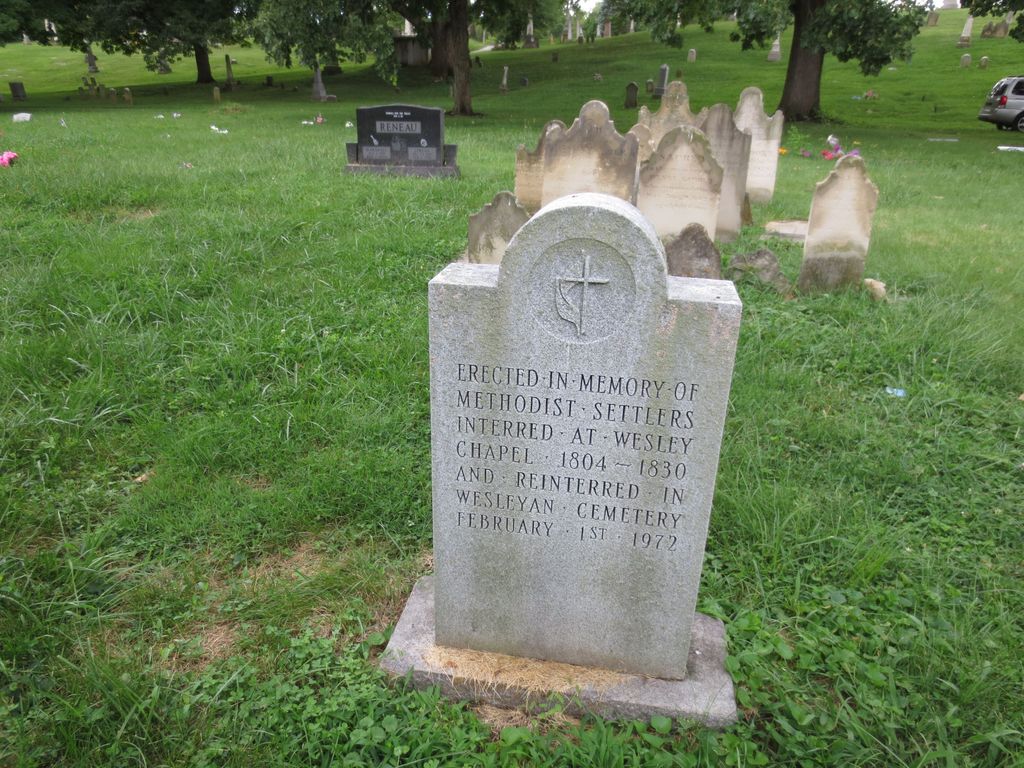
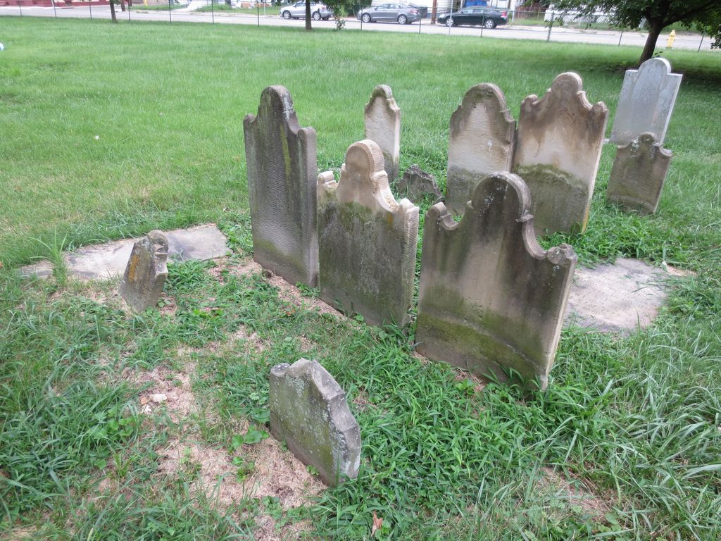
| Description | : | This cemetery was adjacent to the church, which was established about 1805, and was the first Methodist burial ground. Many of the burials were moved to the Wesleyan Cemetery when it opened in 1843. Burials were removed to Spring Grove Cemetery up until 11 May 1972. The former location of the cemetery and church is now a park area on the south side of the Procter and Gamble headquarters building. It is not known if nor where all burials were removed and reinterred. The cemetery was located in the city of Cincinnati, Hamilton County, Ohio, and is # 4614 (Wesleyan Chapel... Read More |
frequently asked questions (FAQ):
-
Where is Wesleyan Chapel Methodist Church Cemetery?
Wesleyan Chapel Methodist Church Cemetery is located at East 5th Street Cincinnati, Hamilton County ,Ohio , 45202USA.
-
Wesleyan Chapel Methodist Church Cemetery cemetery's updated grave count on graveviews.com?
6 memorials
-
Where are the coordinates of the Wesleyan Chapel Methodist Church Cemetery?
Latitude: 39.1022390
Longitude: -84.5073540
Nearby Cemetories:
1. Christ Church Cathedral Columbarium
Cincinnati, Hamilton County, USA
Coordinate: 39.1009690, -84.5073790
2. First Presbyterian Church Cemetery
Cincinnati, Hamilton County, USA
Coordinate: 39.1005310, -84.5102830
3. McCrackin Gravesite
Cincinnati, Hamilton County, USA
Coordinate: 39.0964090, -84.5082230
4. Thomas Williams Cemetery (Defunct)
Cincinnati, Hamilton County, USA
Coordinate: 39.1085060, -84.5146050
5. Presbyterian Burying Ground
Cincinnati, Hamilton County, USA
Coordinate: 39.1082510, -84.5175720
6. First Quaker Cemetery (Defunct)
Cincinnati, Hamilton County, USA
Coordinate: 39.1004360, -84.5201220
7. Christ Episcopal Churchyard (Defunct)
Cincinnati, Hamilton County, USA
Coordinate: 39.1100520, -84.5177220
8. Potters Field
Cincinnati, Hamilton County, USA
Coordinate: 39.1094440, -84.5188890
9. Chestnut Street Cemetery
Over-The-Rhine, Hamilton County, USA
Coordinate: 39.1071610, -84.5212210
10. Christ Church Cemetery
Over-The-Rhine, Hamilton County, USA
Coordinate: 39.1126480, -84.5157623
11. Enon Baptist Church Burying Ground (Defunct)
Cincinnati, Hamilton County, USA
Coordinate: 39.1065420, -84.5238110
12. Catherine Street Methodist Cemetery (Defunct)
Cincinnati, Hamilton County, USA
Coordinate: 39.1064840, -84.5243150
13. Madison Street Burying Ground
Newport, Campbell County, USA
Coordinate: 39.0922790, -84.4948560
14. Catherine Street Burying Ground
Cincinnati, Hamilton County, USA
Coordinate: 39.1067490, -84.5252700
15. Trinity Episcopal Church Memorial Garden
Covington, Kenton County, USA
Coordinate: 39.0873540, -84.5106140
16. Old Newport Cemetery
Newport, Campbell County, USA
Coordinate: 39.0877100, -84.4940800
17. Mother of God Church
Covington, Kenton County, USA
Coordinate: 39.0839600, -84.5125700
18. Craig Street Burying Ground
Covington, Kenton County, USA
Coordinate: 39.0840890, -84.5151330
19. Second Quaker Cemetery (Defunct)
Cincinnati, Hamilton County, USA
Coordinate: 39.1153090, -84.5305240
20. Lincoln Park Potters Field (Defunct)
Cincinnati, Hamilton County, USA
Coordinate: 39.1097710, -84.5346450
21. Mount Saint Martins Cemetery (Defunct)
Newport, Campbell County, USA
Coordinate: 39.0860570, -84.4845320
22. Cathedral Basilica of the Assumption
Covington, Kenton County, USA
Coordinate: 39.0781120, -84.5081700
23. Cote Brilliante World War II Memorial
Newport, Campbell County, USA
Coordinate: 39.0885220, -84.4754710
24. Linden Grove Cemetery
Covington, Kenton County, USA
Coordinate: 39.0738983, -84.5152969