
| Memorials | : | 0 |
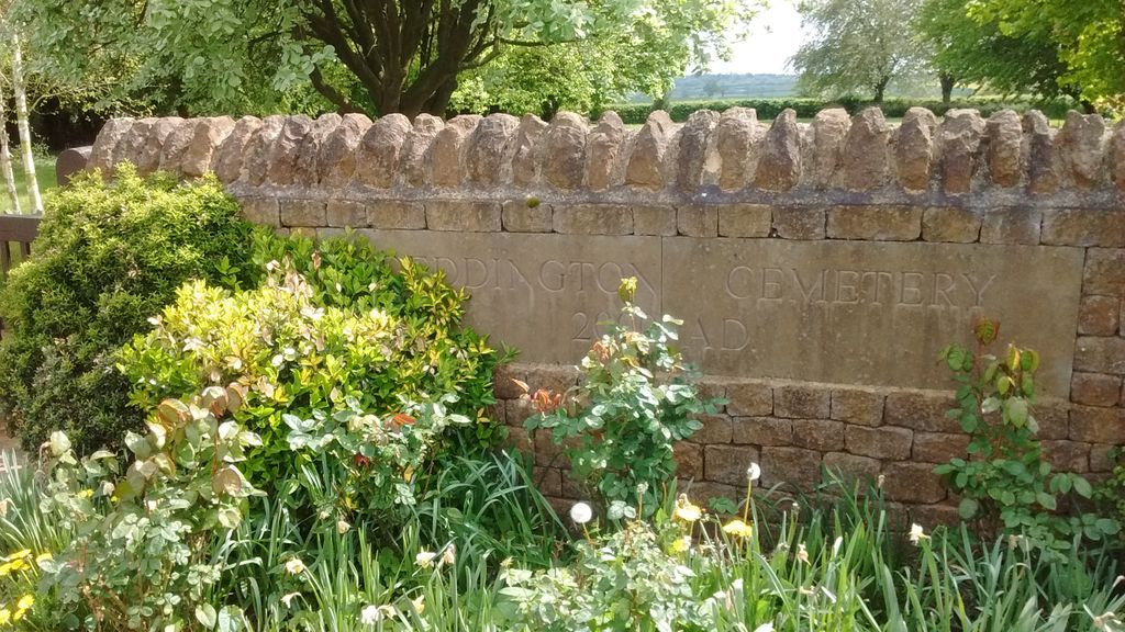
| Location | : | Deddington, Cherwell District, England |
| Website | : | www.deddingtonparishcouncil.org/hempton-road-cemetery.html |
| Coordinate | : | 51.9824490, -1.3338930 |
frequently asked questions (FAQ):
-
Where is Deddington Cemetery?
Deddington Cemetery is located at Deddington, Cherwell District ,Oxfordshire ,England.
-
Deddington Cemetery cemetery's updated grave count on graveviews.com?
0 memorials
-
Where are the coordinates of the Deddington Cemetery?
Latitude: 51.9824490
Longitude: -1.3338930
Nearby Cemetories:
1. Ss Peter and Paul Churchyard
Deddington, Cherwell District, England
Coordinate: 51.9817680, -1.3207470
2. St John's Churchyard
Barford St John, Cherwell District, England
Coordinate: 51.9955050, -1.3620350
3. Barford St. Michael Churchyard
Barford St Michael, Cherwell District, England
Coordinate: 51.9903200, -1.3711500
4. St Mary Magdelene Churchyard
Duns Tew, Cherwell District, England
Coordinate: 51.9528350, -1.3363090
5. St John the Evangelist
Milton, Cherwell District, England
Coordinate: 52.0117900, -1.3452510
6. Adderbury Parish Cemetery
Adderbury, Cherwell District, England
Coordinate: 52.0139537, -1.3246874
7. St James Churchyard
Nether Worton, West Oxfordshire District, England
Coordinate: 51.9678100, -1.3807900
8. St Marys Churchyard
North Aston, Cherwell District, England
Coordinate: 51.9562960, -1.3020350
9. Holy Trinity Churchyard
Over Worton, West Oxfordshire District, England
Coordinate: 51.9598240, -1.3753620
10. St Mary the Virgin Churchyard
Adderbury, Cherwell District, England
Coordinate: 52.0148420, -1.3152270
11. St Mary's Churchyard
Bloxham, Cherwell District, England
Coordinate: 52.0181100, -1.3748900
12. St James Churchyard
Somerton, Cherwell District, England
Coordinate: 51.9539990, -1.2786200
13. South Newington St Peter ad Vincula
South Newington, Cherwell District, England
Coordinate: 51.9970000, -1.4082300
14. Saint Laurence Churchyard
Milcombe, Cherwell District, England
Coordinate: 52.0083060, -1.4033990
15. Kings Sutton Cemetery
Kings Sutton, South Northamptonshire Borough, England
Coordinate: 52.0151400, -1.2711000
16. St Michael Churchyard
Aynho, South Northamptonshire Borough, England
Coordinate: 51.9936080, -1.2522380
17. Ss Peter and Paul Churchyard
Kings Sutton, South Northamptonshire Borough, England
Coordinate: 52.0212000, -1.2763560
18. Saint John the Baptist Churchyard
Bodicote, Cherwell District, England
Coordinate: 52.0356100, -1.3305700
19. SS Peter and Paul Churchyard
Steeple Aston, Cherwell District, England
Coordinate: 51.9311350, -1.3091000
20. Bodicote Cemetery
Bodicote, Cherwell District, England
Coordinate: 52.0391710, -1.3397380
21. St Martins Churchyard
Sandford St Martin, West Oxfordshire District, England
Coordinate: 51.9371500, -1.3901400
22. St Mary the Virgin Churchyard
Souldern, Cherwell District, England
Coordinate: 51.9808600, -1.2399900
23. St Michael and All Angels Churchyard
Great Tew, West Oxfordshire District, England
Coordinate: 51.9569280, -1.4205150
24. St. Edward the Confessor Churchyard
Westcot Barton, West Oxfordshire District, England
Coordinate: 51.9280100, -1.3747200