
| Memorials | : | 1 |
| Location | : | Souldern, Cherwell District, England |
| Coordinate | : | 51.9808600, -1.2399900 |
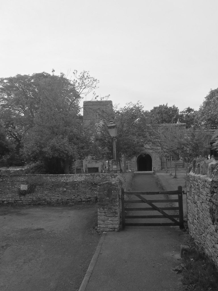
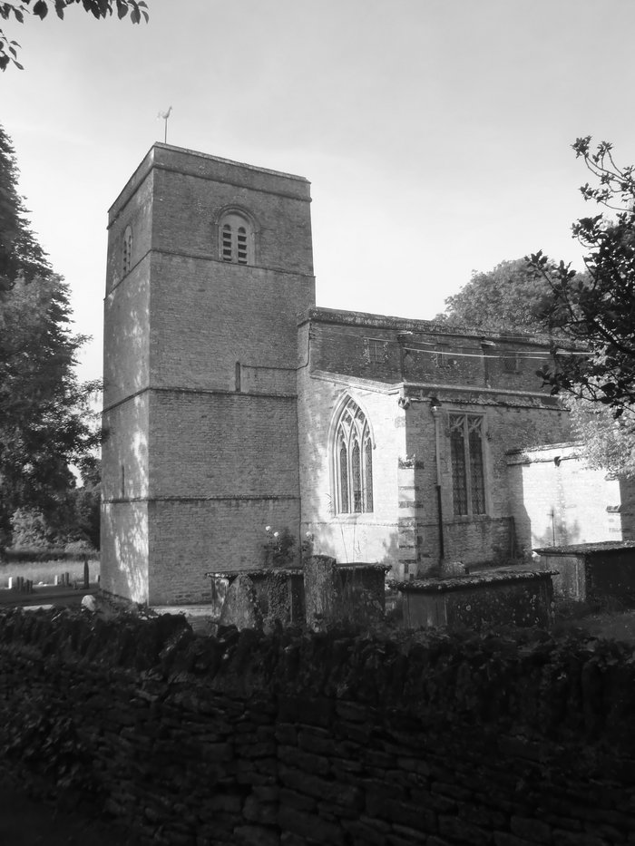
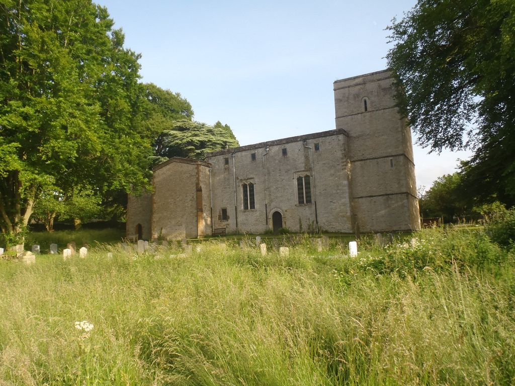
| Description | : | The oldest parts of the Church of England parish church of the Annunciation to the Blessed Virgin Mary are 12th century. The church was enlarged and altered at various times between about 1200 and 1500. The mediaeval chancel fell into disrepair in the 18th century and was demolished after 1775. In 1896-97 the Gothic Revival architect Ninian Comper rebuilt the chancel and in 1906 G.F. Bodley dismantled and rebuilt the Norman tower and tower arch. From 1161 until the Dissolution of the Monasteries in 1539 the Benedictine Eynsham Abbey owned the advowson of the parish. After 1623 John Williams, Bishop of... Read More |
frequently asked questions (FAQ):
-
Where is St Mary the Virgin Churchyard?
St Mary the Virgin Churchyard is located at Souldern, Cherwell District ,Oxfordshire , OX27 7HUEngland.
-
St Mary the Virgin Churchyard cemetery's updated grave count on graveviews.com?
1 memorials
-
Where are the coordinates of the St Mary the Virgin Churchyard?
Latitude: 51.9808600
Longitude: -1.2399900
Nearby Cemetories:
1. St Michael Churchyard
Aynho, South Northamptonshire Borough, England
Coordinate: 51.9936080, -1.2522380
2. Fritwell Parish Council Cemetery
Fritwell, Cherwell District, England
Coordinate: 51.9599490, -1.2380650
3. St Olave Churchyard
Fritwell, Cherwell District, England
Coordinate: 51.9596980, -1.2381180
4. All Saints Churchyard
Croughton, South Northamptonshire Borough, England
Coordinate: 51.9977370, -1.2065760
5. Croughton Cemetery
Croughton, South Northamptonshire Borough, England
Coordinate: 52.0014880, -1.2031960
6. St James Churchyard
Somerton, Cherwell District, England
Coordinate: 51.9539990, -1.2786200
7. Fewcott All Saints Churchyard
Albury, South Oxfordshire District, England
Coordinate: 51.9477100, -1.2170700
8. Kings Sutton Cemetery
Kings Sutton, South Northamptonshire Borough, England
Coordinate: 52.0151400, -1.2711000
9. Newbottle and Charlton Cemetery
Newbottle, South Northamptonshire Borough, England
Coordinate: 52.0225300, -1.2351200
10. St. Mary's Churchyard
Ardley, Cherwell District, England
Coordinate: 51.9422140, -1.2122580
11. St Marys Churchyard
North Aston, Cherwell District, England
Coordinate: 51.9562960, -1.3020350
12. Ss Peter and Paul Churchyard
Kings Sutton, South Northamptonshire Borough, England
Coordinate: 52.0212000, -1.2763560
13. Saint James' Churchyard
Newbottle, South Northamptonshire Borough, England
Coordinate: 52.0280500, -1.2382170
14. St Peters Churchyard
Stoke Lyne, Cherwell District, England
Coordinate: 51.9505340, -1.1771680
15. Ss Peter and Paul Churchyard
Deddington, Cherwell District, England
Coordinate: 51.9817680, -1.3207470
16. St Mary the Virgin Churchyard
Hardwick, Cherwell District, England
Coordinate: 51.9616750, -1.1615570
17. Holy Trinity Church
Hinton-in-the-Hedges, South Northamptonshire Borough, England
Coordinate: 52.0281190, -1.1881330
18. Upper Heyford Cemetery
Upper Heyford, Cherwell District, England
Coordinate: 51.9294701, -1.2808000
19. St Mary the Virgin Churchyard
Adderbury, Cherwell District, England
Coordinate: 52.0148420, -1.3152270
20. Deddington Cemetery
Deddington, Cherwell District, England
Coordinate: 51.9824490, -1.3338930
21. St Marys Churchyard
Upper Heyford, Cherwell District, England
Coordinate: 51.9290710, -1.2819670
22. St. Mary's Churchyard
Cottisford, Cherwell District, England
Coordinate: 51.9749070, -1.1464410
23. Holy Trinity Churchyard
Hethe, Cherwell District, England
Coordinate: 51.9615600, -1.1452100
24. Adderbury Parish Cemetery
Adderbury, Cherwell District, England
Coordinate: 52.0139537, -1.3246874