
| Memorials | : | 1 |
| Location | : | Armstrong County, USA |
| Coordinate | : | 40.9331510, -79.4421280 |
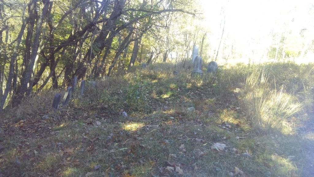
| Description | : | Christian Shunk, who had made the manufacture of iron a specialty and by his close and varied observation become a good judge of suitable locations, in 1851 selected the site of Stewardson Furnace and the adjacent lands containing the requisite material for that manufacture. He, Alexander Laughlin and William Phillips erected this furnace and purchased various tracts of land. William and Robert McCutcheon conveyed to them 2,601 acres and 123 perches of the Wallis-Duncan-Stewardson lands. This furnace was situated about 375 rods slightly north of east in an air line from mouth of Mahoning, in a deep northern bend of... Read More |
frequently asked questions (FAQ):
-
Where is Stewardson Furnace Cemetery?
Stewardson Furnace Cemetery is located at Armstrong County ,Pennsylvania ,USA.
-
Stewardson Furnace Cemetery cemetery's updated grave count on graveviews.com?
1 memorials
-
Where are the coordinates of the Stewardson Furnace Cemetery?
Latitude: 40.9331510
Longitude: -79.4421280
Nearby Cemetories:
1. Bell Town Road Cemetery
Templeton, Armstrong County, USA
Coordinate: 40.9243110, -79.4624050
2. Toy Cemetery
Reesedale, Armstrong County, USA
Coordinate: 40.9297750, -79.4706770
3. Walthour Cemetery
Reesedale, Armstrong County, USA
Coordinate: 40.9379000, -79.4756000
4. Kellersburg Lutheran Cemetery
Kellersburg, Armstrong County, USA
Coordinate: 40.9704000, -79.4244000
5. Cochran Cemetery
Templeton, Armstrong County, USA
Coordinate: 40.8941994, -79.4582977
6. Deanville Cemetery
Deanville, Armstrong County, USA
Coordinate: 40.9517700, -79.3919170
7. Rimer Hill Cemetery
Armstrong County, USA
Coordinate: 40.9398130, -79.4990980
8. Kellersburg Methodist Cemetery
Kellersburg, Armstrong County, USA
Coordinate: 40.9752000, -79.4240000
9. Tidal Cemetery
Tidal, Armstrong County, USA
Coordinate: 40.9582520, -79.4990020
10. John Cemetery
Frenchs Corners, Armstrong County, USA
Coordinate: 40.9003296, -79.4978409
11. Brush Valley Cemetery
Adrian, Armstrong County, USA
Coordinate: 40.9044000, -79.5062000
12. Narrows Cemetery
Mahoning, Armstrong County, USA
Coordinate: 40.9699000, -79.3839000
13. Colwell Cemetery
Armstrong County, USA
Coordinate: 40.9394520, -79.3633680
14. Duncan Cemetery
Armstrong County, USA
Coordinate: 40.9884750, -79.4727370
15. Toy Family Cemetery
Adrian, Armstrong County, USA
Coordinate: 40.8971130, -79.5082120
16. Old Earley Family Graveyard
Rimer, Armstrong County, USA
Coordinate: 40.9361115, -79.5255585
17. Mateer Cemetery
Armstrong County, USA
Coordinate: 40.8721000, -79.4175000
18. Mount Zion Presbyterian Cemetery
Boggs Township, Armstrong County, USA
Coordinate: 40.8717100, -79.4171980
19. Jerusalem Lutheran Cemetery
Wayne Township, Armstrong County, USA
Coordinate: 40.9197006, -79.3566971
20. Lower Piney Cemetery
Armstrong County, USA
Coordinate: 40.8655920, -79.4395400
21. Limestone Church of God Cemetery
Adrian, Armstrong County, USA
Coordinate: 40.8968887, -79.5180740
22. Rehobeth Reformed Presbyterian Church Cemetery
Kittanning, Armstrong County, USA
Coordinate: 40.8922670, -79.3695690
23. Bowser Cemetery
Morrows Corner, Armstrong County, USA
Coordinate: 40.9185070, -79.5341170
24. Croyle Cemetery
Adrian, Armstrong County, USA
Coordinate: 40.8782997, -79.5108032