
| Memorials | : | 0 |
| Location | : | Templeton, Armstrong County, USA |
| Coordinate | : | 40.9243110, -79.4624050 |
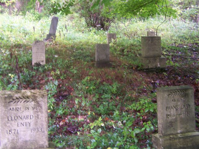
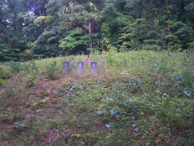
| Description | : | This Cemetery is known, in this area, by two other names: The Colored Cemetery or the Enty (Family) Cemetery. It is, in the woods, overlooking the Allegheny River and is located on the edge of a steep hill, at the end of Bell Town Road, in Templeton, PA. The map depiction, below, is slightly off...It shows Belltown Road out of place. The map marker is on the correct location and it is at the very end of Belltown Road. (Do not drive all the way to the cemetery if there is snow or ice...the hillside is... Read More |
frequently asked questions (FAQ):
-
Where is Bell Town Road Cemetery?
Bell Town Road Cemetery is located at Templeton, Armstrong County ,Pennsylvania ,USA.
-
Bell Town Road Cemetery cemetery's updated grave count on graveviews.com?
0 memorials
-
Where are the coordinates of the Bell Town Road Cemetery?
Latitude: 40.9243110
Longitude: -79.4624050
Nearby Cemetories:
1. Toy Cemetery
Reesedale, Armstrong County, USA
Coordinate: 40.9297750, -79.4706770
2. Walthour Cemetery
Reesedale, Armstrong County, USA
Coordinate: 40.9379000, -79.4756000
3. Stewardson Furnace Cemetery
Armstrong County, USA
Coordinate: 40.9331510, -79.4421280
4. Cochran Cemetery
Templeton, Armstrong County, USA
Coordinate: 40.8941994, -79.4582977
5. Rimer Hill Cemetery
Armstrong County, USA
Coordinate: 40.9398130, -79.4990980
6. John Cemetery
Frenchs Corners, Armstrong County, USA
Coordinate: 40.9003296, -79.4978409
7. Brush Valley Cemetery
Adrian, Armstrong County, USA
Coordinate: 40.9044000, -79.5062000
8. Tidal Cemetery
Tidal, Armstrong County, USA
Coordinate: 40.9582520, -79.4990020
9. Toy Family Cemetery
Adrian, Armstrong County, USA
Coordinate: 40.8971130, -79.5082120
10. Old Earley Family Graveyard
Rimer, Armstrong County, USA
Coordinate: 40.9361115, -79.5255585
11. Limestone Church of God Cemetery
Adrian, Armstrong County, USA
Coordinate: 40.8968887, -79.5180740
12. Kellersburg Lutheran Cemetery
Kellersburg, Armstrong County, USA
Coordinate: 40.9704000, -79.4244000
13. Bowser Cemetery
Morrows Corner, Armstrong County, USA
Coordinate: 40.9185070, -79.5341170
14. Kellersburg Methodist Cemetery
Kellersburg, Armstrong County, USA
Coordinate: 40.9752000, -79.4240000
15. Croyle Cemetery
Adrian, Armstrong County, USA
Coordinate: 40.8782997, -79.5108032
16. Deanville Cemetery
Deanville, Armstrong County, USA
Coordinate: 40.9517700, -79.3919170
17. Lower Piney Cemetery
Armstrong County, USA
Coordinate: 40.8655920, -79.4395400
18. Mateer Cemetery
Armstrong County, USA
Coordinate: 40.8721000, -79.4175000
19. Mount Zion Presbyterian Cemetery
Boggs Township, Armstrong County, USA
Coordinate: 40.8717100, -79.4171980
20. Saint Mark's Lutheran Church Cemetery
Adrian, Armstrong County, USA
Coordinate: 40.8960152, -79.5370865
21. Duncan Cemetery
Armstrong County, USA
Coordinate: 40.9884750, -79.4727370
22. Myers-Patton Cemetery
Adrian, Armstrong County, USA
Coordinate: 40.8619270, -79.4972458
23. Montgomeryville Baptist Church Cemetery
Adrian, Armstrong County, USA
Coordinate: 40.8866615, -79.5376434
24. Crissman Family Cemetery
Adrian, Armstrong County, USA
Coordinate: 40.8877490, -79.5402750