
| Memorials | : | 0 |
| Location | : | Putneyville, Armstrong County, USA |
| Coordinate | : | 40.9268490, -79.2997460 |
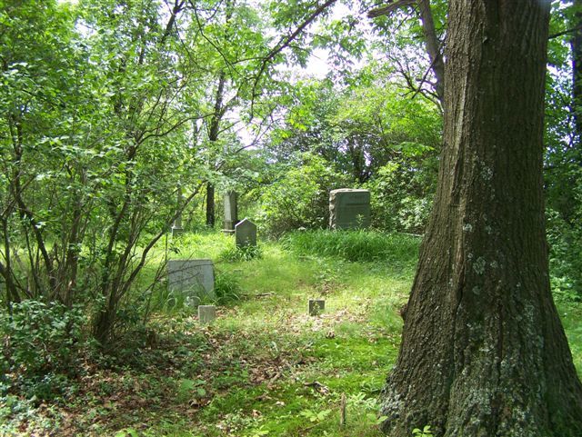
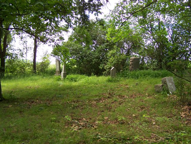
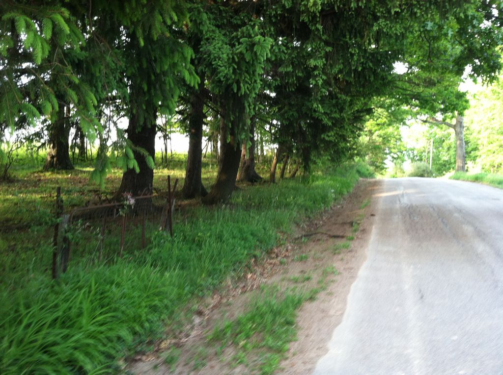
| Description | : | This is a small family cemetery that is no longer in use. It is located next to a corn field and along side the road and it is in the process of being overgrown. There are only about 12 to 15 burials here and have not been any since after WWII. Most of the burials occurred prior to 1900. This cemetery is not easy to find and these directions should be followed to the letter or it will be missed: From the intersection of State Route 28/66 and State Route 85, in Kittanning, PA, drive north on 28/66... Read More |
frequently asked questions (FAQ):
-
Where is Milliron Family Cemetery?
Milliron Family Cemetery is located at Putneyville, Armstrong County ,Pennsylvania ,USA.
-
Milliron Family Cemetery cemetery's updated grave count on graveviews.com?
0 memorials
-
Where are the coordinates of the Milliron Family Cemetery?
Latitude: 40.9268490
Longitude: -79.2997460
Nearby Cemetories:
1. McCreas Furnace Cemetery
McCrea Furnace, Armstrong County, USA
Coordinate: 40.9242060, -79.2952070
2. Putneyville Cemetery
Putneyville, Armstrong County, USA
Coordinate: 40.9426370, -79.3132420
3. Saint Mark's Lutheran Church Cemetery
Eddyville, Armstrong County, USA
Coordinate: 40.9414139, -79.2808609
4. Belknap Cemetery
Dayton, Armstrong County, USA
Coordinate: 40.8926000, -79.2957000
5. Concord Presbyterian Church Cemetery
Wayne Township, Armstrong County, USA
Coordinate: 40.8910599, -79.3240356
6. Jerusalem Lutheran Cemetery
Wayne Township, Armstrong County, USA
Coordinate: 40.9197006, -79.3566971
7. Smullin Cemetery
Distant, Armstrong County, USA
Coordinate: 40.9626000, -79.3346000
8. Colwell Cemetery
Armstrong County, USA
Coordinate: 40.9394520, -79.3633680
9. Mudlic Cemetery
Charlestown, Armstrong County, USA
Coordinate: 40.9798490, -79.2758420
10. Oakland Cemetery
Distant, Armstrong County, USA
Coordinate: 40.9712296, -79.3455124
11. Copenhaver Crossroads Cemetery
Mc Gregor, Armstrong County, USA
Coordinate: 40.9379463, -79.2207184
12. Emory Chapel Memorial Park
Dayton, Armstrong County, USA
Coordinate: 40.8882930, -79.2371320
13. Rehobeth Reformed Presbyterian Church Cemetery
Kittanning, Armstrong County, USA
Coordinate: 40.8922670, -79.3695690
14. Milton Cemetery
Milton, Armstrong County, USA
Coordinate: 40.9086720, -79.2170050
15. Mount Zion Cemetery
Oak Ridge, Armstrong County, USA
Coordinate: 40.9951553, -79.3060226
16. Saint Michael's Episcopal Cemetery
Rural Valley, Armstrong County, USA
Coordinate: 40.8542328, -79.3036499
17. Echo Methodist Episcopal Church Cemetery
Armstrong County, USA
Coordinate: 40.8570420, -79.3275330
18. Dayton Glade Run Cemetery
Dayton, Armstrong County, USA
Coordinate: 40.8710136, -79.2356262
19. Deanville Cemetery
Deanville, Armstrong County, USA
Coordinate: 40.9517700, -79.3919170
20. New Salem Cemetery
Armstrong County, USA
Coordinate: 40.9887733, -79.2424927
21. Narrows Cemetery
Mahoning, Armstrong County, USA
Coordinate: 40.9699000, -79.3839000
22. United Presbyterian Cemetery
Dayton, Armstrong County, USA
Coordinate: 40.8652000, -79.2297000
23. Timblin United Methodist Cemetery
Timblin, Jefferson County, USA
Coordinate: 40.9665620, -79.2057910
24. Saint Charles Cemetery
New Bethlehem, Clarion County, USA
Coordinate: 41.0036000, -79.3395000