
| Memorials | : | 1 |
| Location | : | Wayne Township, Armstrong County, USA |
| Coordinate | : | 40.9197006, -79.3566971 |
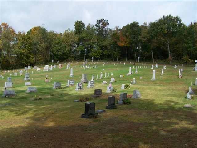
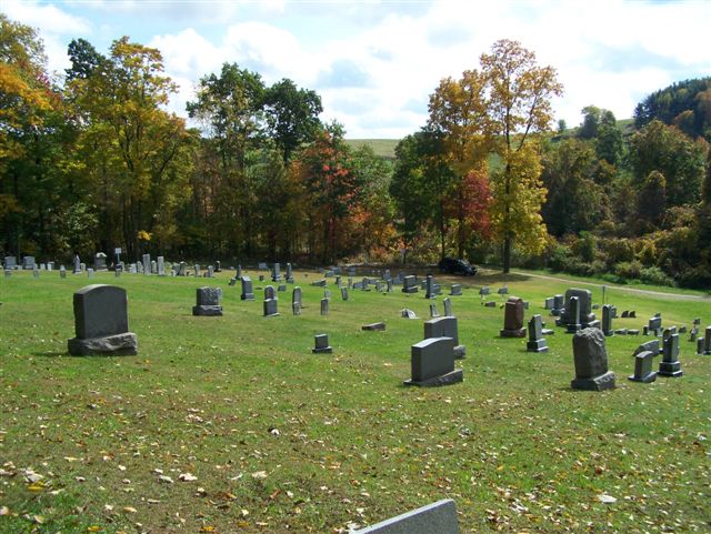
| Description | : | Jerusalem Evangelical Lutheran Church was organized in 1832, by Rev. Gabriel A. Reichert. Peter Kammerdeiner (Buried in this cemetery) was the first Elder and Christopher Rupp and Abraham Zimmerman, the first Trustees. (Both buried in this cemetery) After Rev. Reichert left, the pulpit was filled, intermittently, until 1876, when the Rev. Michael Sweigart became the Pastor. The number of members, then, was 72. The first Church edifice was made of logs and was 30 by 25 feet. The present structure is a frame, 40 by 35 feet and was erected in 1874 on a one acre lot donated by Jacob... Read More |
frequently asked questions (FAQ):
-
Where is Jerusalem Lutheran Cemetery?
Jerusalem Lutheran Cemetery is located at 132 Cemetery Rd Wayne Township, Armstrong County ,Pennsylvania , 16242USA.
-
Jerusalem Lutheran Cemetery cemetery's updated grave count on graveviews.com?
1 memorials
-
Where are the coordinates of the Jerusalem Lutheran Cemetery?
Latitude: 40.9197006
Longitude: -79.3566971
Nearby Cemetories:
1. Colwell Cemetery
Armstrong County, USA
Coordinate: 40.9394520, -79.3633680
2. Rehobeth Reformed Presbyterian Church Cemetery
Kittanning, Armstrong County, USA
Coordinate: 40.8922670, -79.3695690
3. Concord Presbyterian Church Cemetery
Wayne Township, Armstrong County, USA
Coordinate: 40.8910599, -79.3240356
4. Putneyville Cemetery
Putneyville, Armstrong County, USA
Coordinate: 40.9426370, -79.3132420
5. Deanville Cemetery
Deanville, Armstrong County, USA
Coordinate: 40.9517700, -79.3919170
6. Milliron Family Cemetery
Putneyville, Armstrong County, USA
Coordinate: 40.9268490, -79.2997460
7. Smullin Cemetery
Distant, Armstrong County, USA
Coordinate: 40.9626000, -79.3346000
8. McCreas Furnace Cemetery
McCrea Furnace, Armstrong County, USA
Coordinate: 40.9242060, -79.2952070
9. Oakland Cemetery
Distant, Armstrong County, USA
Coordinate: 40.9712296, -79.3455124
10. Belknap Cemetery
Dayton, Armstrong County, USA
Coordinate: 40.8926000, -79.2957000
11. Narrows Cemetery
Mahoning, Armstrong County, USA
Coordinate: 40.9699000, -79.3839000
12. Saint Mark's Lutheran Church Cemetery
Eddyville, Armstrong County, USA
Coordinate: 40.9414139, -79.2808609
13. Stewardson Furnace Cemetery
Armstrong County, USA
Coordinate: 40.9331510, -79.4421280
14. Mateer Cemetery
Armstrong County, USA
Coordinate: 40.8721000, -79.4175000
15. Mount Zion Presbyterian Cemetery
Boggs Township, Armstrong County, USA
Coordinate: 40.8717100, -79.4171980
16. Echo Methodist Episcopal Church Cemetery
Armstrong County, USA
Coordinate: 40.8570420, -79.3275330
17. Kellersburg Lutheran Cemetery
Kellersburg, Armstrong County, USA
Coordinate: 40.9704000, -79.4244000
18. Calhoun Cemetery
Armstrong County, USA
Coordinate: 40.8502426, -79.3848648
19. Kellersburg Methodist Cemetery
Kellersburg, Armstrong County, USA
Coordinate: 40.9752000, -79.4240000
20. Saint Michael's Episcopal Cemetery
Rural Valley, Armstrong County, USA
Coordinate: 40.8542328, -79.3036499
21. Bell Town Road Cemetery
Templeton, Armstrong County, USA
Coordinate: 40.9243110, -79.4624050
22. Scott Fox Memorial Site
Kittanning, Armstrong County, USA
Coordinate: 40.8457580, -79.3972170
23. Cochran Cemetery
Templeton, Armstrong County, USA
Coordinate: 40.8941994, -79.4582977
24. Lower Piney Cemetery
Armstrong County, USA
Coordinate: 40.8655920, -79.4395400