
| Memorials | : | 0 |
| Location | : | Kittanning, Armstrong County, USA |
| Coordinate | : | 40.8922670, -79.3695690 |
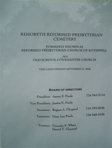
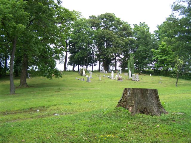
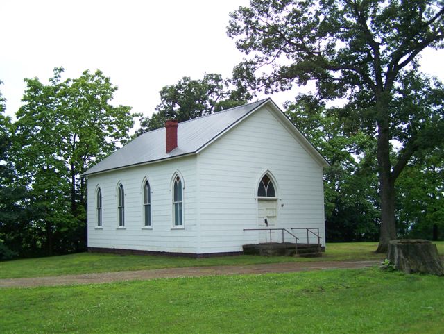
| Description | : | This Church has been known, at one time or another, by all of the following names: "The Reformed Presbyterian Church of Bothwell;" The Old School Covenanter [Covenator] Church;" "White Church:" or the "Rehobeth Reformed Presbyterian Church Cemetery." (And this last one is the name most of the locals know it by today.) There is a sign on the Church Door that lists all these names, with the exception of the "White Church" name. The land for the Church and cemetery was deeded on 27 September 1848, by members of the local White Family and was originally called the White Presbyterian... Read More |
frequently asked questions (FAQ):
-
Where is Rehobeth Reformed Presbyterian Church Cemetery?
Rehobeth Reformed Presbyterian Church Cemetery is located at SR 1027 Kittanning, Armstrong County ,Pennsylvania , 16201USA.
-
Rehobeth Reformed Presbyterian Church Cemetery cemetery's updated grave count on graveviews.com?
0 memorials
-
Where are the coordinates of the Rehobeth Reformed Presbyterian Church Cemetery?
Latitude: 40.8922670
Longitude: -79.3695690
Nearby Cemetories:
1. Jerusalem Lutheran Cemetery
Wayne Township, Armstrong County, USA
Coordinate: 40.9197006, -79.3566971
2. Concord Presbyterian Church Cemetery
Wayne Township, Armstrong County, USA
Coordinate: 40.8910599, -79.3240356
3. Mount Zion Presbyterian Cemetery
Boggs Township, Armstrong County, USA
Coordinate: 40.8717100, -79.4171980
4. Mateer Cemetery
Armstrong County, USA
Coordinate: 40.8721000, -79.4175000
5. Calhoun Cemetery
Armstrong County, USA
Coordinate: 40.8502426, -79.3848648
6. Colwell Cemetery
Armstrong County, USA
Coordinate: 40.9394520, -79.3633680
7. Echo Methodist Episcopal Church Cemetery
Armstrong County, USA
Coordinate: 40.8570420, -79.3275330
8. Scott Fox Memorial Site
Kittanning, Armstrong County, USA
Coordinate: 40.8457580, -79.3972170
9. Belknap Cemetery
Dayton, Armstrong County, USA
Coordinate: 40.8926000, -79.2957000
10. Lower Piney Cemetery
Armstrong County, USA
Coordinate: 40.8655920, -79.4395400
11. Deanville Cemetery
Deanville, Armstrong County, USA
Coordinate: 40.9517700, -79.3919170
12. Saint Michael's Episcopal Cemetery
Rural Valley, Armstrong County, USA
Coordinate: 40.8542328, -79.3036499
13. Pine Creek Methodist Cemetery
Pine Furnace, Armstrong County, USA
Coordinate: 40.8497870, -79.4309590
14. Milliron Family Cemetery
Putneyville, Armstrong County, USA
Coordinate: 40.9268490, -79.2997460
15. McCreas Furnace Cemetery
McCrea Furnace, Armstrong County, USA
Coordinate: 40.9242060, -79.2952070
16. Putneyville Cemetery
Putneyville, Armstrong County, USA
Coordinate: 40.9426370, -79.3132420
17. Pleasant Union Cemetery
Cowanshannock Township, Armstrong County, USA
Coordinate: 40.8314018, -79.3350449
18. Cochran Cemetery
Templeton, Armstrong County, USA
Coordinate: 40.8941994, -79.4582977
19. Stewardson Furnace Cemetery
Armstrong County, USA
Coordinate: 40.9331510, -79.4421280
20. Salem United Church of Christ Cemetery
Kittanning, Armstrong County, USA
Coordinate: 40.8244130, -79.3559970
21. Mount Union Davis Cemetery
Armstrong County, USA
Coordinate: 40.8323850, -79.4236530
22. Schrecengost Farm Cemetery
Armstrong County, USA
Coordinate: 40.8288070, -79.3177450
23. Smullin Cemetery
Distant, Armstrong County, USA
Coordinate: 40.9626000, -79.3346000
24. Bell Town Road Cemetery
Templeton, Armstrong County, USA
Coordinate: 40.9243110, -79.4624050