| Memorials | : | 0 |
| Location | : | Girty, Armstrong County, USA |
| Coordinate | : | 40.6596550, -79.4020500 |
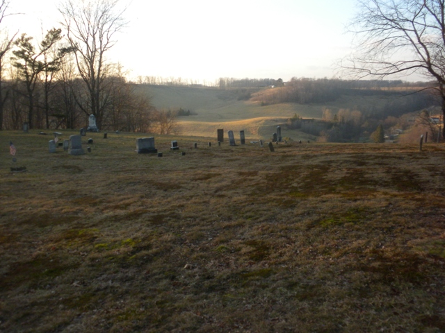
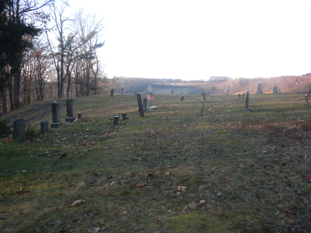
| Description | : | This cemetery is the old Mt. Zion United Methodist Church cemetery, also known as Rupert Cemetery. The church was destroyed around 1867 or so and moved to its current location at 449 Girty Road. From 422 West in Elderton, take a left onto Girty Road. Go up the road until you come to 598 Girty Road on the left. Right beside the drive for 598 Girty Road is a dirt road on the left. Turn on the dirt road and when you get to the top of the hill, take a sharp right and you will go directly to the... Read More |
frequently asked questions (FAQ):
-
Where is Rupert Cemetery?
Rupert Cemetery is located at Girty Road Girty, Armstrong County ,Pennsylvania ,USA.
-
Rupert Cemetery cemetery's updated grave count on graveviews.com?
0 memorials
-
Where are the coordinates of the Rupert Cemetery?
Latitude: 40.6596550
Longitude: -79.4020500
Nearby Cemetories:
1. Mount Zion United Methodist Church Cemetery
Girty, Armstrong County, USA
Coordinate: 40.6555710, -79.4134674
2. Montgomery Family Cemetery
South Bend, Armstrong County, USA
Coordinate: 40.6597000, -79.3714000
3. Rowley Cemetery
Elderton, Armstrong County, USA
Coordinate: 40.6889750, -79.4027500
4. South Bend Cemetery
Elderton, Armstrong County, USA
Coordinate: 40.6370087, -79.3699417
5. Mount Union Lutheran Church Cemetery
Elderton, Armstrong County, USA
Coordinate: 40.6876678, -79.3781967
6. McDonald Cemetery
Burrell Township, Armstrong County, USA
Coordinate: 40.6603012, -79.4464035
7. Ramaley Family Cemetery
Cochrans Mills, Armstrong County, USA
Coordinate: 40.6574780, -79.4585220
8. Shaeffer Cemetery
Brick Church, Armstrong County, USA
Coordinate: 40.6927986, -79.4441986
9. Saint Michael's Lutheran Church Cemetery
Brick Church, Armstrong County, USA
Coordinate: 40.6831360, -79.4557114
10. Shoemaker Family Cemetery
Cochrans Mills, Armstrong County, USA
Coordinate: 40.6639400, -79.4665790
11. Cochrans Mill United Methodist Church Cemetery
Cochrans Mills, Armstrong County, USA
Coordinate: 40.6706000, -79.4700000
12. Dunkard Baptist Christian Bretheren Cemetery
Cochrans Mills, Armstrong County, USA
Coordinate: 40.6697655, -79.4726105
13. Elderton Cemetery
Elderton, Armstrong County, USA
Coordinate: 40.6918000, -79.3436000
14. Elderton United Methodist Church Cemetery
Elderton, Armstrong County, USA
Coordinate: 40.6941681, -79.3455887
15. Elderton Presbyterian Church Cemetery
Elderton, Armstrong County, USA
Coordinate: 40.6972520, -79.3432240
16. Kimmel Cemetery
Elderton, Armstrong County, USA
Coordinate: 40.6910190, -79.3346140
17. Shellhammer-Beck Cemetery
Mateer, Armstrong County, USA
Coordinate: 40.6394230, -79.4799040
18. West Union United Presbyterian Church Cemetery
Parkwood, Indiana County, USA
Coordinate: 40.6163000, -79.3425000
19. Shellhammer Cemetery
Mateer, Armstrong County, USA
Coordinate: 40.6420000, -79.4887000
20. Shellhammer Cemetery
Mateer, Armstrong County, USA
Coordinate: 40.6404860, -79.4944850
21. Olivet Cemetery
South Bend, Armstrong County, USA
Coordinate: 40.5872000, -79.4106000
22. Pettigrew Cemetery
Elderton, Armstrong County, USA
Coordinate: 40.7330560, -79.3991670
23. Saint John's Lutheran Church Cemetery
Ford City, Armstrong County, USA
Coordinate: 40.7197037, -79.4614410
24. United Rockville Lutheran Cemetery
Ford City, Armstrong County, USA
Coordinate: 40.7305260, -79.4382095


