
| Memorials | : | 0 |
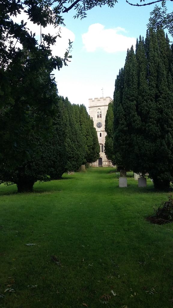
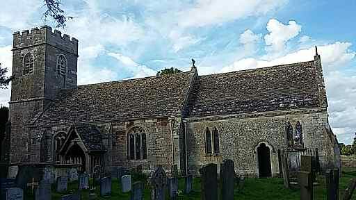
| Location | : | Saul, Stroud District, England |
| Coordinate | : | 51.7830000, -2.3548500 |
| Description | : | Saul is a village in Gloucestershire, England. It is in the parish of Fretherne with Saul in the district of Stroud. |
frequently asked questions (FAQ):
-
Where is St James the Great Churchyard?
St James the Great Churchyard is located at Church Street Saul, Stroud District ,Gloucestershire , GL2 7LWEngland.
-
St James the Great Churchyard cemetery's updated grave count on graveviews.com?
0 memorials
-
Where are the coordinates of the St James the Great Churchyard?
Latitude: 51.7830000
Longitude: -2.3548500
Nearby Cemetories:
1. St Andrews Churchyard
Whitminster, Stroud District, England
Coordinate: 51.7798400, -2.3487000
2. St. Peter's Church
Stroud District, England
Coordinate: 51.7927144, -2.3752327
3. St Mary the Virgin Churchyard
Fretherne, Stroud District, England
Coordinate: 51.7804140, -2.3873960
4. St. Stephen's Churchyard
Moreton Valence, Stroud District, England
Coordinate: 51.7857492, -2.3208765
5. St Mary Churchyard
Frampton-on-Severn, Stroud District, England
Coordinate: 51.7605650, -2.3730980
6. St. Laurence Churchyard
Longney, Stroud District, England
Coordinate: 51.8100627, -2.3441589
7. St. Michael and All Angels Churchyard
Eastington, Stroud District, England
Coordinate: 51.7501680, -2.3161330
8. St Nicholas Churchyard
Hardwicke, Stroud District, England
Coordinate: 51.8101200, -2.3007300
9. St. Mary the Virgin Churchyard
Arlingham, Stroud District, England
Coordinate: 51.7940080, -2.4263290
10. St. Peter's Churchyard
Haresfield, Stroud District, England
Coordinate: 51.7921323, -2.2767870
11. Saint Peter and Saint Paul Churchyard
Westbury-on-Severn, Forest of Dean District, England
Coordinate: 51.8228858, -2.4117957
12. St. John the Evangelist Churchyard
Slimbridge, Stroud District, England
Coordinate: 51.7302510, -2.3773070
13. St. Cyr Churchyard
Stonehouse, Stroud District, England
Coordinate: 51.7433750, -2.2917980
14. St Peters Churchyard
Frocester, Stroud District, England
Coordinate: 51.7277690, -2.3329860
15. Saint Andrew's Churchyard
Frocester, Stroud District, England
Coordinate: 51.7273322, -2.3129734
16. St. Peter's Churchyard
Newnham, Forest of Dean District, England
Coordinate: 51.8015700, -2.4501300
17. St. James' Churchyard
Quedgeley, City of Gloucester, England
Coordinate: 51.8257770, -2.2811150
18. St George's Churchyard
Kings Stanley, Stroud District, England
Coordinate: 51.7352650, -2.2765210
19. St. John the Baptist Churchyard
Randwick, Stroud District, England
Coordinate: 51.7587400, -2.2514000
20. St. Peter's Churchyard
Minsterworth, Tewkesbury Borough, England
Coordinate: 51.8511500, -2.3307800
21. St John the Baptist Churchyard
Harescombe, Stroud District, England
Coordinate: 51.7921570, -2.2373260
22. St. Swithun Churchyard
Brookthorpe, Stroud District, England
Coordinate: 51.8087500, -2.2402900
23. Saint Matthews Churchyard
Cainscross, Stroud District, England
Coordinate: 51.7430640, -2.2469780
24. All Saints Churchyard
Blakeney, Forest of Dean District, England
Coordinate: 51.7615380, -2.4765280