
| Memorials | : | 1 |
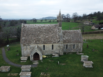
| Location | : | Harescombe, Stroud District, England |
| Coordinate | : | 51.7921570, -2.2373260 |
frequently asked questions (FAQ):
-
Where is St John the Baptist Churchyard?
St John the Baptist Churchyard is located at Harescombe, Stroud District ,Gloucestershire , GL4 0XDEngland.
-
St John the Baptist Churchyard cemetery's updated grave count on graveviews.com?
1 memorials
-
Where are the coordinates of the St John the Baptist Churchyard?
Latitude: 51.7921570
Longitude: -2.2373260
Nearby Cemetories:
1. St. Swithun Churchyard
Brookthorpe, Stroud District, England
Coordinate: 51.8087500, -2.2402900
2. St John the Baptist Churchyard
Pitchcombe, Stroud District, England
Coordinate: 51.7727590, -2.2166790
3. St. Peter's Churchyard
Haresfield, Stroud District, England
Coordinate: 51.7921323, -2.2767870
4. St. Mary the Virgin Churchyard
Painswick, Stroud District, England
Coordinate: 51.7852975, -2.1947224
5. Painswick Cemetery
Painswick, Stroud District, England
Coordinate: 51.7971040, -2.1918690
6. St Margaret Church
Whaddon, Stroud District, England
Coordinate: 51.8214600, -2.2433000
7. St Paul Churchyard
Whiteshill, Stroud District, England
Coordinate: 51.7597750, -2.2321540
8. St. John the Baptist Churchyard
Randwick, Stroud District, England
Coordinate: 51.7587400, -2.2514000
9. Holy Trinity Churchyard
Slad, Stroud District, England
Coordinate: 51.7647770, -2.1866550
10. St Nicholas Churchyard
Hardwicke, Stroud District, England
Coordinate: 51.8101200, -2.3007300
11. St. James' Churchyard
Quedgeley, City of Gloucester, England
Coordinate: 51.8257770, -2.2811150
12. St. Laurence Churchyard
Stroud, Stroud District, England
Coordinate: 51.7459470, -2.2153950
13. Prinknash Abbey
Cranham, Stroud District, England
Coordinate: 51.8225000, -2.1761110
14. St. John the Apostle Churchyard
Sheepscombe, Stroud District, England
Coordinate: 51.7894990, -2.1582430
15. Saint Matthews Churchyard
Cainscross, Stroud District, England
Coordinate: 51.7430640, -2.2469780
16. St. James the Great Churchyard
Cranham, Stroud District, England
Coordinate: 51.8102797, -2.1596329
17. St. Stephen's Churchyard
Moreton Valence, Stroud District, England
Coordinate: 51.7857492, -2.3208765
18. St. Mary Magdalene Churchyard
Rodborough, Stroud District, England
Coordinate: 51.7384180, -2.2284060
19. Stroud Hill Cemetery
Stroud, Stroud District, England
Coordinate: 51.7415670, -2.2002660
20. Gloucester Old Cemetery
Gloucester, City of Gloucester, England
Coordinate: 51.8482100, -2.2276700
21. Rodborough Tabernacle
Rodborough, Stroud District, England
Coordinate: 51.7345300, -2.2245700
22. St. Cyr Churchyard
Stonehouse, Stroud District, England
Coordinate: 51.7433750, -2.2917980
23. All Saints Churchyard
Selsley, Stroud District, England
Coordinate: 51.7327800, -2.2487900
24. Stroud Old Cemetery
Stroud, Stroud District, England
Coordinate: 51.7337658, -2.2094599