
| Memorials | : | 65 |
| Location | : | Whitminster, Stroud District, England |
| Coordinate | : | 51.7798400, -2.3487000 |
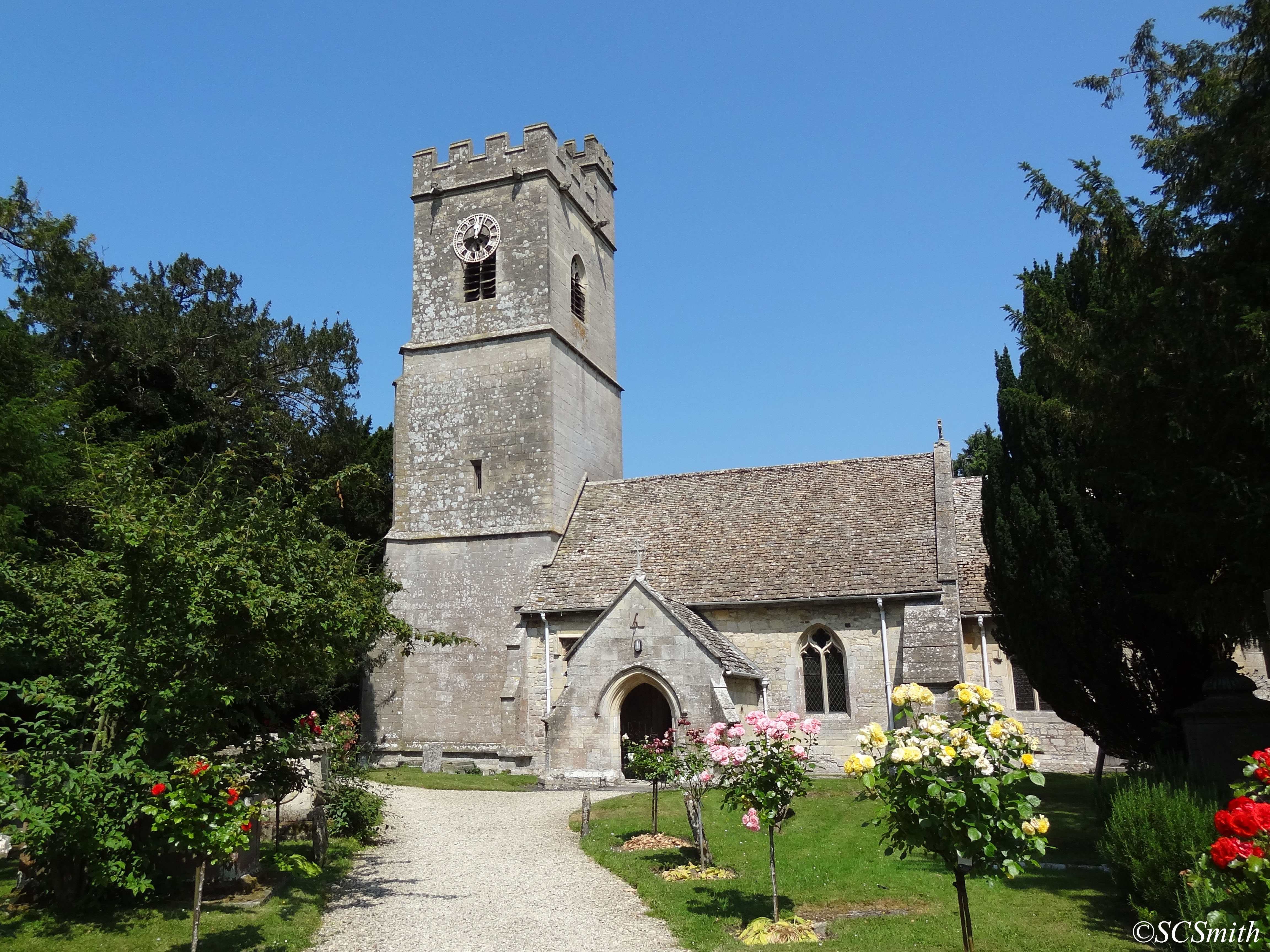
| Description | : | St. Andrew's Church in Whitminster, Gloucestershire is a village church constructed from Cotswold stone. The church site dates from 1086, although no part of the surviving fabric is visibly older than the 14th century. It was enlarged in 1842 to include a north aisle, designed by Bristol architect Thomas Foster, the tower was restored in 1844 and various other areas in 1884 by Sir A.W. Blomfeld, with the externals remaining mostly unchanged from that date. It currently has a peel of 6 bells, the earliest of which dates from 1634. It is one of only a few churches in Gloucestershire to... Read More |
frequently asked questions (FAQ):
-
Where is St Andrews Churchyard?
St Andrews Churchyard is located at Whitminster, Stroud District ,Gloucestershire ,England.
-
St Andrews Churchyard cemetery's updated grave count on graveviews.com?
65 memorials
-
Where are the coordinates of the St Andrews Churchyard?
Latitude: 51.7798400
Longitude: -2.3487000
Nearby Cemetories:
1. St James the Great Churchyard
Saul, Stroud District, England
Coordinate: 51.7830000, -2.3548500
2. St. Stephen's Churchyard
Moreton Valence, Stroud District, England
Coordinate: 51.7857492, -2.3208765
3. St. Peter's Church
Stroud District, England
Coordinate: 51.7927144, -2.3752327
4. St Mary the Virgin Churchyard
Fretherne, Stroud District, England
Coordinate: 51.7804140, -2.3873960
5. St Mary Churchyard
Frampton-on-Severn, Stroud District, England
Coordinate: 51.7605650, -2.3730980
6. St. Laurence Churchyard
Longney, Stroud District, England
Coordinate: 51.8100627, -2.3441589
7. St. Michael and All Angels Churchyard
Eastington, Stroud District, England
Coordinate: 51.7501680, -2.3161330
8. St Nicholas Churchyard
Hardwicke, Stroud District, England
Coordinate: 51.8101200, -2.3007300
9. St. Peter's Churchyard
Haresfield, Stroud District, England
Coordinate: 51.7921323, -2.2767870
10. St. Mary the Virgin Churchyard
Arlingham, Stroud District, England
Coordinate: 51.7940080, -2.4263290
11. St. Cyr Churchyard
Stonehouse, Stroud District, England
Coordinate: 51.7433750, -2.2917980
12. St. John the Evangelist Churchyard
Slimbridge, Stroud District, England
Coordinate: 51.7302510, -2.3773070
13. St Peters Churchyard
Frocester, Stroud District, England
Coordinate: 51.7277690, -2.3329860
14. Saint Andrew's Churchyard
Frocester, Stroud District, England
Coordinate: 51.7273322, -2.3129734
15. Saint Peter and Saint Paul Churchyard
Westbury-on-Severn, Forest of Dean District, England
Coordinate: 51.8228858, -2.4117957
16. St. James' Churchyard
Quedgeley, City of Gloucester, England
Coordinate: 51.8257770, -2.2811150
17. St George's Churchyard
Kings Stanley, Stroud District, England
Coordinate: 51.7352650, -2.2765210
18. St. John the Baptist Churchyard
Randwick, Stroud District, England
Coordinate: 51.7587400, -2.2514000
19. St. Peter's Churchyard
Newnham, Forest of Dean District, England
Coordinate: 51.8015700, -2.4501300
20. St John the Baptist Churchyard
Harescombe, Stroud District, England
Coordinate: 51.7921570, -2.2373260
21. St. Peter's Churchyard
Minsterworth, Tewkesbury Borough, England
Coordinate: 51.8511500, -2.3307800
22. Saint Matthews Churchyard
Cainscross, Stroud District, England
Coordinate: 51.7430640, -2.2469780
23. St. Swithun Churchyard
Brookthorpe, Stroud District, England
Coordinate: 51.8087500, -2.2402900
24. St Paul Churchyard
Whiteshill, Stroud District, England
Coordinate: 51.7597750, -2.2321540