
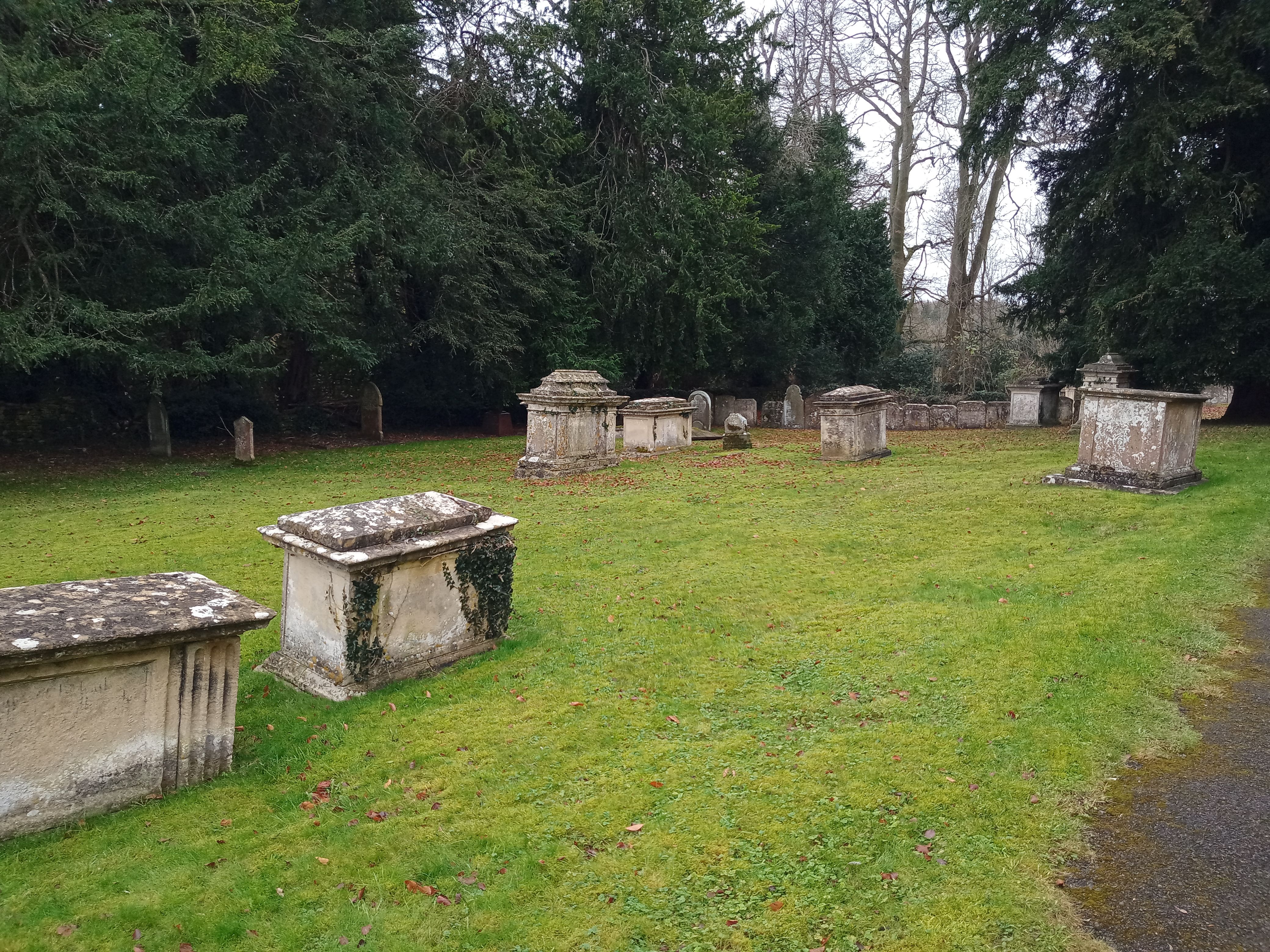
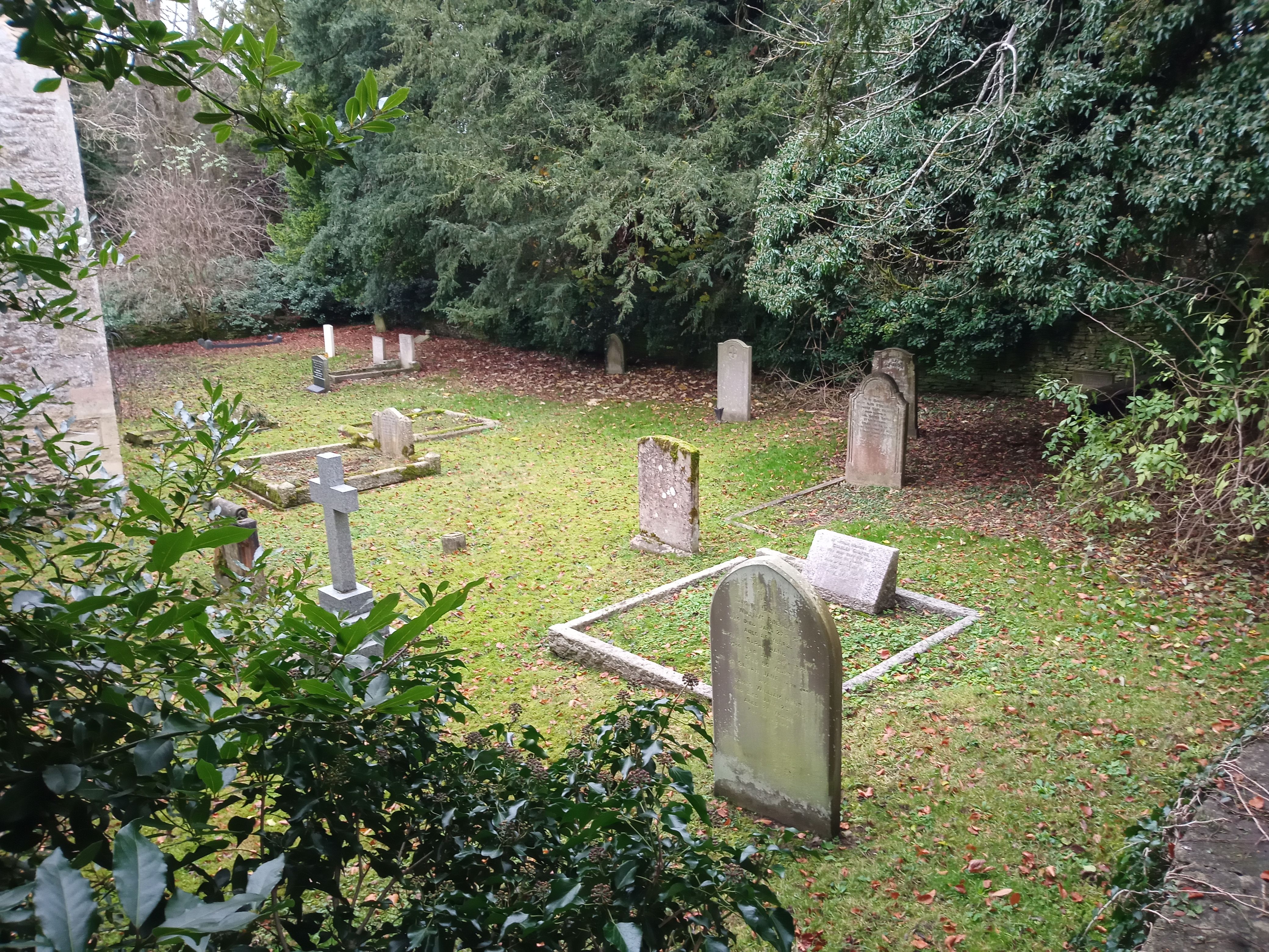
| Memorials | : | 33 |
| Location | : | Coln St Aldwyns, Cotswold District, England |
| Coordinate | : | 51.7447000, -1.7928600 |
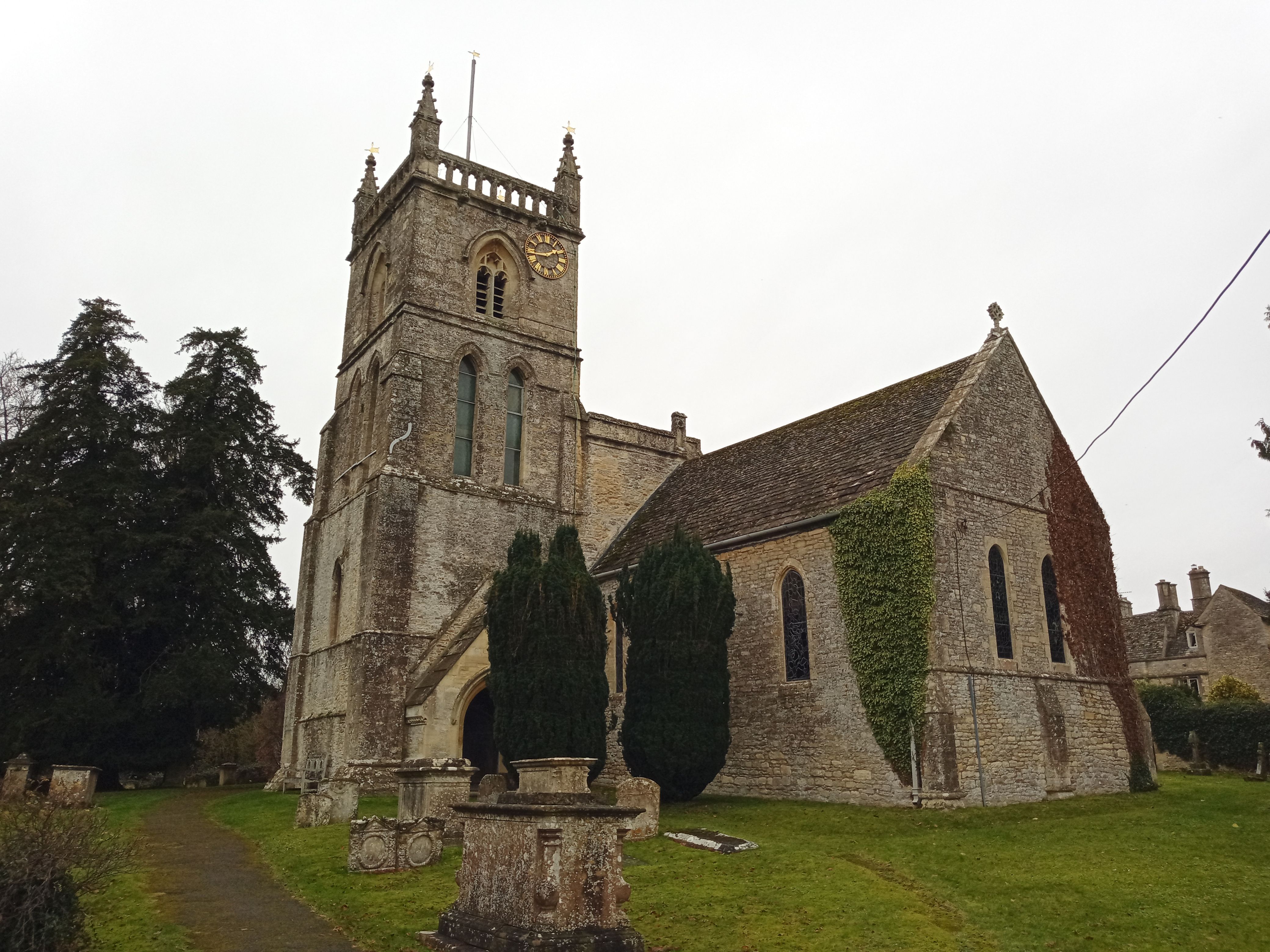
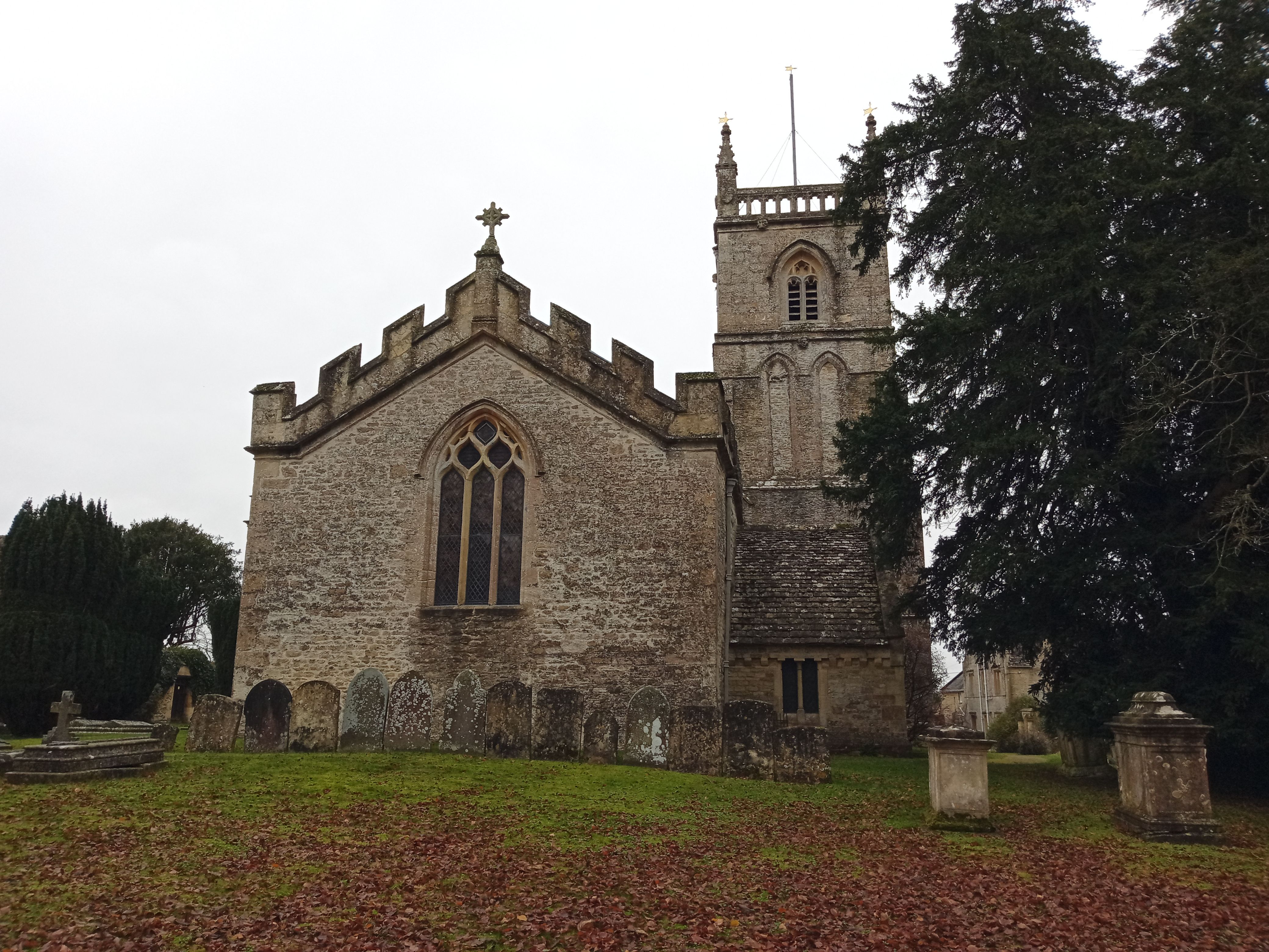
| Description | : | Coln St. Aldwyns (sometimes Coln St. Aldwyn) is a village and civil parish in the Cotswold district of Gloucestershire. The church building dates largely from the thirteenth century, but it has been added to since and was restored in the Victorian era. The south porch is late Norman, the chancel's lancet windows date from the thirteenth century and the tower was completed in the fifteenth century. The chancel was refurbished in the early 20th century in commemoration of the first Earl St Aldwyn, his son and wife who all died in 1916. The church is, unusually, dedicated to the... Read More |
frequently asked questions (FAQ):
-
Where is St. John the Baptist Churchyard?
St. John the Baptist Churchyard is located at Church Lane Coln St Aldwyns, Cotswold District ,Gloucestershire , GL7 5AGEngland.
-
St. John the Baptist Churchyard cemetery's updated grave count on graveviews.com?
33 memorials
-
Where are the coordinates of the St. John the Baptist Churchyard?
Latitude: 51.7447000
Longitude: -1.7928600
Nearby Cemetories:
1. St. Nicholas' Churchyard
Hatherop, Cotswold District, England
Coordinate: 51.7443000, -1.7786600
2. St. Nicholas Churchyard
Hatherop, Cotswold District, England
Coordinate: 51.7444700, -1.7780800
3. St. Mary the Virgin Churchyard
Bibury, Cotswold District, England
Coordinate: 51.7587037, -1.8376852
4. St. Mary the Virgin Churchyard
Fairford, Cotswold District, England
Coordinate: 51.7088500, -1.7814600
5. St. Thomas Churchyard
Fairford, Cotswold District, England
Coordinate: 51.7028776, -1.7801562
6. St. Andrew's Churchyard
Eastleach, Cotswold District, England
Coordinate: 51.7465120, -1.7087670
7. St Mary Churchyard
Barnsley, Cotswold District, England
Coordinate: 51.7445030, -1.8894860
8. Poulton Priory
Poulton, Cotswold District, England
Coordinate: 51.6989750, -1.8638940
9. Ampney St Peter Churchyard
Ampney St Peter, Cotswold District, England
Coordinate: 51.7126320, -1.8918160
10. Ampney St. Mary Parish Churchyard
Ampney St Mary, Cotswold District, England
Coordinate: 51.7125000, -1.8919000
11. St. Mary's Churchyard
Kempsford, Cotswold District, England
Coordinate: 51.6670420, -1.7681363
12. St. Margaret's Churchyard
Little Faringdon, West Oxfordshire District, England
Coordinate: 51.7109400, -1.6739760
13. Parish Church of St. Mary
Castle Eaton, Swindon Unitary Authority, England
Coordinate: 51.6624180, -1.7896647
14. St. Mary's Churchyard
Westwell, West Oxfordshire District, England
Coordinate: 51.7886840, -1.6779678
15. St Peter's Churchyard
Filkins, West Oxfordshire District, England
Coordinate: 51.7358700, -1.6578250
16. All Saints Churchyard
Down Ampney, Cotswold District, England
Coordinate: 51.6674850, -1.8592640
17. St Mary Magdalene Churchyard
Sherborne, Cotswold District, England
Coordinate: 51.8308380, -1.7562570
18. Sherborne Churchyard extension
Sherborne, Cotswold District, England
Coordinate: 51.8308450, -1.7536600
19. SS Peter & Paul
Northleach, Cotswold District, England
Coordinate: 51.8295720, -1.8390300
20. St. Peter's Churchyard
Little Barrington, Cotswold District, England
Coordinate: 51.8130930, -1.6983770
21. St. Mary's Churchyard
Buscot, Vale of White Horse District, England
Coordinate: 51.6815710, -1.6736770
22. Saint Matthew's Churchyard
Langford, West Oxfordshire District, England
Coordinate: 51.7209390, -1.6405280
23. St Georges Churchyard
Kencot, West Oxfordshire District, England
Coordinate: 51.7407160, -1.6330900
24. St Andrews
Chedworth, Cotswold District, England
Coordinate: 51.8078450, -1.9259590