
| Memorials | : | 0 |
| Location | : | Ampney St Mary, Cotswold District, England |
| Coordinate | : | 51.7125000, -1.8919000 |
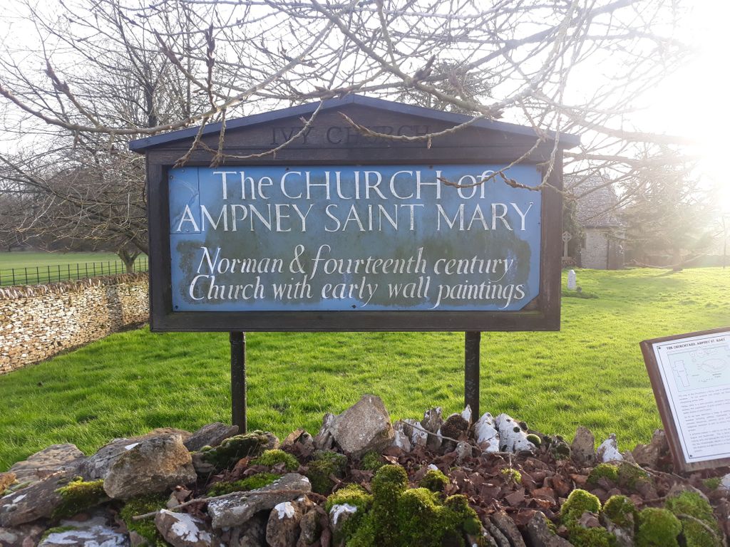
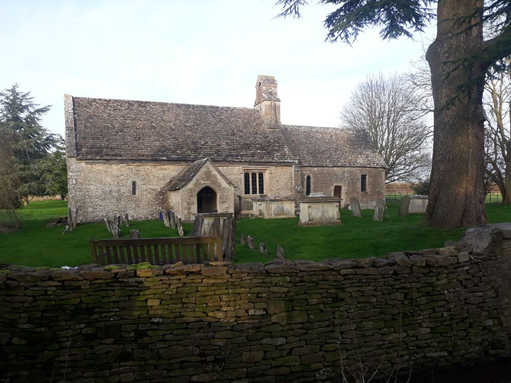
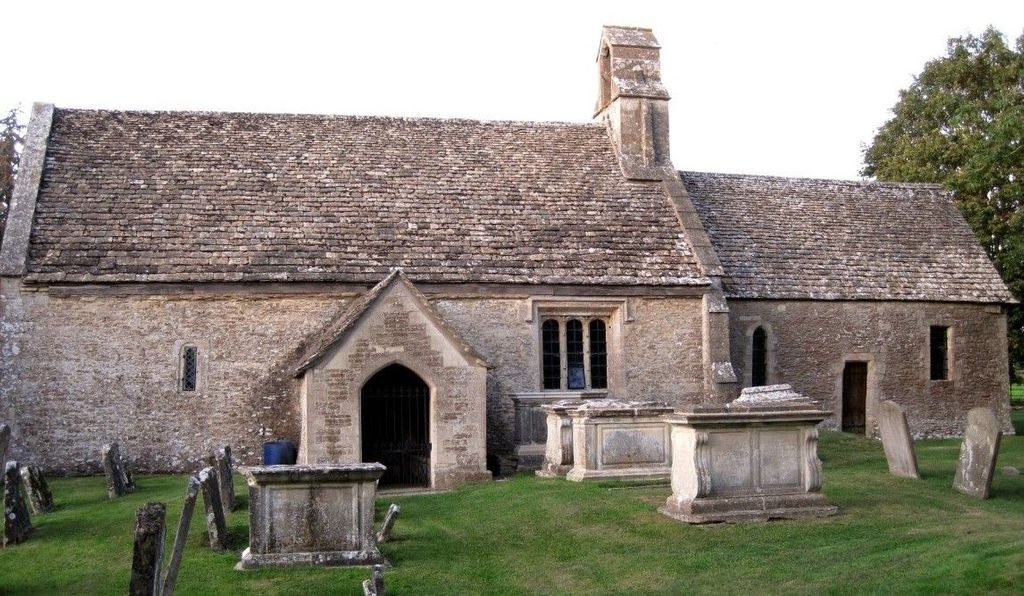
| Description | : | Ampney St Mary Parish Church Church of England. Near Cirencester, Gloucestershire. The parish register of baptisms and marriages dates from the year 1602; burials, 1605. The church of St. Mary is a small and ancient building of stone, in the Late Norman and Early English style, one bell, dated 1747 |
frequently asked questions (FAQ):
-
Where is Ampney St. Mary Parish Churchyard?
Ampney St. Mary Parish Churchyard is located at Ampney St Mary, Cotswold District ,Gloucestershire , GL7England.
-
Ampney St. Mary Parish Churchyard cemetery's updated grave count on graveviews.com?
0 memorials
-
Where are the coordinates of the Ampney St. Mary Parish Churchyard?
Latitude: 51.7125000
Longitude: -1.8919000

Nearby Cemetories:
1. Ampney St Peter Churchyard
Ampney St Peter, Cotswold District, England
Coordinate: 51.7126320, -1.8918160
2. Poulton Priory
Poulton, Cotswold District, England
Coordinate: 51.6989750, -1.8638940
3. St Mary Churchyard
Barnsley, Cotswold District, England
Coordinate: 51.7445030, -1.8894860
4. All Hallows Churchyard
South Cerney, Cotswold District, England
Coordinate: 51.6748248, -1.9292083
5. St. John the Baptist Churchyard
Cirencester, Cotswold District, England
Coordinate: 51.7175600, -1.9678580
6. All Saints Churchyard
Down Ampney, Cotswold District, England
Coordinate: 51.6674850, -1.8592640
7. Chesterton Cemetery
Cirencester, Cotswold District, England
Coordinate: 51.7099230, -1.9801340
8. St Mary Magdalene Churchyard
Baunton, Cotswold District, England
Coordinate: 51.7400511, -1.9692225
9. St. Mary the Virgin Churchyard
Bibury, Cotswold District, England
Coordinate: 51.7587037, -1.8376852
10. Stratton Cemetery
Cirencester, Cotswold District, England
Coordinate: 51.7353020, -1.9859041
11. St. Mary the Virgin Churchyard
Fairford, Cotswold District, England
Coordinate: 51.7088500, -1.7814600
12. St. John the Baptist Churchyard
Coln St Aldwyns, Cotswold District, England
Coordinate: 51.7447000, -1.7928600
13. St. Thomas Churchyard
Fairford, Cotswold District, England
Coordinate: 51.7028776, -1.7801562
14. Holy Cross Churchyard
Ashton Keynes, Wiltshire Unitary Authority, England
Coordinate: 51.6479000, -1.9394000
15. St. Mary's Churchyard
Cricklade, Wiltshire Unitary Authority, England
Coordinate: 51.6435624, -1.8553451
16. Cricklade Cemetery
Cricklade, Wiltshire Unitary Authority, England
Coordinate: 51.6414360, -1.8605570
17. St. Sampson Churchyard
Cricklade, Wiltshire Unitary Authority, England
Coordinate: 51.6405970, -1.8580760
18. All Saints Churchyard
North Cerney, Cotswold District, England
Coordinate: 51.7687300, -1.9746800
19. St. Nicholas' Churchyard
Hatherop, Cotswold District, England
Coordinate: 51.7443000, -1.7786600
20. St. Nicholas Churchyard
Hatherop, Cotswold District, England
Coordinate: 51.7444700, -1.7780800
21. Parish Church of St. Mary
Castle Eaton, Swindon Unitary Authority, England
Coordinate: 51.6624180, -1.7896647
22. All Saints Church
Kemble, Cotswold District, England
Coordinate: 51.6711000, -2.0154000
23. St. Mary's Churchyard
Kempsford, Cotswold District, England
Coordinate: 51.6670420, -1.7681363
24. St Matthew Churchyard
Coates, Cotswold District, England
Coordinate: 51.7077470, -2.0411010