
| Memorials | : | 0 |
| Location | : | Cannock, Cannock Chase District, England |
| Coordinate | : | 52.7370580, -2.0265050 |
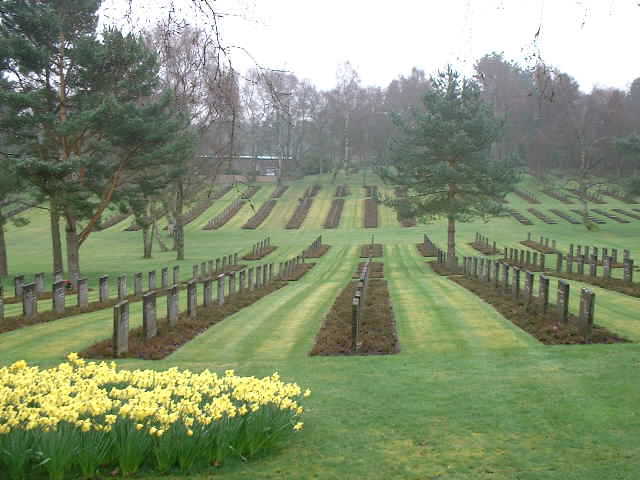
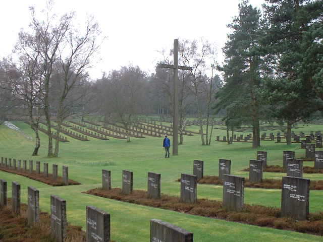
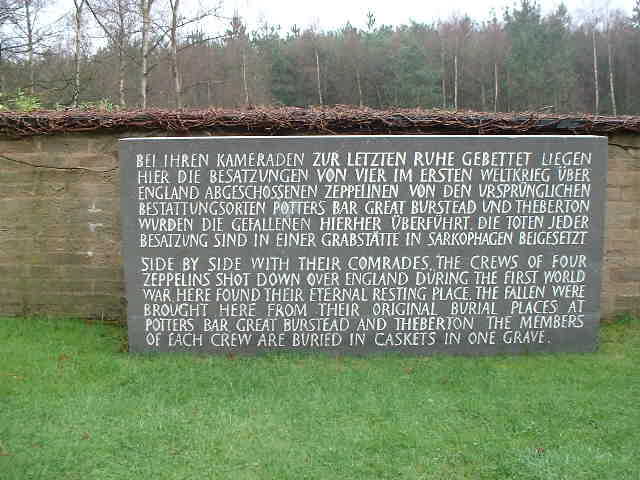
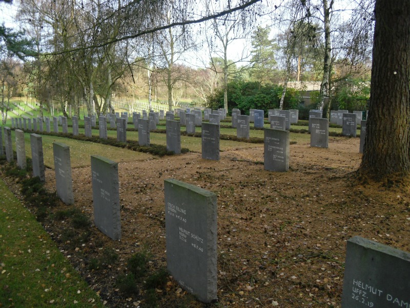
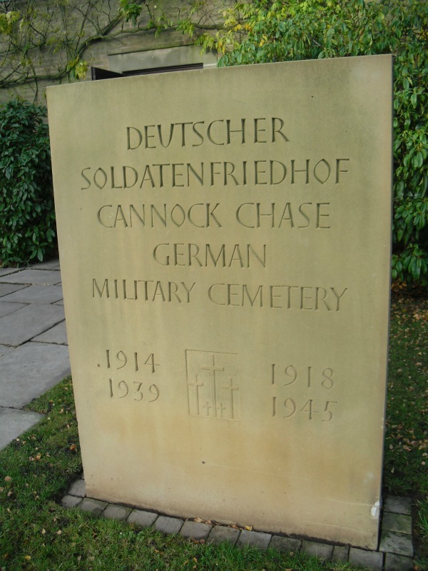
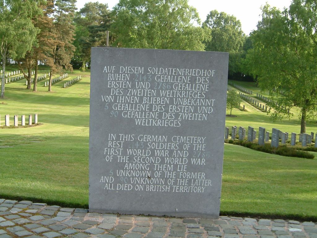
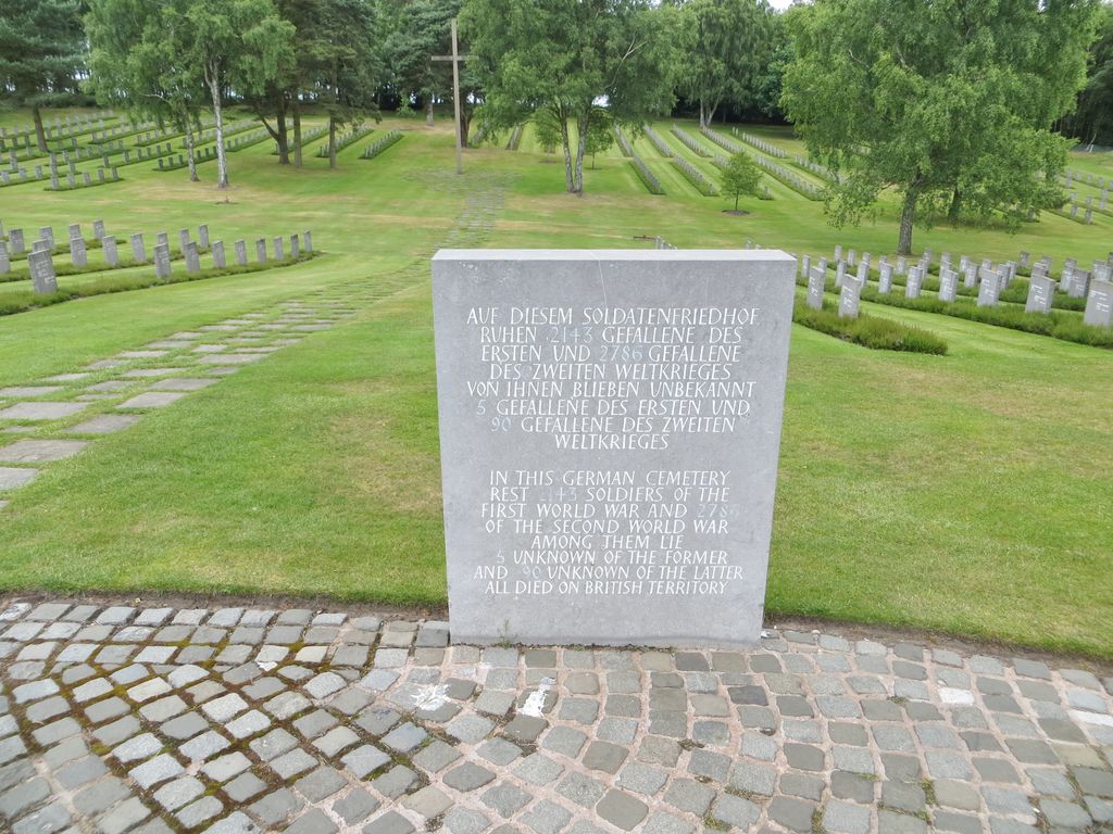
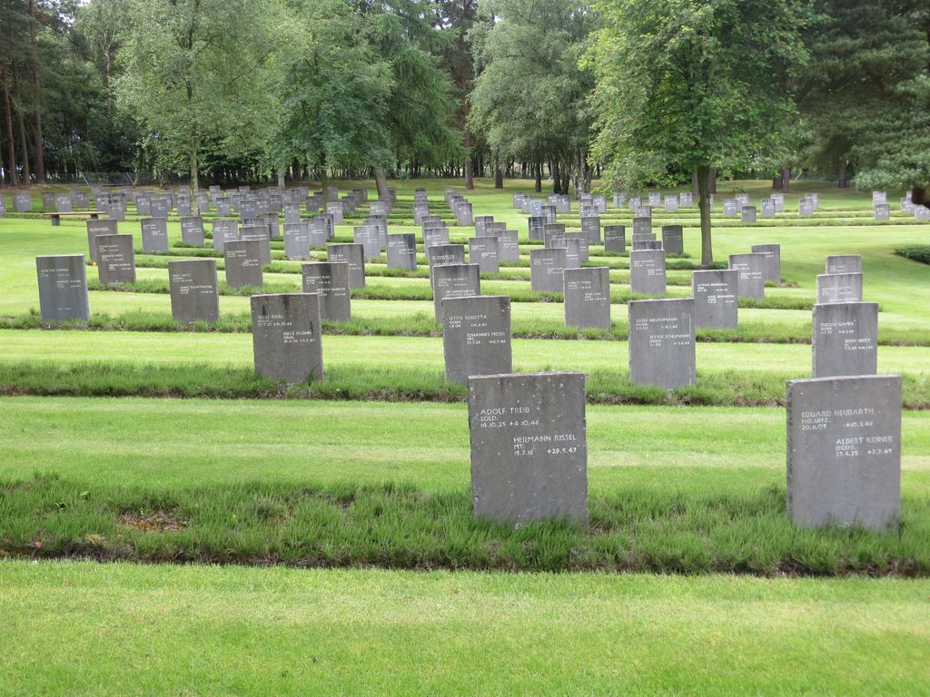
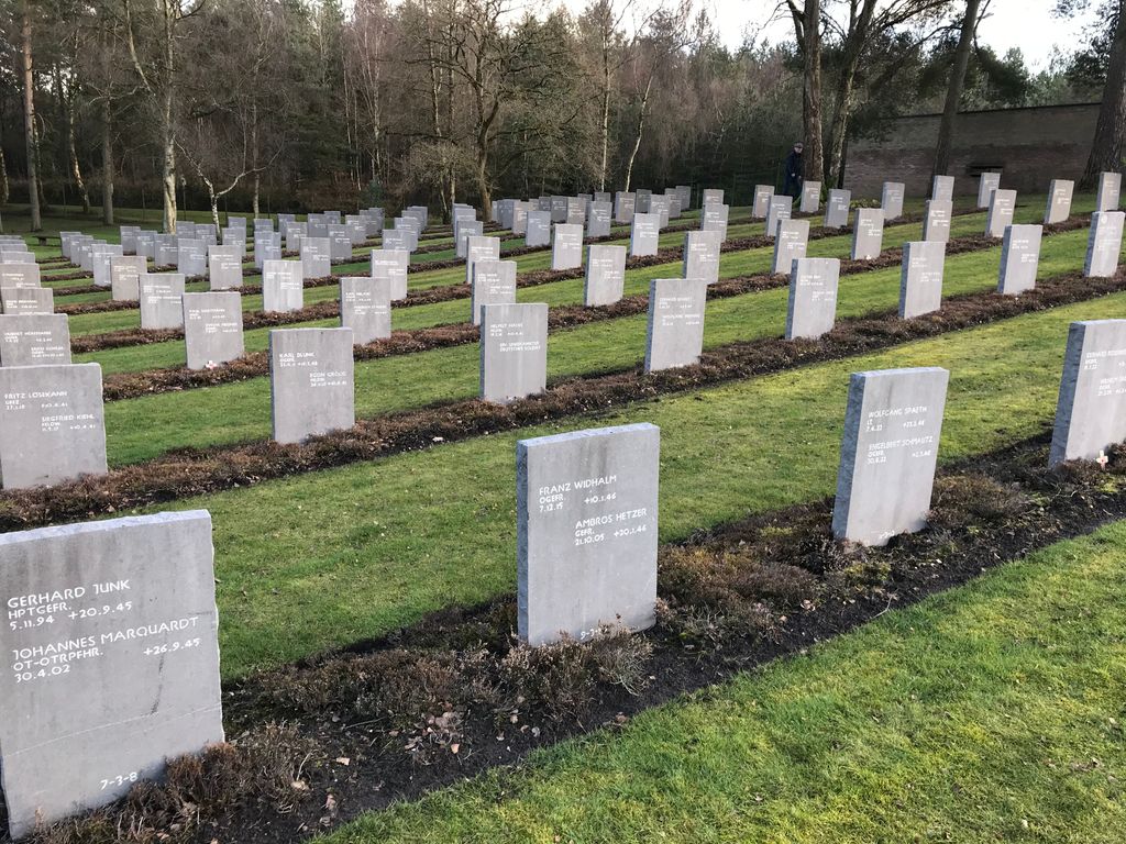
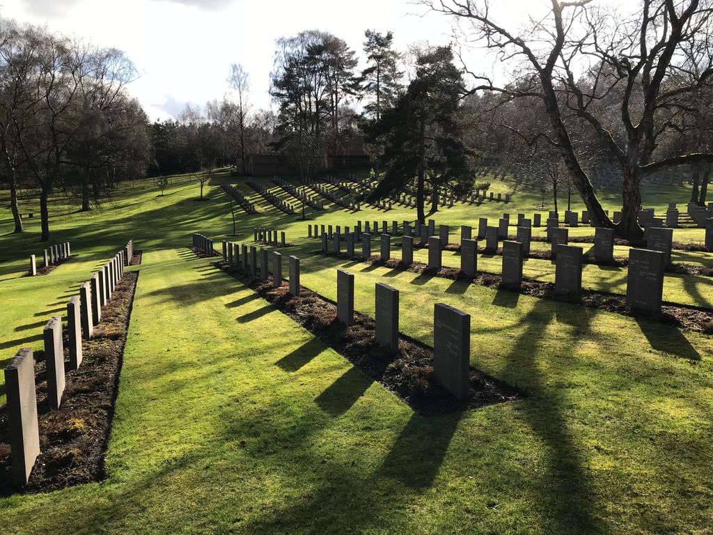
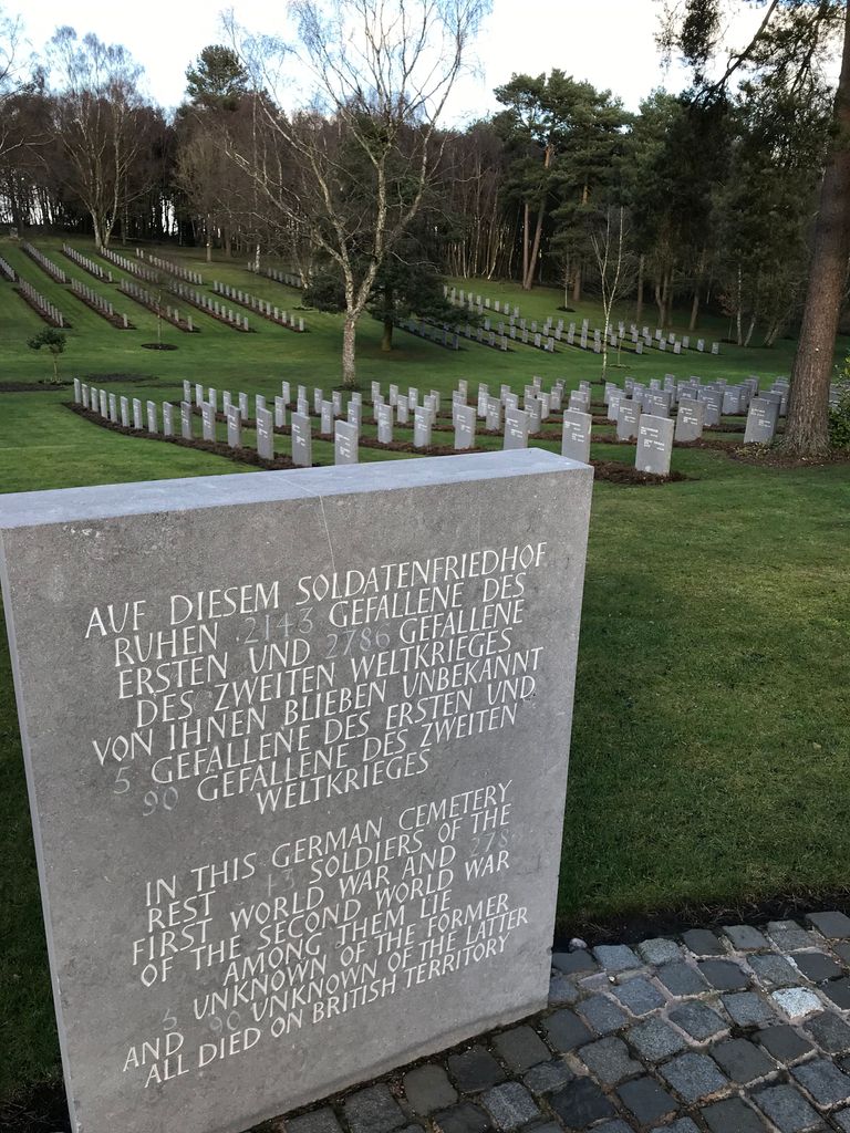
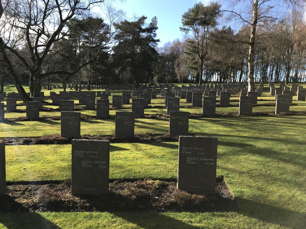
| Description | : | Historical Information: On 16 October 1959, an agreement was concluded by the governments of the United Kingdom and the Federal Republic of Germany concerning the future care of the graves of German nationals who lost their lives in the United Kingdom during the two World Wars. The agreement provided for the transfer to a central cemetery in the United Kingdom of all graves which were not situated in cemeteries and plots of Commonwealth war graves maintained by the Commonwealth War Graves Commission in situ. Following this agreement, the German War Graves Commission (Volksbund Deutsche Kriegsgraberfursorge) made arrangements to transfer the... Read More |
frequently asked questions (FAQ):
-
Where is Cannock Chase German Military Cemetery?
Cannock Chase German Military Cemetery is located at Cannock, Cannock Chase District ,Staffordshire ,England.
-
Cannock Chase German Military Cemetery cemetery's updated grave count on graveviews.com?
0 memorials
-
Where are the coordinates of the Cannock Chase German Military Cemetery?
Latitude: 52.7370580
Longitude: -2.0265050
Nearby Cemetories:
1. Cannock Chase War Cemetery
Cannock, Cannock Chase District, England
Coordinate: 52.7370710, -2.0266340
2. Cannock Cemetery
Cannock, Cannock Chase District, England
Coordinate: 52.7008790, -2.0288950
3. Our Lady of Lourdes Churchyard
Hednesford, Cannock Chase District, England
Coordinate: 52.7051311, -1.9969935
4. St. Peter's Churchyard
Hednesford, Cannock Chase District, England
Coordinate: 52.7050630, -1.9918330
5. St. James Churchyard
Acton Trussell, South Staffordshire Borough, England
Coordinate: 52.7546980, -2.0943120
6. St. Luke's Churchyard
Cannock, Cannock Chase District, England
Coordinate: 52.6889919, -2.0287352
7. Stile Cop Cemetery
Rugeley, Cannock Chase District, England
Coordinate: 52.7423710, -1.9448220
8. St Mary Roman Catholic Churchyard
Cannock, Cannock Chase District, England
Coordinate: 52.6867620, -2.0283360
9. St John Churchyard
Heath Hayes, Cannock Chase District, England
Coordinate: 52.6914160, -1.9846280
10. St. Michael and All Angels Church
Colwich, Stafford Borough, England
Coordinate: 52.7876070, -1.9853500
11. St. Michael & All Angels Churchyard
Penkridge, South Staffordshire Borough, England
Coordinate: 52.7245874, -2.1181258
12. Saint Mary's Abbey
Colwich, Stafford Borough, England
Coordinate: 52.7900000, -1.9895000
13. St. Saviour Churchyard
Hatherton, South Staffordshire Borough, England
Coordinate: 52.6841730, -2.0660840
14. Rugeley Cemetery
Rugeley, Cannock Chase District, England
Coordinate: 52.7650720, -1.9370440
15. The Old Chancel
Rugeley, Cannock Chase District, England
Coordinate: 52.7648400, -1.9355010
16. St. Augustine's Churchyard
Rugeley, Cannock Chase District, England
Coordinate: 52.7644253, -1.9345868
17. St. Michael's Churchyard
Brereton, Cannock Chase District, England
Coordinate: 52.7451169, -1.9228718
18. St Stephen Churchyard
Great Haywood, Stafford Borough, England
Coordinate: 52.8004360, -2.0049890
19. Christ Church Gentleshaw
Rugeley, Cannock Chase District, England
Coordinate: 52.7050151, -1.9264458
20. St. Mark's Churchyard
Great Wyrley, South Staffordshire Borough, England
Coordinate: 52.6664250, -2.0231955
21. St John's Church Cemetery
Burntwood, Lichfield District, England
Coordinate: 52.6901000, -1.9349300
22. Great Wyrley Cemetery
Great Wyrley, South Staffordshire Borough, England
Coordinate: 52.6642130, -2.0269380
23. Hawkesyard Priory
Rugeley, Cannock Chase District, England
Coordinate: 52.7439175, -1.9032955
24. Stafford Crematorium and Burial Ground
Stafford, Stafford Borough, England
Coordinate: 52.8080900, -2.0747420