
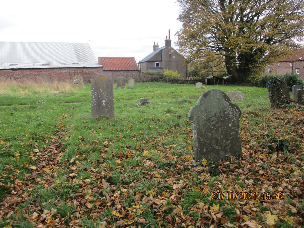
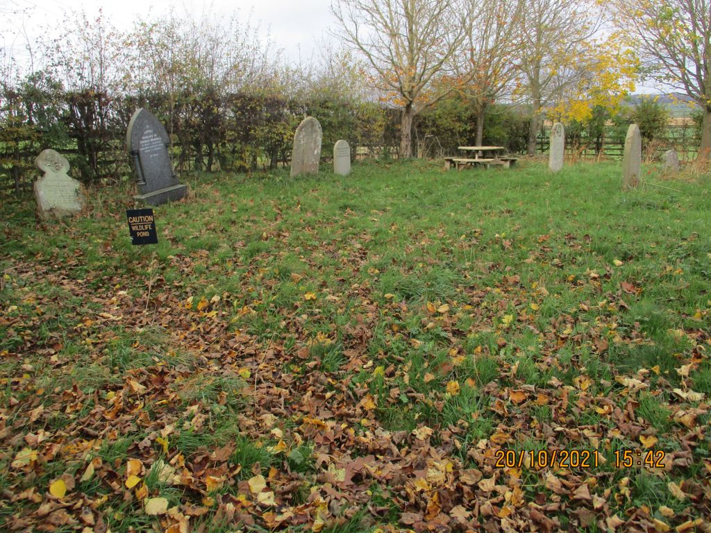
| Memorials | : | 232 |
| Location | : | Marton-on-the Forest, Hambleton District, England |
| Coordinate | : | 54.1064900, -1.0807800 |
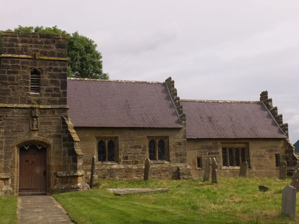
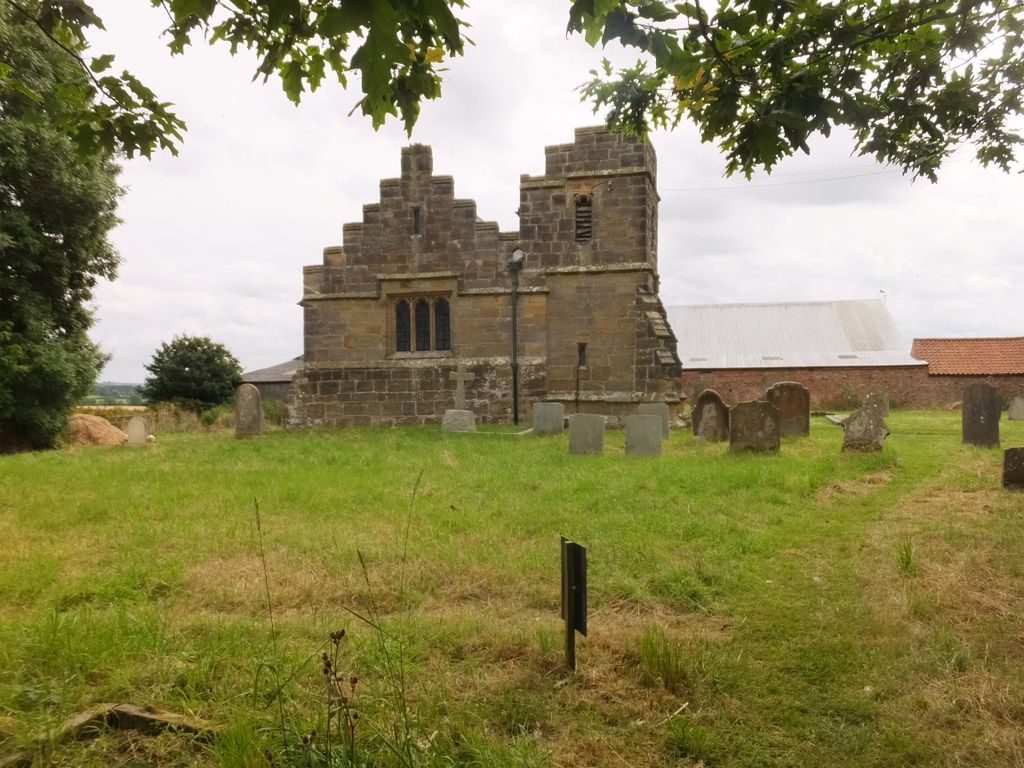
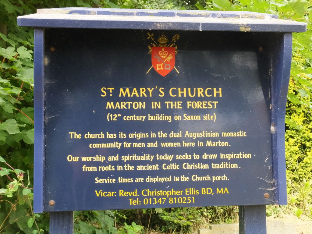
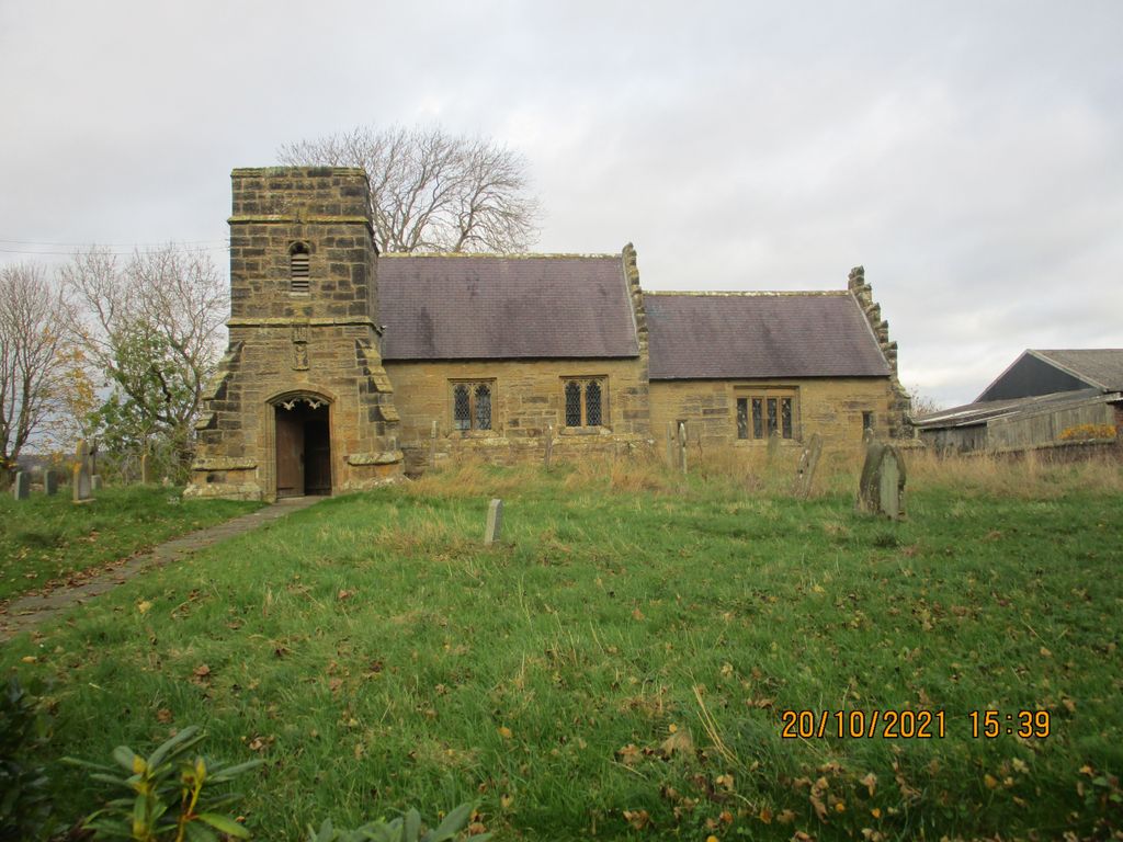
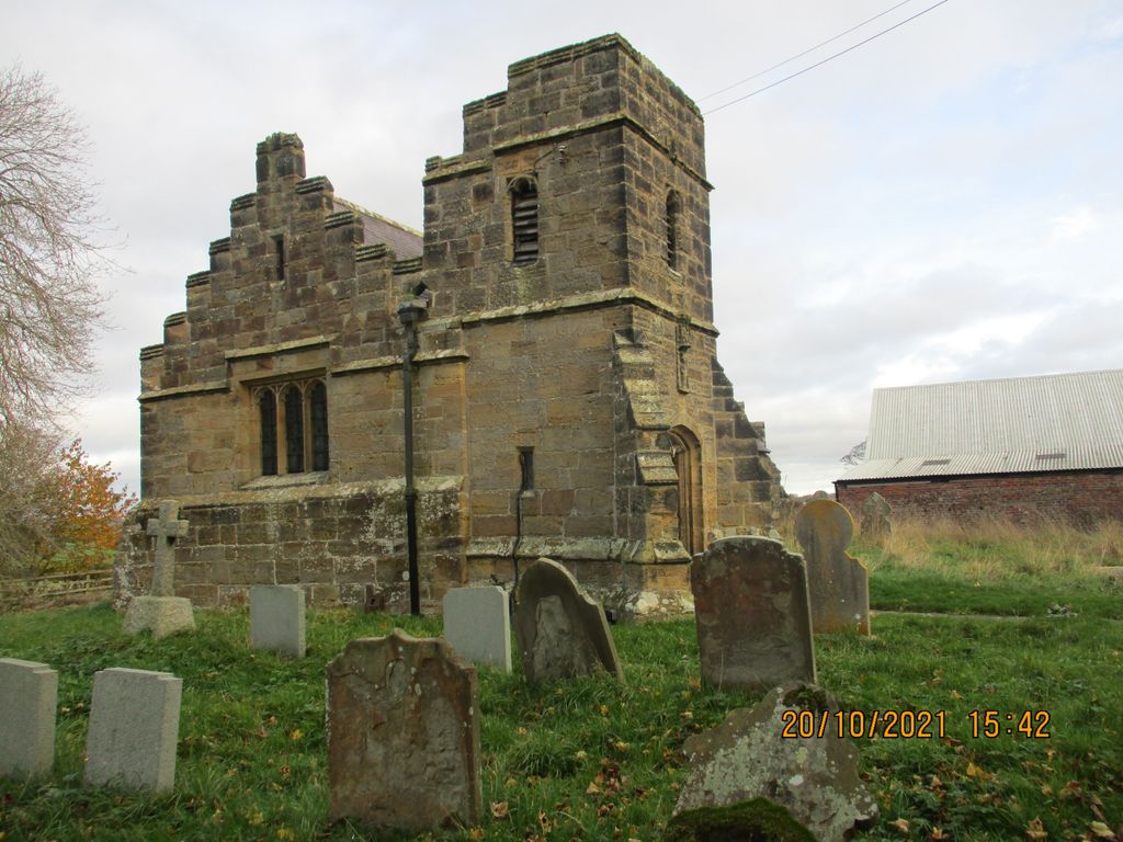
| Description | : | The parish is historically known as Marton cum Moxby. The parish burial register (1539-1990) has been deposited with the Borthwick Institute for Archives, University of York, Heslington, York, YO10 5DD. Portions of the church building date from the 12th century, although most represents a 16th century reconstruction. A separate Augustinian convent dedicated to St Mary and founded in the 12th century by the High Sherriff of Yorkshire Bertram de Bulmer was also present in the vicinity of Marton-on-the-Forest. However, little remains with certainty to mark the location of the convent. |
frequently asked questions (FAQ):
-
Where is St Mary Churchyard?
St Mary Churchyard is located at Marton-on-the Forest, Hambleton District ,North Yorkshire ,England.
-
St Mary Churchyard cemetery's updated grave count on graveviews.com?
232 memorials
-
Where are the coordinates of the St Mary Churchyard?
Latitude: 54.1064900
Longitude: -1.0807800
Nearby Cemetories:
1. St Leonard Churchyard
Farlington, Hambleton District, England
Coordinate: 54.0999600, -1.0614900
2. St. Nicholas Churchyard
Stillington, Hambleton District, England
Coordinate: 54.1029710, -1.1098920
3. St Martin Churchyard
Whenby, Hambleton District, England
Coordinate: 54.1202600, -1.0363700
4. All Saints Churchyard
Brandsby, Hambleton District, England
Coordinate: 54.1397200, -1.0853500
5. All Hallows Churchyard
Sutton-on-the-Forest, Hambleton District, England
Coordinate: 54.0746800, -1.1103500
6. All Hallows Churchyard Extension Cemetery
Sutton-on-the-Forest, Hambleton District, England
Coordinate: 54.0757200, -1.1188700
7. St Peter Churchyard
Dalby, Hambleton District, England
Coordinate: 54.1329290, -1.0262920
8. St Cuthbert Churchyard
Crayke, Hambleton District, England
Coordinate: 54.1285740, -1.1441370
9. St Helen and the Holy Cross Churchyard
Sheriff Hutton, Ryedale District, England
Coordinate: 54.0882280, -0.9965280
10. Holy Trinity Churchyard
Yearsley, Hambleton District, England
Coordinate: 54.1619100, -1.1052300
11. St George the Martyr Churchyard
Scackleton, Ryedale District, England
Coordinate: 54.1457520, -1.0066750
12. Terrington Burial Ground
Terrington, Ryedale District, England
Coordinate: 54.1231640, -0.9717280
13. All Saints Churchyard
Terrington, Ryedale District, England
Coordinate: 54.1282770, -0.9735330
14. St John the Baptist and All Saints Churchyard
Easingwold, Hambleton District, England
Coordinate: 54.1235320, -1.1973170
15. St Mary the Virgin Churchyard
Strensall, York Unitary Authority, England
Coordinate: 54.0389130, -1.0394910
16. Holy Cross Churchyard
Gilling East, Ryedale District, England
Coordinate: 54.1841290, -1.0580460
17. Gilling New Churchyard
Gilling East, Ryedale District, England
Coordinate: 54.1856070, -1.0559535
18. Haxby and Wigginton Cemetery
Haxby, York Unitary Authority, England
Coordinate: 54.0219200, -1.0808600
19. Moorlands Nature Reserve
Skelton, York Unitary Authority, England
Coordinate: 54.0226680, -1.1201180
20. St Martin Churchyard
Bulmer, Ryedale District, England
Coordinate: 54.0997510, -0.9317700
21. Wigginton Garden of Rest
Wigginton, York Unitary Authority, England
Coordinate: 54.0183970, -1.0851200
22. St. Nicholas' Churchyard
Wigginton, York Unitary Authority, England
Coordinate: 54.0182590, -1.0850720
23. All Saints Churchyard
Hovingham, Ryedale District, England
Coordinate: 54.1728980, -0.9801260
24. St Lawrence Churchyard
Flaxton, Ryedale District, England
Coordinate: 54.0508680, -0.9624500