
| Memorials | : | 134 |
| Location | : | Sutton-on-the-Forest, Hambleton District, England |
| Coordinate | : | 54.0757200, -1.1188700 |
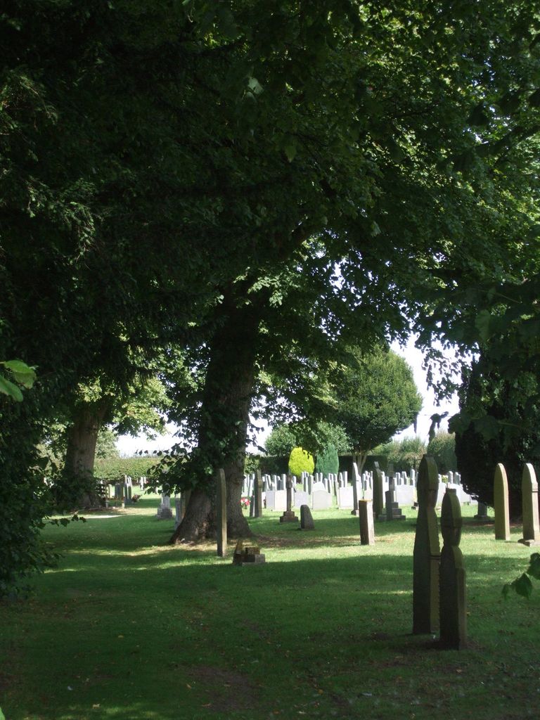
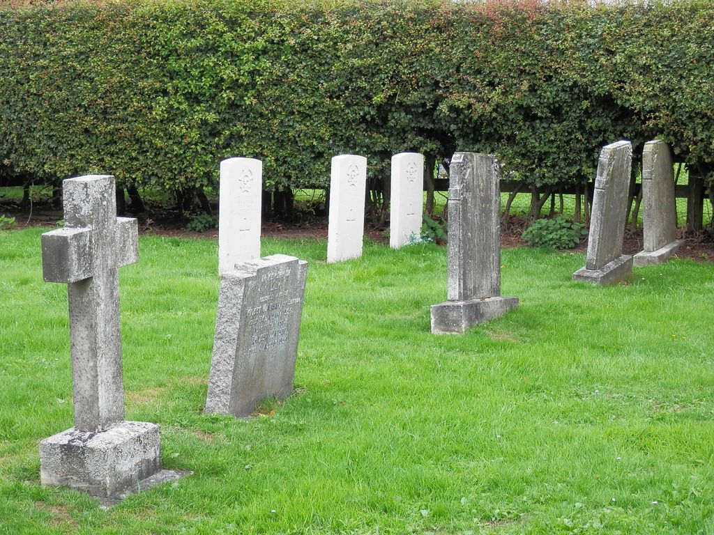
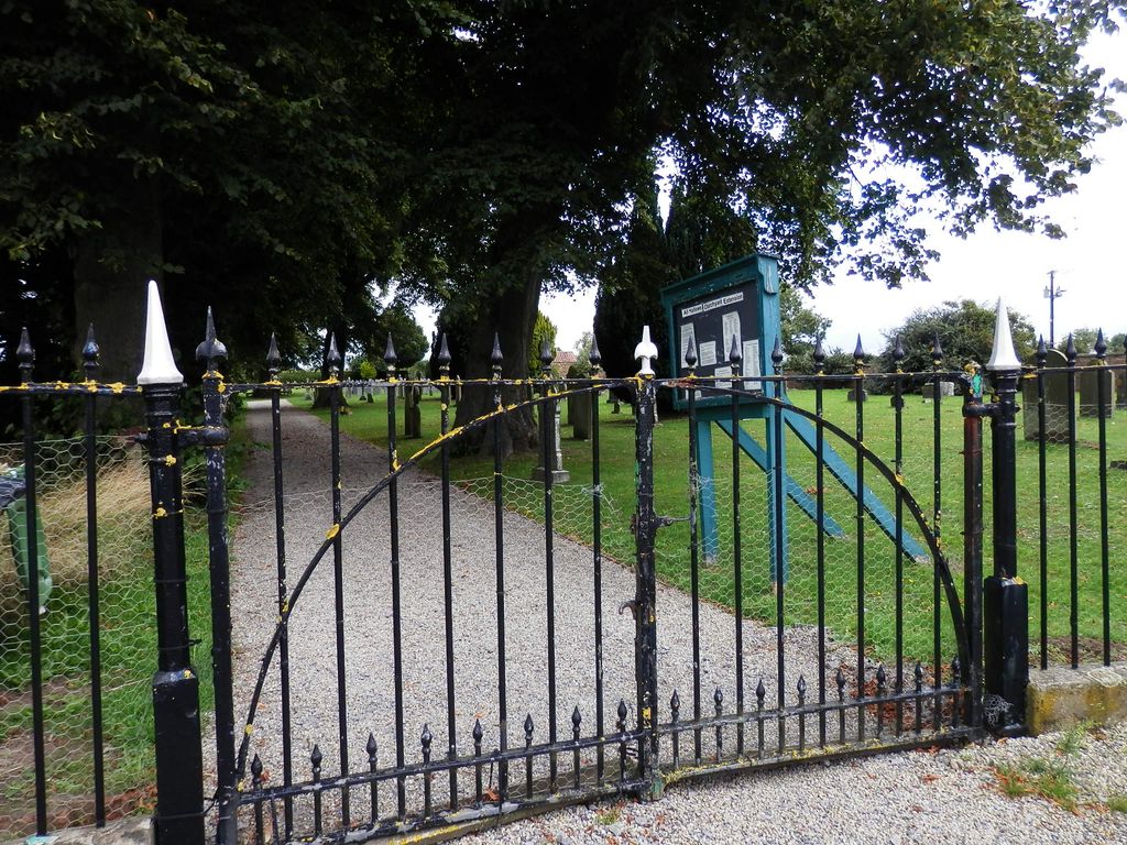
| Description | : | This cemetery was established as an extension to the original All Saints Churchyard that is located within the village of Sutton-on-the-Forest. Land for the cemetery was donated by Hon. A. Duncombe when the churchyard was closed in 1866. In addition to the local parishioners, the cemetery contains the graves of Polish refugees who lived at East Moor Camp immediately after the Second World War, and the graves of three Canadian airmen who died during that conflict. |
frequently asked questions (FAQ):
-
Where is All Hallows Churchyard Extension Cemetery?
All Hallows Churchyard Extension Cemetery is located at Huby Road Sutton-on-the-Forest, Hambleton District ,North Yorkshire , YO61 1DYEngland.
-
All Hallows Churchyard Extension Cemetery cemetery's updated grave count on graveviews.com?
134 memorials
-
Where are the coordinates of the All Hallows Churchyard Extension Cemetery?
Latitude: 54.0757200
Longitude: -1.1188700
Nearby Cemetories:
1. All Hallows Churchyard
Sutton-on-the-Forest, Hambleton District, England
Coordinate: 54.0746800, -1.1103500
2. St. Nicholas Churchyard
Stillington, Hambleton District, England
Coordinate: 54.1029710, -1.1098920
3. St Mary Churchyard
Marton-on-the Forest, Hambleton District, England
Coordinate: 54.1064900, -1.0807800
4. St Leonard Churchyard
Farlington, Hambleton District, England
Coordinate: 54.0999600, -1.0614900
5. Moorlands Nature Reserve
Skelton, York Unitary Authority, England
Coordinate: 54.0226680, -1.1201180
6. St Cuthbert Churchyard
Crayke, Hambleton District, England
Coordinate: 54.1285740, -1.1441370
7. Holy Evangelists Churchyard
Shipton, Hambleton District, England
Coordinate: 54.0234400, -1.1572300
8. Haxby and Wigginton Cemetery
Haxby, York Unitary Authority, England
Coordinate: 54.0219200, -1.0808600
9. St Mary the Virgin Churchyard
Strensall, York Unitary Authority, England
Coordinate: 54.0389130, -1.0394910
10. Wigginton Garden of Rest
Wigginton, York Unitary Authority, England
Coordinate: 54.0183970, -1.0851200
11. St. Nicholas' Churchyard
Wigginton, York Unitary Authority, England
Coordinate: 54.0182590, -1.0850720
12. St Mary Churchyard
Haxby, York Unitary Authority, England
Coordinate: 54.0167790, -1.0754230
13. St Martin Churchyard
Whenby, Hambleton District, England
Coordinate: 54.1202600, -1.0363700
14. St John the Baptist and All Saints Churchyard
Easingwold, Hambleton District, England
Coordinate: 54.1235320, -1.1973170
15. All Saints Churchyard
Brandsby, Hambleton District, England
Coordinate: 54.1397200, -1.0853500
16. Skelton Parish Council Cemetery
Skelton, York Unitary Authority, England
Coordinate: 54.0070970, -1.1150970
17. St Helen and the Holy Cross Churchyard
Sheriff Hutton, Ryedale District, England
Coordinate: 54.0882280, -0.9965280
18. St Mary Churchyard
Alne, Hambleton District, England
Coordinate: 54.0814400, -1.2438800
19. All Saints Churchyard
Newton-on-Ouse, Hambleton District, England
Coordinate: 54.0324800, -1.2210800
20. St. Giles' Churchyard
Skelton, York Unitary Authority, England
Coordinate: 54.0019111, -1.1342660
21. St Peter Churchyard
Dalby, Hambleton District, England
Coordinate: 54.1329290, -1.0262920
22. All Saints Churchyard
Huntington, York Unitary Authority, England
Coordinate: 53.9977460, -1.0633490
23. St Mary Priory Churchyard
Nun Monkton, Harrogate Borough, England
Coordinate: 54.0149100, -1.2212150
24. Holy Trinity Churchyard
Yearsley, Hambleton District, England
Coordinate: 54.1619100, -1.1052300