
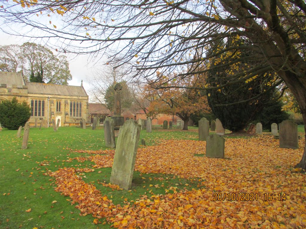
| Memorials | : | 68 |
| Location | : | Sutton-on-the-Forest, Hambleton District, England |
| Coordinate | : | 54.0746800, -1.1103500 |
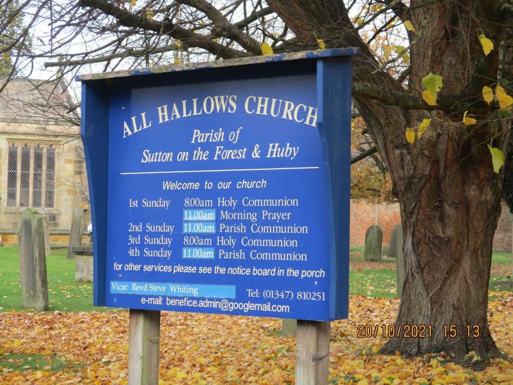
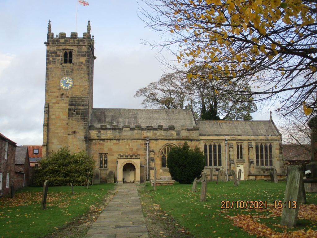
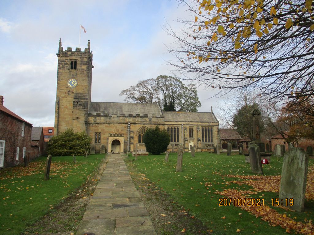
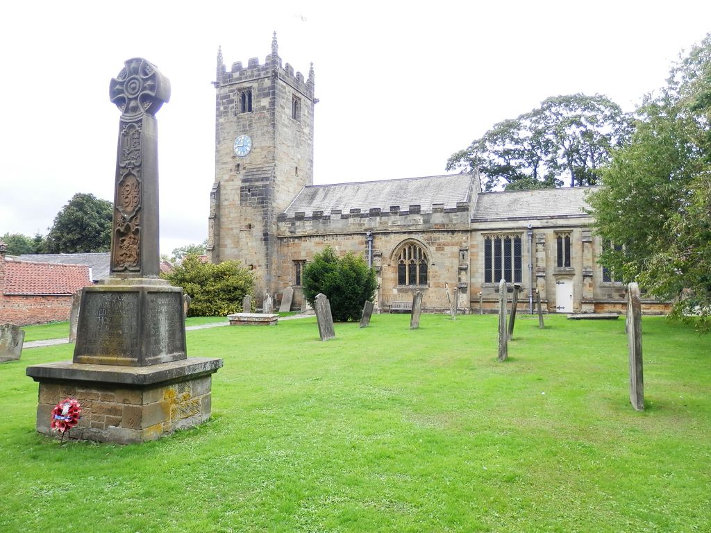
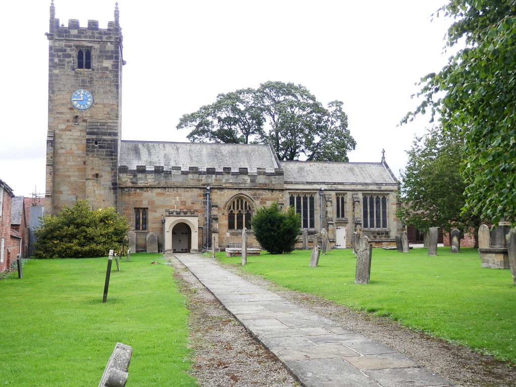
| Description | : | Burial registers for Sutton-on-the-Forest parish date from 1557 and have been deposited with the Borthwick Institute for Archives, University of York, Heslington, York, YO10 5DD. The churchyard was closed to burials in 1866. More recent burials take place in the All Saints Churchyard Extension Cemetery located just west of the village on Huby Road. |
frequently asked questions (FAQ):
-
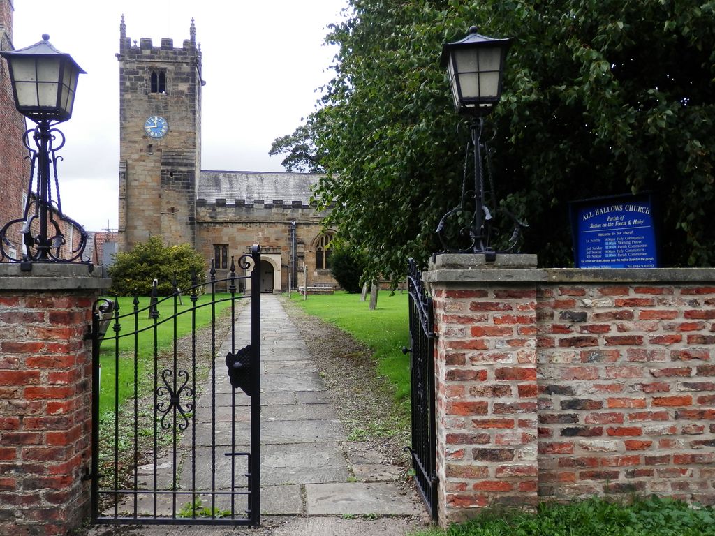
Where is All Hallows Churchyard?
All Hallows Churchyard is located at Main Street Sutton-on-the-Forest, Hambleton District ,North Yorkshire , YO61 1DREngland.
-
All Hallows Churchyard cemetery's updated grave count on graveviews.com?
68 memorials
-
Where are the coordinates of the All Hallows Churchyard?
Latitude: 54.0746800
Longitude: -1.1103500
Nearby Cemetories:
1. All Hallows Churchyard Extension Cemetery
Sutton-on-the-Forest, Hambleton District, England
Coordinate: 54.0757200, -1.1188700
2. St. Nicholas Churchyard
Stillington, Hambleton District, England
Coordinate: 54.1029710, -1.1098920
3. St Mary Churchyard
Marton-on-the Forest, Hambleton District, England
Coordinate: 54.1064900, -1.0807800
4. St Leonard Churchyard
Farlington, Hambleton District, England
Coordinate: 54.0999600, -1.0614900
5. Moorlands Nature Reserve
Skelton, York Unitary Authority, England
Coordinate: 54.0226680, -1.1201180
6. St Mary the Virgin Churchyard
Strensall, York Unitary Authority, England
Coordinate: 54.0389130, -1.0394910
7. Haxby and Wigginton Cemetery
Haxby, York Unitary Authority, England
Coordinate: 54.0219200, -1.0808600
8. St Cuthbert Churchyard
Crayke, Hambleton District, England
Coordinate: 54.1285740, -1.1441370
9. Holy Evangelists Churchyard
Shipton, Hambleton District, England
Coordinate: 54.0234400, -1.1572300
10. Wigginton Garden of Rest
Wigginton, York Unitary Authority, England
Coordinate: 54.0183970, -1.0851200
11. St. Nicholas' Churchyard
Wigginton, York Unitary Authority, England
Coordinate: 54.0182590, -1.0850720
12. St Mary Churchyard
Haxby, York Unitary Authority, England
Coordinate: 54.0167790, -1.0754230
13. St Martin Churchyard
Whenby, Hambleton District, England
Coordinate: 54.1202600, -1.0363700
14. All Saints Churchyard
Brandsby, Hambleton District, England
Coordinate: 54.1397200, -1.0853500
15. Skelton Parish Council Cemetery
Skelton, York Unitary Authority, England
Coordinate: 54.0070970, -1.1150970
16. St Helen and the Holy Cross Churchyard
Sheriff Hutton, Ryedale District, England
Coordinate: 54.0882280, -0.9965280
17. St John the Baptist and All Saints Churchyard
Easingwold, Hambleton District, England
Coordinate: 54.1235320, -1.1973170
18. St. Giles' Churchyard
Skelton, York Unitary Authority, England
Coordinate: 54.0019111, -1.1342660
19. St Peter Churchyard
Dalby, Hambleton District, England
Coordinate: 54.1329290, -1.0262920
20. All Saints Churchyard
Newton-on-Ouse, Hambleton District, England
Coordinate: 54.0324800, -1.2210800
21. St Mary Churchyard
Alne, Hambleton District, England
Coordinate: 54.0814400, -1.2438800
22. All Saints Churchyard
Huntington, York Unitary Authority, England
Coordinate: 53.9977460, -1.0633490
23. Holy Trinity Churchyard
Yearsley, Hambleton District, England
Coordinate: 54.1619100, -1.1052300
24. St Everilda Churchyard
Nether Poppleton, York Unitary Authority, England
Coordinate: 53.9882060, -1.1403710