
| Memorials | : | 0 |
| Location | : | Barkway, North Hertfordshire District, England |
| Coordinate | : | 52.0015793, 0.0129600 |
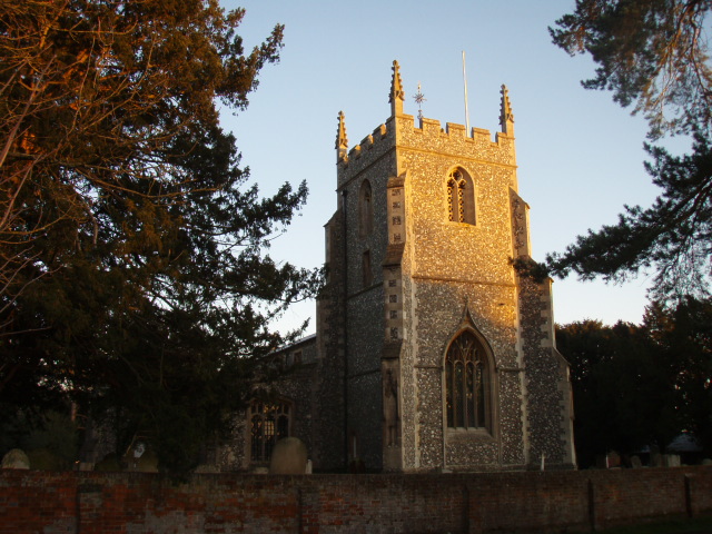
| Description | : | There has been a church here since Norman and possibly since Saxon times. During the 13th century the chancel was rebuilt, and traces of windows from that period are still visible on the north side. In the 15th century the nave was widened, the aisles and clerestory added and the tower rebuilt. The church was largely restored in 1861, when the tower was rebuilt and enlarged. The east window in the south aisle comprises a jumble of glass and includes the remains of a 15th century window, the glass of which... Read More |
frequently asked questions (FAQ):
-
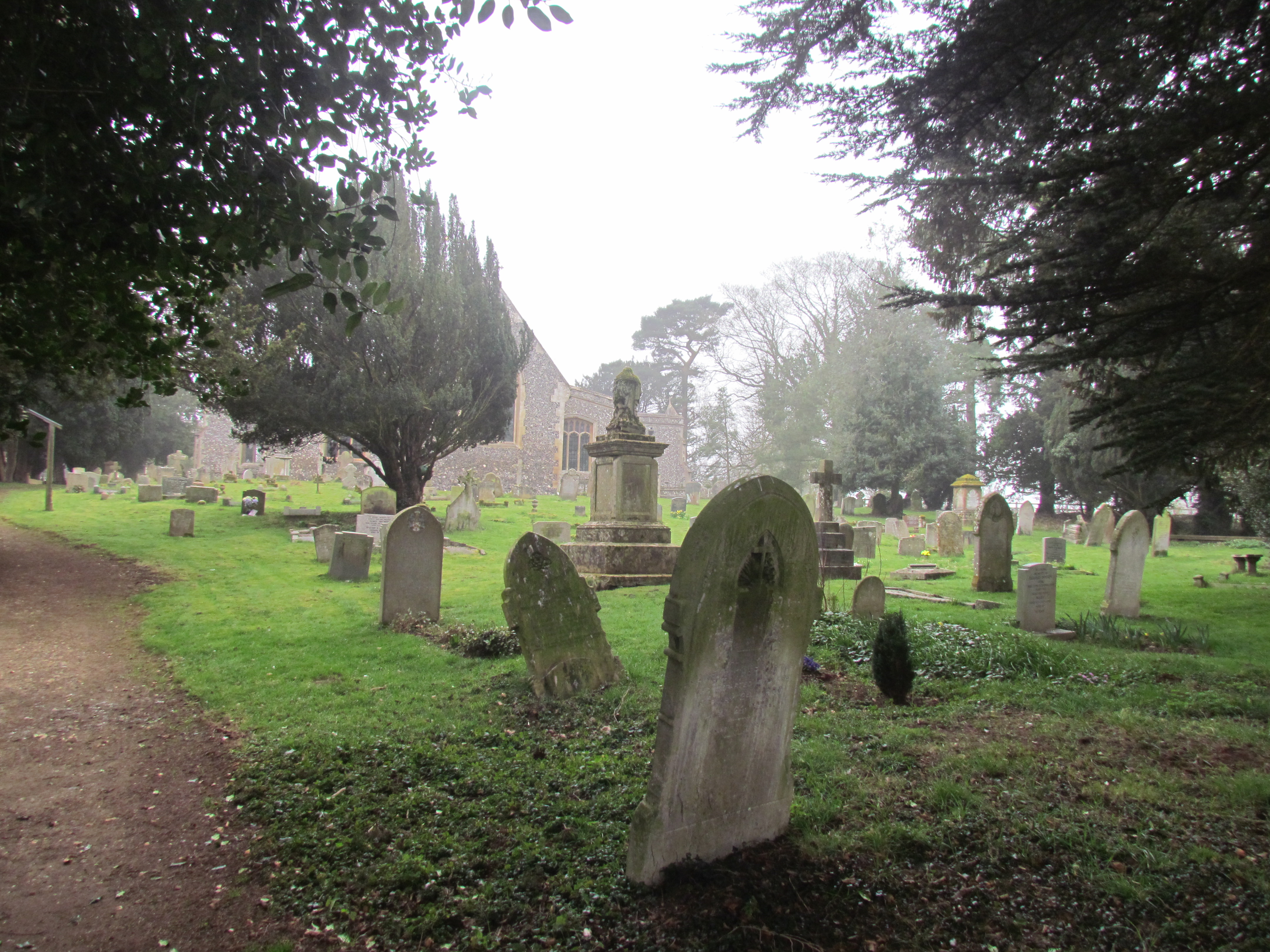
Where is St Mary Magdalene Churchyard?
St Mary Magdalene Churchyard is located at Barkway, North Hertfordshire District ,Hertfordshire , SG8 8EDEngland.
-
St Mary Magdalene Churchyard cemetery's updated grave count on graveviews.com?
0 memorials
-
Where are the coordinates of the St Mary Magdalene Churchyard?
Latitude: 52.0015793
Longitude: 0.0129600
Nearby Cemetories:
1. Barkway Chapel Cemetery
Barkway, North Hertfordshire District, England
Coordinate: 52.0047910, 0.0151040
2. St Mary Churchyard
Reed, North Hertfordshire District, England
Coordinate: 52.0034714, -0.0183250
3. St Andrew Churchyard
Buckland, East Hertfordshire District, England
Coordinate: 51.9866510, -0.0230880
4. St. Margaret of Antioch Churchyard
Barley, North Hertfordshire District, England
Coordinate: 52.0264390, 0.0416390
5. St George Churchyard
Anstey, East Hertfordshire District, England
Coordinate: 51.9766990, 0.0431300
6. St Nicholas Churchyard
Little Chishill, South Cambridgeshire District, England
Coordinate: 52.0154690, 0.0654890
7. St Giles Churchyard
Wyddial, East Hertfordshire District, England
Coordinate: 51.9673270, -0.0010730
8. St Mary the Virgin Churchyard
Therfield, North Hertfordshire District, England
Coordinate: 52.0162060, -0.0568230
9. St Swithin Churchyard
Great Chishill, South Cambridgeshire District, England
Coordinate: 52.0300090, 0.0715990
10. St Faiths Churchyard
Kelshall, North Hertfordshire District, England
Coordinate: 52.0084230, -0.0656070
11. St Bartholomew's Church Churchyard
Buntingford, East Hertfordshire District, England
Coordinate: 51.9525530, -0.0089720
12. St John the Baptist Churchyard
Royston, North Hertfordshire District, England
Coordinate: 52.0478410, -0.0218200
13. Hare Street Benson Grounds
Buntingford, East Hertfordshire District, England
Coordinate: 51.9492640, 0.0221120
14. St. John The Evangelist Churchyard
Langley, Uttlesford District, England
Coordinate: 51.9969356, 0.0995640
15. Royston Cemetery
Royston, North Hertfordshire District, England
Coordinate: 52.0522860, -0.0190440
16. All Saints Churchyard
Sandon, North Hertfordshire District, England
Coordinate: 51.9934160, -0.0756170
17. Great Hormead St Nicholas Churchyard
Hormead, East Hertfordshire District, England
Coordinate: 51.9469500, 0.0353300
18. Saint Mary Churchyard
Meesden, East Hertfordshire District, England
Coordinate: 51.9728000, 0.0934270
19. Holy Trinity Churchyard
Heydon, South Cambridgeshire District, England
Coordinate: 52.0399400, 0.0868500
20. Little Hormead St Mary Churchyard
Hormead, East Hertfordshire District, England
Coordinate: 51.9428430, 0.0331630
21. Holy Trinity Churchyard
Buntingford, East Hertfordshire District, England
Coordinate: 51.9540854, -0.0541753
22. Holy Trinity Churchyard
Chrishall, Uttlesford District, England
Coordinate: 52.0276500, 0.1139577
23. The Hamlet Church Cemetery
Duddenhoe End, Uttlesford District, England
Coordinate: 52.0145269, 0.1285385
24. St. Mary the Virgin-Westmill
St Albans, St Albans District, England
Coordinate: 51.9262000, -0.0098000