
| Memorials | : | 0 |
| Location | : | Little Chishill, South Cambridgeshire District, England |
| Coordinate | : | 52.0154690, 0.0654890 |
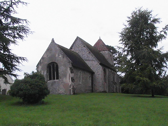
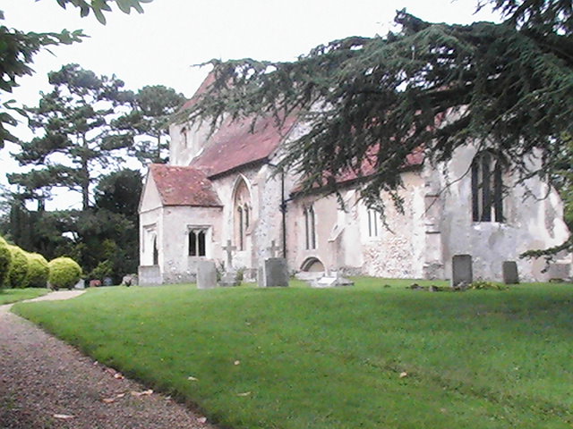
| Description | : | LITTLE CHISHALL, 8 miles West of Saffron Walden, has in its parish only 96 souls, and 1167A.1R.37P. of land, having a hilly and well wooded surface. In the 14th century, it was held by the Argentine family, and afterwards by the Ufford, Effield, Boteler, and Ayllif families. Since 1684, it has been the property of the Soame family, formerly seated in the adjacent parish of Haydon, but Sir Peter Buckworth-Herne Soame, Bart., the present lord of the manor, and owner of most of the parish, resides here in a neat modern house called To Ho Cottage, and at Thorndon... Read More |
frequently asked questions (FAQ):
-
Where is St Nicholas Churchyard?
St Nicholas Churchyard is located at Little Chishill, South Cambridgeshire District ,Cambridgeshire ,England.
-
St Nicholas Churchyard cemetery's updated grave count on graveviews.com?
0 memorials
-
Where are the coordinates of the St Nicholas Churchyard?
Latitude: 52.0154690
Longitude: 0.0654890
Nearby Cemetories:
1. St Swithin Churchyard
Great Chishill, South Cambridgeshire District, England
Coordinate: 52.0300090, 0.0715990
2. St. Margaret of Antioch Churchyard
Barley, North Hertfordshire District, England
Coordinate: 52.0264390, 0.0416390
3. Holy Trinity Churchyard
Heydon, South Cambridgeshire District, England
Coordinate: 52.0399400, 0.0868500
4. St. John The Evangelist Churchyard
Langley, Uttlesford District, England
Coordinate: 51.9969356, 0.0995640
5. Holy Trinity Churchyard
Chrishall, Uttlesford District, England
Coordinate: 52.0276500, 0.1139577
6. Barkway Chapel Cemetery
Barkway, North Hertfordshire District, England
Coordinate: 52.0047910, 0.0151040
7. St Mary Magdalene Churchyard
Barkway, North Hertfordshire District, England
Coordinate: 52.0015793, 0.0129600
8. The Hamlet Church Cemetery
Duddenhoe End, Uttlesford District, England
Coordinate: 52.0145269, 0.1285385
9. St George Churchyard
Anstey, East Hertfordshire District, England
Coordinate: 51.9766990, 0.0431300
10. St. Nicholas Churchyard
Elmdon, Uttlesford District, England
Coordinate: 52.0359900, 0.1294000
11. Saint Mary Churchyard
Meesden, East Hertfordshire District, England
Coordinate: 51.9728000, 0.0934270
12. St Mary Churchyard
Reed, North Hertfordshire District, England
Coordinate: 52.0034714, -0.0183250
13. St Andrew Churchyard
Buckland, East Hertfordshire District, England
Coordinate: 51.9866510, -0.0230880
14. St Margaret Churchyard
Arkesden, Uttlesford District, England
Coordinate: 51.9897000, 0.1571200
15. St John the Baptist Churchyard
Royston, North Hertfordshire District, England
Coordinate: 52.0478410, -0.0218200
16. St Giles Churchyard
Wyddial, East Hertfordshire District, England
Coordinate: 51.9673270, -0.0010730
17. Royston Cemetery
Royston, North Hertfordshire District, England
Coordinate: 52.0522860, -0.0190440
18. Ss Mary and Clement Churchyard
Clavering, Uttlesford District, England
Coordinate: 51.9653720, 0.1393760
19. Great Hormead St Nicholas Churchyard
Hormead, East Hertfordshire District, England
Coordinate: 51.9469500, 0.0353300
20. Hare Street Benson Grounds
Buntingford, East Hertfordshire District, England
Coordinate: 51.9492640, 0.0221120
21. Melbourn United Reformed Churchyard
Melbourn, South Cambridgeshire District, England
Coordinate: 52.0811610, 0.0165870
22. Melbourn Burial Ground
Melbourn, South Cambridgeshire District, England
Coordinate: 52.0834230, 0.0202940
23. Fowlmere United Reformed Churchyard
Fowlmere, South Cambridgeshire District, England
Coordinate: 52.0902000, 0.0734000
24. St Mary the Virgin Churchyard
Therfield, North Hertfordshire District, England
Coordinate: 52.0162060, -0.0568230