
| Memorials | : | 2 |
| Location | : | Barnwood, City of Gloucester, England |
| Coordinate | : | 51.8580470, -2.2069750 |
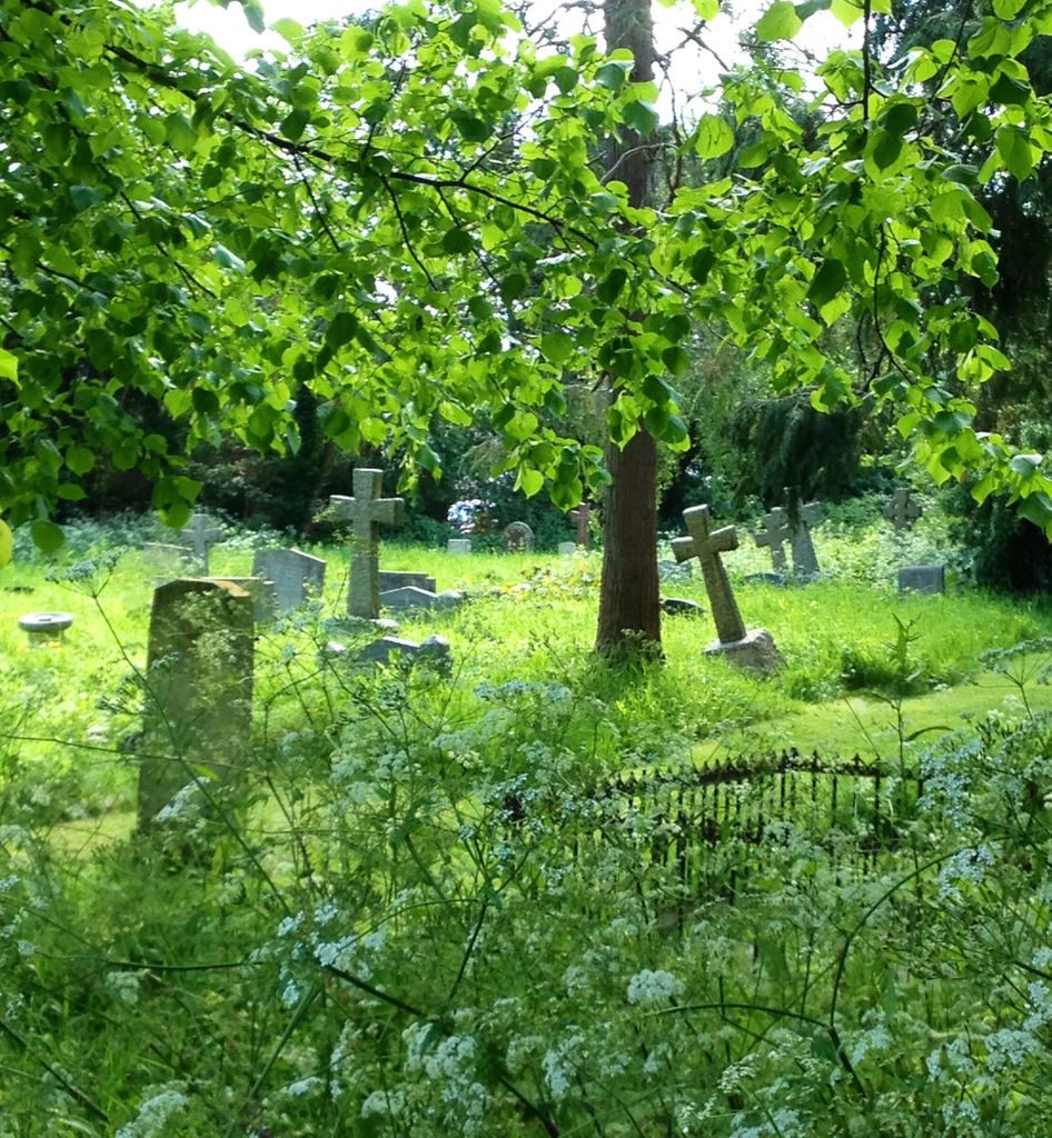
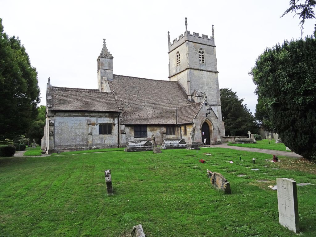
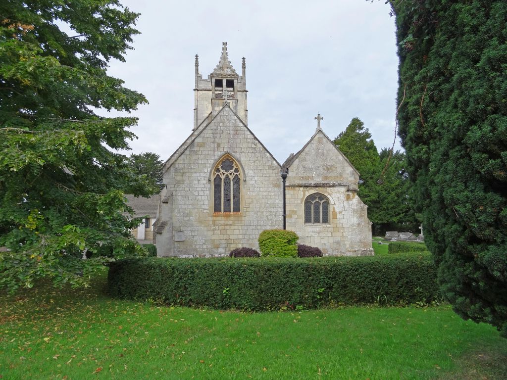
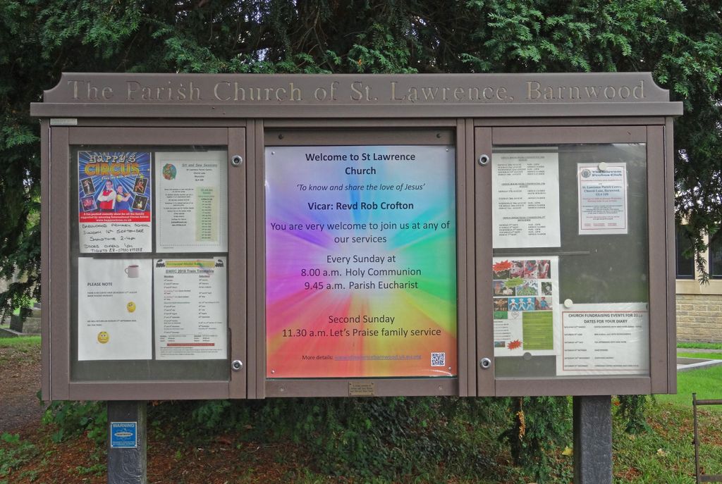
| Description | : | Barnwood, in Gloucestershire, England is on the old Roman road that links the City of Gloucester with Hucclecote, Brockworth and Cirencester. Barnwood was originally a small village. The Church of England parish church of St Lawrence, about two miles east of the city centre of Gloucester, is known for The Barnwood Guild of Church Bellringers, inaugurated in 1952. However, bell ringing has a long history in the Gloucester area and Barnwood had long been a part of it when its activities were disrupted by World War II. |
frequently asked questions (FAQ):
-
Where is St Lawrence Churchyard?
St Lawrence Churchyard is located at 32 Church Lane Barnwood, City of Gloucester ,Gloucestershire , GL4 3JBEngland.
-
St Lawrence Churchyard cemetery's updated grave count on graveviews.com?
1 memorials
-
Where are the coordinates of the St Lawrence Churchyard?
Latitude: 51.8580470
Longitude: -2.2069750
Nearby Cemetories:
1. Gloucester Crematorium
Gloucester, City of Gloucester, England
Coordinate: 51.8538180, -2.2219260
2. Ss Philip and James Churchyard
Hucclecote, Tewkesbury Borough, England
Coordinate: 51.8573040, -2.1876440
3. Horton Road Cemetery
Gloucester, City of Gloucester, England
Coordinate: 51.8666900, -2.2268300
4. Gloucester Old Cemetery
Gloucester, City of Gloucester, England
Coordinate: 51.8482100, -2.2276700
5. Saint Catharine's
Gloucester, City of Gloucester, England
Coordinate: 51.8691700, -2.2273500
6. Chapel of St Mary Magdalen
Gloucester, City of Gloucester, England
Coordinate: 51.8693000, -2.2291000
7. St Margaret's Chapel
Gloucester, City of Gloucester, England
Coordinate: 51.8686720, -2.2321530
8. Gloucester Cathedral
Gloucester, City of Gloucester, England
Coordinate: 51.8675920, -2.2467670
9. Saint Oswald's Priory
Gloucester, City of Gloucester, England
Coordinate: 51.8694000, -2.2478000
10. St Nicholas' Church
Gloucester, City of Gloucester, England
Coordinate: 51.8672800, -2.2496760
11. St George Churchyard
Brockworth, Tewkesbury Borough, England
Coordinate: 51.8517460, -2.1598180
12. Llanthony Secunda Priory
Hempsted, City of Gloucester, England
Coordinate: 51.8602130, -2.2572640
13. St. Matthew's Cemetery
Twigworth, Tewkesbury Borough, England
Coordinate: 51.8936090, -2.2307820
14. Prinknash Abbey
Cranham, Stroud District, England
Coordinate: 51.8225000, -2.1761110
15. St. Swithun's Churchyard
Hempsted, City of Gloucester, England
Coordinate: 51.8515740, -2.2719420
16. Holy Trinity Churchyard
Badgeworth, Tewkesbury Borough, England
Coordinate: 51.8715360, -2.1444640
17. St Margaret Church
Whaddon, Stroud District, England
Coordinate: 51.8214600, -2.2433000
18. St. Peter's Churchyard
Bentham, Tewkesbury Borough, England
Coordinate: 51.8436420, -2.1249330
19. St. Giles Churchyard
Maisemore, Tewkesbury Borough, England
Coordinate: 51.8931690, -2.2719540
20. St. Swithun Churchyard
Brookthorpe, Stroud District, England
Coordinate: 51.8087500, -2.2402900
21. Church of St. Mary
Great Witcombe, Tewkesbury Borough, England
Coordinate: 51.8316950, -2.1311090
22. St. James the Great Churchyard
Cranham, Stroud District, England
Coordinate: 51.8102797, -2.1596329
23. St. James' Churchyard
Quedgeley, City of Gloucester, England
Coordinate: 51.8257770, -2.2811150
24. St Lawrence Churchyard
Sandhurst, Tewkesbury Borough, England
Coordinate: 51.9083260, -2.2489570