Carrie Zoppi
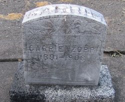
| Birth | : | 3 Apr 1891 Olema, Marin County, California, USA |
| Death | : | 24 May 1908 Eldridge, Sonoma County, California, USA |
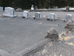
| Burial | : | Olema Cemetery, Olema, Marin County, USA |
| Coordinate | : | 38.0313988, -122.7789001 |
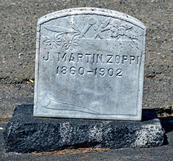
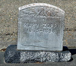
| Description | : | Carrie's mother died when she was six. Her father died when she was 11. Carrie and four siblings were entrusted to J. Codini, business partner of her father, for guardianship. Carrie was admitted to the Institution for Feeble-Minded, Eldridge on May 11, 1908. The poor girl was physically sick, but considered an "imbecile." She became ill with temperature up to 108.5 and died in coma at 1:30 am. Diagnosis was Leptomeningitis. Carrie was 17 years, 1 month and 21 days. |
frequently asked questions (FAQ):
-
Where is Carrie Zoppi's memorial?
Carrie Zoppi's memorial is located at: Olema Cemetery, Olema, Marin County, USA.
-
When did Carrie Zoppi death?
Carrie Zoppi death on 24 May 1908 in Eldridge, Sonoma County, California, USA
-
Where are the coordinates of the Carrie Zoppi's memorial?
Latitude: 38.0313988
Longitude: -122.7789001
Family Members:
Parent
Siblings
Flowers:
Nearby Cemetories:
1. Olema Cemetery
Olema, Marin County, USA
Coordinate: 38.0313988, -122.7789001
2. Taylor Cemetery
Lagunitas, Marin County, USA
Coordinate: 38.0272580, -122.7346590
3. Saint Columbas Church Cemetery
Inverness, Marin County, USA
Coordinate: 38.0998250, -122.8576210
4. Bolinas Cemetery
Bolinas, Marin County, USA
Coordinate: 37.9212600, -122.6938900
5. Saint Mary Magdalene Catholic Church Cemetery
Bolinas, Marin County, USA
Coordinate: 37.9212570, -122.6938858
6. Historic Life-Saving Service and G Ranch Cemetery
Point Reyes Station, Marin County, USA
Coordinate: 38.0933000, -122.9311300
7. Miwok Cemetery
Reynolds, Marin County, USA
Coordinate: 38.1491420, -122.8852400
8. Marin County Farm Cemetery
Marin County, USA
Coordinate: 38.0285500, -122.5652530
9. Pioneer Memorial Cemetery
Novato, Marin County, USA
Coordinate: 38.1132532, -122.5902599
10. First Presbyterian Church Memorial Garden
San Anselmo, Marin County, USA
Coordinate: 37.9703310, -122.5667860
11. Montgomery Memorial Chapel Crypt
San Anselmo, Marin County, USA
Coordinate: 37.9687940, -122.5638630
12. Mount Tamalpais Cemetery
San Rafael, Marin County, USA
Coordinate: 37.9861984, -122.5544891
13. Mount Olivet Catholic Cemetery
San Rafael, Marin County, USA
Coordinate: 38.0024986, -122.5397034
14. Saint Vincents Orphanage Cemetery
San Rafael, Marin County, USA
Coordinate: 38.0355800, -122.5334550
15. Valley Memorial Park
Novato, Marin County, USA
Coordinate: 38.1204300, -122.5436300
16. Mission San Rafael Arcangel Cemetery
San Rafael, Marin County, USA
Coordinate: 37.9744330, -122.5280570
17. Druid Heights Burial Site
Mill Valley, Marin County, USA
Coordinate: 37.8892100, -122.5647100
18. Two Rock Presbyterian Church Cemetery
Two Rock, Sonoma County, USA
Coordinate: 38.2570000, -122.7795029
19. Oak Hill Cemetery
Petaluma, Sonoma County, USA
Coordinate: 38.2365130, -122.6509010
20. Calvary Catholic Cemetery
Petaluma, Sonoma County, USA
Coordinate: 38.2449000, -122.6493400
21. Tomales Presbyterian Cemetery
Tomales, Marin County, USA
Coordinate: 38.2455215, -122.9075089
22. B'nai Israel Cemetery
Petaluma, Sonoma County, USA
Coordinate: 38.2454700, -122.6490000
23. My Pets Cemetery
Petaluma, Sonoma County, USA
Coordinate: 38.2472000, -122.6506000
24. Cypress Hill Memorial Park
Petaluma, Sonoma County, USA
Coordinate: 38.2472000, -122.6505966

