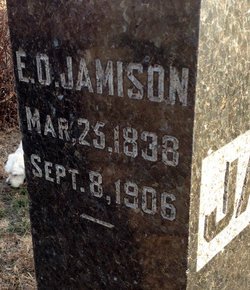
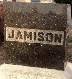
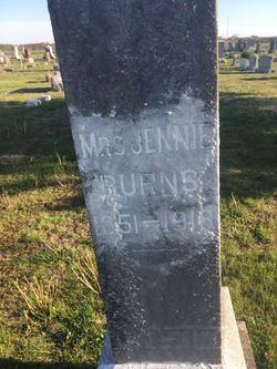
Elizabeth O. Messmore Jamison
| Birth | : | 25 Mar 1838 Uniontown, Fayette County, Pennsylvania, USA |
| Death | : | 8 Sep 1906 Glasco, Cloud County, Kansas, USA |
| Burial | : | Holy Trinity Churchyard, Street, Mendip District, England |
| Coordinate | : | 51.1310100, -2.7330800 |
| Plot | : | 2GE13 |
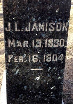
| Description | : | Glasco Sun, Sept. 14, 1906, page 6: Obituary of Mrs. Elizabeth Jamison Another of Our Earliest Settlers Gone --- Followed to the Grave by a Long Concourse of Old and New Friends Elizabeth O. Messmore Jamison was born March 25, 1838, near Uniontown, Fayette county, Pa., and died at the home of her son, C. A. Jamison, in Glasco, September 8, 1906. On October 11, 1860, at Carmichael, Pa., the deceased was married to Josiah L. Jamison. To this union were born seven children -- five sons and two daughters, of which number the sons all survive, the father and two daughters having... Read More |
frequently asked questions (FAQ):
-
Where is Elizabeth O. Messmore Jamison's memorial?
Elizabeth O. Messmore Jamison's memorial is located at: Holy Trinity Churchyard, Street, Mendip District, England.
-
When did Elizabeth O. Messmore Jamison death?
Elizabeth O. Messmore Jamison death on 8 Sep 1906 in Glasco, Cloud County, Kansas, USA
-
Where are the coordinates of the Elizabeth O. Messmore Jamison's memorial?
Latitude: 51.1310100
Longitude: -2.7330800
Family Members:
Parent
Spouse
Siblings
Children
Flowers:
Nearby Cemetories:
1. Holy Trinity Churchyard
Street, Mendip District, England
Coordinate: 51.1310100, -2.7330800
2. Religious Society of Friends Quaker Cemetery
Street, Mendip District, England
Coordinate: 51.1294100, -2.7375630
3. Street Cemetery
Street, Mendip District, England
Coordinate: 51.1302840, -2.7508240
4. St Benedict Churchyard
Glastonbury, Mendip District, England
Coordinate: 51.1465970, -2.7196900
5. Glastonbury Abbey
Glastonbury, Mendip District, England
Coordinate: 51.1464996, -2.7151000
6. Saint John the Baptist Churchyard
Glastonbury, Mendip District, England
Coordinate: 51.1481520, -2.7161400
7. Holy Trinity Churchyard Extension
Walton, Mendip District, England
Coordinate: 51.1234150, -2.7695832
8. Holy Trinity Churchyard
Walton, Mendip District, England
Coordinate: 51.1236200, -2.7709580
9. Glastonbury Cemetery
Glastonbury, Mendip District, England
Coordinate: 51.1565160, -2.7132380
10. St Leonard Churchyard
Butleigh, Mendip District, England
Coordinate: 51.1025800, -2.6868850
11. Saint Andrew Churchyard
Compton Dundon, South Somerset District, England
Coordinate: 51.0897330, -2.7442800
12. All Saint's Churchyard
Ashcott, Sedgemoor District, England
Coordinate: 51.1309220, -2.8058870
13. Holy Trinity Church
Godney, Mendip District, England
Coordinate: 51.1793400, -2.7377400
14. St. Mary & All Saints Churchyard
Meare, Mendip District, England
Coordinate: 51.1715900, -2.7804100
15. St. Dunstan Churchyard
Baltonsborough, Mendip District, England
Coordinate: 51.1107200, -2.6557600
16. St Nicholas Churchyard
West Pennard, Mendip District, England
Coordinate: 51.1415596, -2.6413050
17. All Saints Churchyard
Kingweston, South Somerset District, England
Coordinate: 51.0793076, -2.6791489
18. Saint James Churchyard
West Bradley, Mendip District, England
Coordinate: 51.1293030, -2.6332386
19. Blessed Virgin Mary Churchyard
Shapwick, Sedgemoor District, England
Coordinate: 51.1405090, -2.8336100
20. Christ Church
Coxley, Mendip District, England
Coordinate: 51.1869530, -2.6797580
21. St. David's Churchyard
Barton St David, South Somerset District, England
Coordinate: 51.0828220, -2.6585470
22. St. Michael and All Angels Churchyard
Greinton, Sedgemoor District, England
Coordinate: 51.1240140, -2.8408590
23. Coxley Methodist Churchyard
Coxley, Mendip District, England
Coordinate: 51.1918900, -2.6723700
24. Christ Church Churchyard
Henton, Mendip District, England
Coordinate: 51.2056460, -2.7256380

