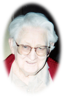
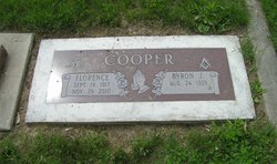
Florence Proell Cooper
| Birth | : | 19 Sep 1917 Dalkena, Pend Oreille County, Washington, USA |
| Death | : | 29 Nov 2010 Colville, Stevens County, Washington, USA |
| Burial | : | St Peter and St Paul Churchyard, Cranfield, Central Bedfordshire Unitary Authority, England |
| Coordinate | : | 52.0679750, -0.6071570 |
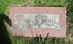
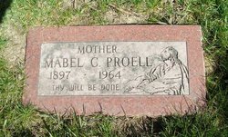
| Description | : | Biography - Read at her funeral Service Florence Cooper, a longtime resident of Kettle Falls passed away on November 29, 2010 in Colville at the age of 93. She was born on September 19, 1917 in Dalkena, WA, the daughter of Frank and Mabel (Hallgreen) Proell. Florence moved as a small child to Enterprise, OR and lived there until she was 16 and moved to the Pingston Creek area of Kettle Falls when she was 16. She met Byron Cooper in 1939, and they carried on a friendship until they were married on April 24, 1953 in Spokane, WA. The couple lived... Read More |
frequently asked questions (FAQ):
-
Where is Florence Proell Cooper's memorial?
Florence Proell Cooper's memorial is located at: St Peter and St Paul Churchyard, Cranfield, Central Bedfordshire Unitary Authority, England.
-
When did Florence Proell Cooper death?
Florence Proell Cooper death on 29 Nov 2010 in Colville, Stevens County, Washington, USA
-
Where are the coordinates of the Florence Proell Cooper's memorial?
Latitude: 52.0679750
Longitude: -0.6071570
Family Members:
Parent
Spouse
Flowers:
Nearby Cemetories:
1. St Peter and St Paul Churchyard
Cranfield, Central Bedfordshire Unitary Authority, England
Coordinate: 52.0679750, -0.6071570
2. Cranfield Cemetery
Cranfield, Central Bedfordshire Unitary Authority, England
Coordinate: 52.0683000, -0.6041200
3. Mount Zion Burial Ground
Cranfield, Central Bedfordshire Unitary Authority, England
Coordinate: 52.0703595, -0.6110791
4. Cranfield Friend's Burial Ground
Cranfield, Central Bedfordshire Unitary Authority, England
Coordinate: 52.0820192, -0.5998549
5. St Nicholas Churchyard
Hulcote, Central Bedfordshire Unitary Authority, England
Coordinate: 52.0399000, -0.6246000
6. St. Mary the Virgin Churchyard
Salford, Central Bedfordshire Unitary Authority, England
Coordinate: 52.0424070, -0.6368910
7. St. Firmin Churchyard
North Crawley, Milton Keynes Borough, England
Coordinate: 52.0924400, -0.6485000
8. St Mary the Virgin Churchyard
Marston Moretaine, Central Bedfordshire Unitary Authority, England
Coordinate: 52.0597750, -0.5484290
9. Assumption of the Blessed Virgin Mary Churchyard
Moulsoe, Milton Keynes Borough, England
Coordinate: 52.0666500, -0.6790070
10. St. Peter's Churchyard
Astwood, Milton Keynes Borough, England
Coordinate: 52.1164390, -0.6135200
11. St Mary the Virgin Churchyard
Wootton, Bedford Borough, England
Coordinate: 52.0948730, -0.5362630
12. St James Churchyard
Husborne Crawley, Central Bedfordshire Unitary Authority, England
Coordinate: 52.0162250, -0.6090110
13. St. Botolph's Churchyard
Aspley Guise, Central Bedfordshire Unitary Authority, England
Coordinate: 52.0166510, -0.6281470
14. Wootton (Lorraine Road) Cemetery
Wootton, Bedford Borough, England
Coordinate: 52.0987769, -0.5351370
15. St. Mary's Churchyard
Hardmead, Milton Keynes Borough, England
Coordinate: 52.1196000, -0.6358000
16. St Lawrence Churchyard
Chicheley, Milton Keynes Borough, England
Coordinate: 52.1037000, -0.6807000
17. St. Lawrence's Churchyard
Broughton, Milton Keynes Borough, England
Coordinate: 52.0522000, -0.6980000
18. St. Mary's Churchyard
Wavendon, Milton Keynes Borough, England
Coordinate: 52.0257000, -0.6730000
19. All Saint's Churchyard
Ridgmont, Central Bedfordshire Unitary Authority, England
Coordinate: 52.0117910, -0.5719780
20. St. Michael and All Angels Churchyard
Millbrook, Central Bedfordshire Unitary Authority, England
Coordinate: 52.0358350, -0.5231810
21. St Marys Roman Catholic Cemetery
Woburn Sands, Milton Keynes Borough, England
Coordinate: 52.0103000, -0.6413000
22. Woburn Sands & Aspley Heath War Memorial
Woburn, Central Bedfordshire Unitary Authority, England
Coordinate: 52.0115470, -0.6473350
23. St. Michael's Churchyard
Woburn Sands, Milton Keynes Borough, England
Coordinate: 52.0087770, -0.6485350
24. Tickford Street Cemetery
Newport Pagnell, Milton Keynes Borough, England
Coordinate: 52.0807670, -0.7121200

