| Birth | : | 2 Aug 1864 Pawnee County, Nebraska, USA |
| Death | : | 23 Aug 1921 Burchard, Pawnee County, Nebraska, USA |
| Burial | : | Cote Baptist Chapel, Cote, West Oxfordshire District, England |
| Coordinate | : | 51.7254430, -1.4929510 |
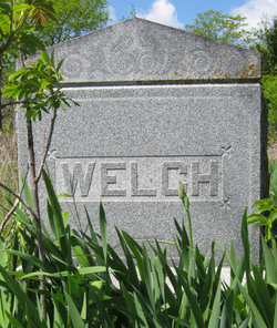
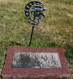
| Description | : | Daughter of George W. & Harriett Jennett Malory Welch. Married to Daniel T. Champenoy in 1884. (Pawnee Library, book of obits in the Pawnee Republican.) FRANCES A. CHAMPENOY Frances Alice Welch was born south of Pawnee City July 2, 1864, and died at the home of her daughter, Mrs. M. E. Milligan, at Burchard August 23, 1921, aged 57 years. She was married to Daniel T. Champenoy. There were two children, Thomas J., Wauneta Jeanette. The early married life was spent at Ionia, Mich. They returned to Pawnee county for a time and in 1896 went to Omaha. When her mother was stricken,... Read More |
frequently asked questions (FAQ):
-
Where is Frances Alice Welch Champenoy's memorial?
Frances Alice Welch Champenoy's memorial is located at: Cote Baptist Chapel, Cote, West Oxfordshire District, England.
-
When did Frances Alice Welch Champenoy death?
Frances Alice Welch Champenoy death on 23 Aug 1921 in Burchard, Pawnee County, Nebraska, USA
-
Where are the coordinates of the Frances Alice Welch Champenoy's memorial?
Latitude: 51.7254430
Longitude: -1.4929510
Family Members:
Parent
Siblings
Children
Flowers:
Nearby Cemetories:
1. Cote Baptist Chapel
Cote, West Oxfordshire District, England
Coordinate: 51.7254430, -1.4929510
2. St. James the Great Churchyard
Aston, West Oxfordshire District, England
Coordinate: 51.7252620, -1.5059510
3. St Marys Churchyard
Shifford, West Oxfordshire District, England
Coordinate: 51.7151440, -1.4631340
4. St. Mary the Virgin Churchyard
Bampton, West Oxfordshire District, England
Coordinate: 51.7278250, -1.5487270
5. Bampton Cemetery
Bampton, West Oxfordshire District, England
Coordinate: 51.7296400, -1.5490200
6. St Margaret of Antioch Churchyard Extension
Hinton Waldrist, Vale of White Horse District, England
Coordinate: 51.6911016, -1.4589705
7. St. Bartholomew Churchyard
Ducklington, West Oxfordshire District, England
Coordinate: 51.7658689, -1.4810340
8. St. Giles' Churchyard
Standlake, West Oxfordshire District, England
Coordinate: 51.7299550, -1.4262300
9. St. Margaret Churchyard
Hinton Waldrist, Vale of White Horse District, England
Coordinate: 51.6894380, -1.4587200
10. Saint Mary Churchyard
Longworth, Vale of White Horse District, England
Coordinate: 51.6926577, -1.4457428
11. St Mary Churchyard
Buckland, Vale of White Horse District, England
Coordinate: 51.6819730, -1.5060150
12. St George Roman Catholic Churchyard
Buckland, Vale of White Horse District, England
Coordinate: 51.6804300, -1.5068720
13. St John The Baptist
Curbridge, West Oxfordshire District, England
Coordinate: 51.7764570, -1.5203140
14. St. Mary's Churchyard
Witney, West Oxfordshire District, England
Coordinate: 51.7807116, -1.4850508
15. Saint Mary's Churchyard
Black Bourton, West Oxfordshire District, England
Coordinate: 51.7360520, -1.5864600
16. St Mary Churchyard
Cogges, West Oxfordshire District, England
Coordinate: 51.7839280, -1.4782010
17. All Saints Church
Pusey, Vale of White Horse District, England
Coordinate: 51.6663890, -1.4801330
18. Tower Hill Cemetery
Witney, West Oxfordshire District, England
Coordinate: 51.7852950, -1.4999610
19. St. Britius Churchyard Extension
Brize Norton, West Oxfordshire District, England
Coordinate: 51.7660800, -1.5662600
20. St. Britius Churchyard
Brize Norton, West Oxfordshire District, England
Coordinate: 51.7662000, -1.5667000
21. St. Stephen's Churchyard
Clanfield, West Oxfordshire District, England
Coordinate: 51.7174060, -1.5911740
22. St. Denys' Churchyard
Northmoor, West Oxfordshire District, England
Coordinate: 51.7230000, -1.3918000
23. St Michael's Churchyard
Stanton Harcourt, West Oxfordshire District, England
Coordinate: 51.7480000, -1.3977000
24. Littleworth Cemetery
Littleworth, Vale of White Horse District, England
Coordinate: 51.6722500, -1.5492500


