
| Birth | : | 25 Dec 1873 Saline County, Nebraska, USA |
| Death | : | 30 Jul 1966 Nelson, Nuckolls County, Nebraska, USA |
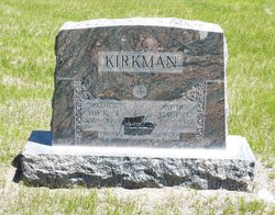
| Burial | : | Street Cemetery, Street, Mendip District, England |
| Coordinate | : | 51.1302840, -2.7508240 |
| Plot | : | Block 16, Lot 5, Grave 5, Row 8 |
| Description | : | Gertrude Lilliedoll was born in Saline County, Nebraska, December 25, 1873, the daughter of John Quincy and Mary Elizabeth Johnston. She passed away Saturday, July 30, at the Good Samaritan Home in Nelson. The family moved to Oak in 1875. She was educated in the schools of Oak, Edgar, and various Nebraska schools and later served as a teacher in Oak and other communities. She was united in marriage on August 4, 1898, with Nels F. Lilliedoll, who preceded her in death on March 26, 1951. They celebrated their golden wedding anniversary in 1948. She was active in Eastern Star... Read More |
frequently asked questions (FAQ):
-
Where is Gertrude Johnston Lilliedoll's memorial?
Gertrude Johnston Lilliedoll's memorial is located at: Street Cemetery, Street, Mendip District, England.
-
When did Gertrude Johnston Lilliedoll death?
Gertrude Johnston Lilliedoll death on 30 Jul 1966 in Nelson, Nuckolls County, Nebraska, USA
-
Where are the coordinates of the Gertrude Johnston Lilliedoll's memorial?
Latitude: 51.1302840
Longitude: -2.7508240
Family Members:
Parent

Spouse
Siblings
Flowers:


Nearby Cemetories:
1. Religious Society of Friends Quaker Cemetery
Street, Mendip District, England
Coordinate: 51.1294100, -2.7375630
2. Holy Trinity Churchyard
Street, Mendip District, England
Coordinate: 51.1310100, -2.7330800
3. Holy Trinity Churchyard Extension
Walton, Mendip District, England
Coordinate: 51.1234150, -2.7695832
4. Holy Trinity Churchyard
Walton, Mendip District, England
Coordinate: 51.1236200, -2.7709580
5. St Benedict Churchyard
Glastonbury, Mendip District, England
Coordinate: 51.1465970, -2.7196900
6. Glastonbury Abbey
Glastonbury, Mendip District, England
Coordinate: 51.1464996, -2.7151000
7. Saint John the Baptist Churchyard
Glastonbury, Mendip District, England
Coordinate: 51.1481520, -2.7161400
8. All Saint's Churchyard
Ashcott, Sedgemoor District, England
Coordinate: 51.1309220, -2.8058870
9. Glastonbury Cemetery
Glastonbury, Mendip District, England
Coordinate: 51.1565160, -2.7132380
10. Saint Andrew Churchyard
Compton Dundon, South Somerset District, England
Coordinate: 51.0897330, -2.7442800
11. St. Mary & All Saints Churchyard
Meare, Mendip District, England
Coordinate: 51.1715900, -2.7804100
12. St Leonard Churchyard
Butleigh, Mendip District, England
Coordinate: 51.1025800, -2.6868850
13. Holy Trinity Church
Godney, Mendip District, England
Coordinate: 51.1793400, -2.7377400
14. Blessed Virgin Mary Churchyard
Shapwick, Sedgemoor District, England
Coordinate: 51.1405090, -2.8336100
15. St. Michael and All Angels Churchyard
Greinton, Sedgemoor District, England
Coordinate: 51.1240140, -2.8408590
16. St. Dunstan Churchyard
Baltonsborough, Mendip District, England
Coordinate: 51.1107200, -2.6557600
17. All Saints Churchyard
Kingweston, South Somerset District, England
Coordinate: 51.0793076, -2.6791489
18. Blessed Virgin Mary Churchyard
Moorlinch, Sedgemoor District, England
Coordinate: 51.1280000, -2.8616000
19. St Nicholas Churchyard
West Pennard, Mendip District, England
Coordinate: 51.1415596, -2.6413050
20. St. Andrew's Churchyard
High Ham, South Somerset District, England
Coordinate: 51.0760320, -2.8218400
21. High Ham Cemetery
High Ham, South Somerset District, England
Coordinate: 51.0739931, -2.8216351
22. Christ Church
Coxley, Mendip District, England
Coordinate: 51.1869530, -2.6797580
23. Saint James Churchyard
West Bradley, Mendip District, England
Coordinate: 51.1293030, -2.6332386
24. St. David's Churchyard
Barton St David, South Somerset District, England
Coordinate: 51.0828220, -2.6585470